129.43.40.112 - IP Lookup: Free IP Address Lookup, Postal Code Lookup, IP Location Lookup, IP ASN, Public IP
Country:
Region:
City:
Location:
Time Zone:
Postal Code:
IP information under different IP Channel
ip-api
Country
Region
City
ASN
Time Zone
ISP
Blacklist
Proxy
Latitude
Longitude
Postal
Route
Luminati
Country
ASN
Time Zone
America/Chicago
ISP
NCIFCRF
Latitude
Longitude
Postal
IPinfo
Country
Region
City
ASN
Time Zone
ISP
Blacklist
Proxy
Latitude
Longitude
Postal
Route
IP2Location
129.43.40.112Country
Region
maryland
City
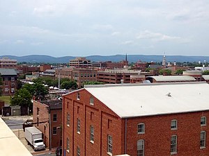
frederick
Time Zone
America/New_York
ISP
Language
User-Agent
Latitude
Longitude
Postal
db-ip
Country
Region
City
ASN
Time Zone
ISP
Blacklist
Proxy
Latitude
Longitude
Postal
Route
ipdata
Country
Region
City
ASN
Time Zone
ISP
Blacklist
Proxy
Latitude
Longitude
Postal
Route
Popular places and events near this IP address

Frederick County, Maryland
County in Maryland, United States
Distance: Approx. 5339 meters
Latitude and longitude: 39.47,-77.4
Frederick County is a county located in Maryland, United States. As of the 2020 U.S. census, the population was 271,717. The county seat is Frederick.

Clover Hill, Maryland
Unincorporated community in Maryland
Distance: Approx. 4588 meters
Latitude and longitude: 39.4575,-77.42972222
Clover Hill is an unincorporated community and former census-designated place (CDP) in Frederick County, Maryland, United States. The population was 3,260 at the 2000 census. The area was not listed as a CDP for the 2010 census, and no population total was published.
WFRE
Radio station in Maryland, United States
Distance: Approx. 3958 meters
Latitude and longitude: 39.5,-77.499
WFRE (99.9 FM) is a radio station located in Frederick, Maryland, in the United States. It plays country music and is owned by Local Daily Media along with its sister station 930 WFMD. Despite the station being located approximately 45 miles (72 km) from the two closest major cities (Baltimore, Maryland, and Washington, D.C.), its signal reaches both markets. In 2007, Clear Channel Communications was required to spin off stations to comply with ownership limits.

Gambrill State Park
State park in Maryland, United States
Distance: Approx. 5098 meters
Latitude and longitude: 39.46166667,-77.495
Gambrill State Park is a public recreation area located on Catoctin Mountain near the city of Frederick in Frederick County, Maryland. The state park is known for the dramatic views of the surrounding area that can be seen from stone overlooks built in the 1930s by the Civilian Conservation Corps. The park is operated by the Maryland Department of Natural Resources.
Tuscarora Creek (Juniata River tributary)
Distance: Approx. 3791 meters
Latitude and longitude: 39.474506,-77.417683
Tuscarora Creek is a 49.2-mile-long (79.2 km) tributary of the Juniata River in central Pennsylvania in the United States. It rises in eastern Huntingdon County, east of the borough of Shade Gap, and flows northeast between Tuscarora Mountain and Shade Mountain, reaching the Juniata River at Port Royal in Juniata County. It is traversed by the Academia Pomeroy Covered Bridge, which at 278 feet (85 m) portal to portal is the longest remaining covered bridge in Pennsylvania.

Utica Covered Bridge
United States historic place
Distance: Approx. 5956 meters
Latitude and longitude: 39.52444444,-77.39611111
The Utica Road Covered Bridge is a Burr truss wooden covered bridge located near Lewistown, Maryland. Originally built in 1834, it spanned the Monocacy River at the Devilbiss Bridge crossing. An 1889 flood damaged the bridge and the surviving half was moved to Fishing Creek in 1891.

Nallin Farm House
Historic house in Maryland, United States
Distance: Approx. 6194 meters
Latitude and longitude: 39.44777778,-77.41416667
The Nallin Farm House and the related Nallin Farm Springhouse and Bank Barn are located on Fort Detrick at Frederick, Maryland. The Federal style brick farmhouse was built in stages between the 1780s and the 1830s and formerly served as the residence of the Fort Detrick commanding officer. It is known on post as "Building 1652".
Edgewood (Frederick, Maryland)
Historic house in Maryland, United States
Distance: Approx. 4688 meters
Latitude and longitude: 39.45888889,-77.42416667
Edgewood is a historic home located at Frederick, Frederick County, Maryland, United States. It is a two-story multipart limestone farmhouse featuring narrow courses of native stone. The house was constructed and added to over the 18th and 19th century and reflects the Greek Revival style popular at that time.
Frederick Community College
Community college in Frederick, Maryland, U.S.
Distance: Approx. 5623 meters
Latitude and longitude: 39.45222222,-77.4175
Frederick Community College (FCC) is a public community college in Frederick, Maryland.

Tuscarora Creek railroad bridge
Bridge in Frederick County, Maryland
Distance: Approx. 6200 meters
Latitude and longitude: 39.46333333,-77.39361111
The Tuscarora Creek bridge is a 63.5-foot (19.4 m) single-span, steel, through-girder bridge with a floor beam/stringer system supporting a 12-inch (300 mm)-thick concrete slab south of Walkersville, Maryland. Originally constructed by the Frederick and Pennsylvania Line Railroad Company (F&PL) in 1872. It was later rebuilt by the Pennsylvania Railroad in 1907 as a thru girder concrete deck bridge using an older bridge from the Northern Central Railway.

Monocacy River bridge and viaduct
Bridge in Frederick County, Maryland
Distance: Approx. 6179 meters
Latitude and longitude: 39.465,-77.3925
The Monocacy River Railroad Bridge and Viaduct is a 326-foot (99 m) open deck steel girder bridge with two main spans crossing the river and two viaduct sections crossing the floodplain, south of Walkersville, Maryland. Originally constructed by the Frederick and Pennsylvania Line Railroad Company (F&PL). Construction began in late 1871, and continued until July 1872 when the railroad opened that year.
Charlesville, Maryland
Unincorporated community in Maryland, United States
Distance: Approx. 2184 meters
Latitude and longitude: 39.48805556,-77.42944444
Charlesville is an unincorporated community in Frederick County, Maryland, United States.
Weather in this IP's area
overcast clouds
15 Celsius
15 Celsius
13 Celsius
16 Celsius
1016 hPa
97 %
1016 hPa
1000 hPa
10000 meters
2.24 m/s
4.02 m/s
208 degree
100 %