129.19.149.53 - IP Lookup: Free IP Address Lookup, Postal Code Lookup, IP Location Lookup, IP ASN, Public IP
Country:
Region:
City:
Location:
Time Zone:
Postal Code:
IP information under different IP Channel
ip-api
Country
Region
City
ASN
Time Zone
ISP
Blacklist
Proxy
Latitude
Longitude
Postal
Route
Luminati
Country
Region
co
City
louisville
ASN
Time Zone
America/Denver
ISP
AS14041
Latitude
Longitude
Postal
IPinfo
Country
Region
City
ASN
Time Zone
ISP
Blacklist
Proxy
Latitude
Longitude
Postal
Route
IP2Location
129.19.149.53Country
Region
colorado
City
boulder
Time Zone
America/Denver
ISP
Language
User-Agent
Latitude
Longitude
Postal
db-ip
Country
Region
City
ASN
Time Zone
ISP
Blacklist
Proxy
Latitude
Longitude
Postal
Route
ipdata
Country
Region
City
ASN
Time Zone
ISP
Blacklist
Proxy
Latitude
Longitude
Postal
Route
Popular places and events near this IP address

Geological Society of America
Nonprofit organization dedicated to geoscience
Distance: Approx. 3364 meters
Latitude and longitude: 40.03725,-105.24994444
The Geological Society of America (GSA) is a nonprofit organization dedicated to the advancement of the geosciences.
Boulder Municipal Airport
Airport in Boulder County, Colorado, United States
Distance: Approx. 1401 meters
Latitude and longitude: 40.03944444,-105.22583333
Boulder Municipal Airport (IATA: WBU, ICAO: KBDU, FAA LID: BDU) is a public airport located 3 miles (4.8 km) northeast of the central business district of Boulder, a city in Boulder County, Colorado, United States. It is owned by the City of Boulder and used almost exclusively for general aviation. Its location in the foothills of the Rockies east of the continental divide gives excellent conditions for soaring, and there is extensive gliding activity.
Boulder Valley School District
School district in Colorado, United States
Distance: Approx. 3724 meters
Latitude and longitude: 40.014485,-105.201221
The Boulder Valley School District No. Re2 is a school district in Colorado, United States. It is headquartered in the BVSD Education Center in unincorporated Boulder County, near Boulder.
Leanin' Tree Museum of Western Art
Art museum in Boulder, Colorado
Distance: Approx. 2027 meters
Latitude and longitude: 40.065,-105.2133
The Leanin' Tree Museum of Western Art was a private art museum located in Boulder, Colorado. It exhibited the private art collection of Ed Trumble, founder and chairman of Leanin' Tree, Incorporated. Trumble is a publisher of fine art greeting cards since 1949.
South Boulder Creek (Colorado)
River in Boulder County, Colorado, United States
Distance: Approx. 1445 meters
Latitude and longitude: 40.03416667,-105.21638889
South Boulder Creek is a tributary of Boulder Creek in central Colorado in the United States. Its source is near Rogers Pass on the Continental Divide. The stream flows to a confluence with Boulder Creek in northeast Boulder.

Valmont, Colorado
Census Designated Place in Colorado, United States
Distance: Approx. 1500 meters
Latitude and longitude: 40.03416667,-105.20638889
Valmont is an unincorporated community and a census-designated place (CDP) located in and governed by Boulder County, Colorado, United States. The CDP is a part of the Boulder, CO Metropolitan Statistical Area. The population of the Valmont CDP was 64 at the United States Census 2020.
Fourmile Canyon Creek
River
Distance: Approx. 1032 meters
Latitude and longitude: 40.03777778,-105.20972222
Fourmile Canyon Creek or Four Mile Canyon Creek is a tributary of Boulder Creek. Its source is northwest of Boulder, Colorado and flows through the northern part of the city for part of its length. It should not be confused with a similarly named stream that runs through Fourmile Canyon west of Boulder, which was the site of a major wildfire in 2010.
Climbing (magazine)
American rock climbing magazine
Distance: Approx. 2728 meters
Latitude and longitude: 40.024304,-105.225206
Climbing is a major US-based rock climbing magazine first published in 1970. In 2007, it was bought by Skram Media, the publisher of Urban Climber Magazine. The headquarters of the magazine is in Boulder, Colorado.

McKenzie Well
United States historic place
Distance: Approx. 2445 meters
Latitude and longitude: 40.04333333,-105.24083333
The McKenzie Well (also known as McKenzie #1) is an oil well site in Boulder, Colorado. The Boulder Oil Field was discovered on this site in 1901, making it the oldest oil-producing site in the entire Denver Basin, and one of the oldest in the western United States. The first producing well on the site was drilled in 1902.

Walden Ponds Wildlife Habitat
Distance: Approx. 2118 meters
Latitude and longitude: 40.0441,-105.1879
Walden Ponds Wildlife Habitat is a 102-acre (41 ha) Boulder County, Colorado park. It was reclaimed between 1974 and the 1990s from an open-pit gravel mine on the site, and is named after Walden "Wally" Toevs, the Boulder County Commissioner who spearheaded the plan to convert the gravel pits into a wildlife habitat. After the mining ceased and the property had been stripped 15 feet (4.6 m) down to bedrock, all that was left were open pits and puddles of ground water.

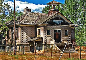
Boulder County Poor Farm
United States historic place
Distance: Approx. 539 meters
Latitude and longitude: 40.04555556,-105.20638889
Boulder County Poor Farm is the site of a poor farm in the Valmont area of Boulder County, Colorado, where long-term care for the county's indigent was provided from 1902 to 1918. The site operated as a farm from 1897, and many of the original farm buildings are still present, including a main house built in Queen Anne style. It was listed on the National Register of Historic Places in 2011.
Boulder Reservoir
Boulder County, Colorado water storage and recreation reservoir
Distance: Approx. 3601 meters
Latitude and longitude: 40.07833333,-105.22194444
Boulder Reservoir is located in the northern part of Boulder, Colorado. It stores water for the Northern Colorado Water Conservancy District — also called Northern Water — and for the City of Boulder. The reservoir is the centerpiece of the Boulder Reservoir Regional Park, which is managed by the City of Boulder's Department of Parks and Recreation.
Weather in this IP's area
clear sky
7 Celsius
5 Celsius
4 Celsius
10 Celsius
1001 hPa
51 %
1001 hPa
827 hPa
10000 meters
2.57 m/s
300 degree


