Country:
 USA
USARegion:
City:
Latitude and Longitude:
Time Zone:
Postal Code:
IP information under different IP Channel
ip-api
Country
Region
City
ASN
Time Zone
ISP
Blacklist
Proxy
Latitude
Longitude
Postal
Route
IPinfo
Country
Region
City
ASN
Time Zone
ISP
Blacklist
Proxy
Latitude
Longitude
Postal
Route
MaxMind
Country
Region
City
ASN
Time Zone
ISP
Blacklist
Proxy
Latitude
Longitude
Postal
Route
Luminati
Country
USRegion
va
City
ashburn
ASN
Time Zone
America/New_York
ISP
ORACLE-BMC-31898
Latitude
Longitude
Postal
db-ip
Country
Region
City
ASN
Time Zone
ISP
Blacklist
Proxy
Latitude
Longitude
Postal
Route
ipdata
Country
Region
City
ASN
Time Zone
ISP
Blacklist
Proxy
Latitude
Longitude
Postal
Route
Popular places and events near this IP address

Brambleton, Virginia
Census-designated place in Virginia
Distance: Approx. 4014 meters
Latitude and longitude: 38.98194444,-77.53861111
Brambleton is a census-designated place (CDP) in Loudoun County, Virginia, United States, south of the Dulles Greenway. The population as of the 2010 United States Census was 9,845. In 2017, Brambleton had an estimated population of 19,900, with a median age of 34.3 and a median household income of $173,690.
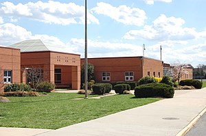
Briar Woods High School
Public school in Ashburn, Virginia, United States
Distance: Approx. 2931 meters
Latitude and longitude: 38.9925,-77.53055556
Briar Woods High School is a public secondary school located in Ashburn, an unincorporated area in Loudoun County, Virginia, United States, and is part of Loudoun County Public Schools. The school serves students who live in the Broadlands, Brambleton, and Waxpool communities.

Ashburn station (Washington Metro)
Washington Metro station
Distance: Approx. 4420 meters
Latitude and longitude: 39.0046,-77.4909
Ashburn station is a Washington Metro station in Loudoun County, Virginia, United States, that serves as the western terminus of the Silver Line. Originally planned to begin operation in 2016, the station opened on November 15, 2022. Ashburn station is located at the median of the Dulles Greenway (SR 267) east of Old Ryan Road (SR 772).
Broad Run High School
Public school in Ashburn, Loudoun County, Virginia
Distance: Approx. 4124 meters
Latitude and longitude: 39.0225,-77.49166667
Broad Run High School is a public secondary school in Ashburn, an unincorporated area in Loudoun County, Virginia, United States. Broad Run is part of the Loudoun County Public Schools system (LCPS). It was ranked as the #1 Best Public High School in Loudoun County and the #9 Best Public High School in Virginia by U.S. News in 2020.

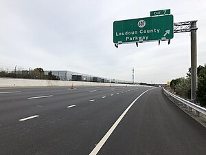
Loudoun County Public Schools
Public school division serving Loudoun County, Virginia, United States
Distance: Approx. 2557 meters
Latitude and longitude: 39.033609,-77.517316
Loudoun County Public Schools (LCPS) is a branch of the Loudoun County, Virginia, United States government, and administers public schools in the county. LCPS's headquarters is located at 21000 Education Court in Ashburn, an unincorporated section of the county. Due to rapid growth in the region, LCPS is one of the fastest-growing school divisions in Virginia and the third largest school division in the state.
Waxpool, Virginia
Unincorporated community in Virginia, United States
Distance: Approx. 1385 meters
Latitude and longitude: 39.01388889,-77.52388889
Waxpool is an unincorporated community in Loudoun County, Virginia. Waxpool is centered on Waxpool Road (Virginia Secondary Route 625) in the vicinity of Beaver Dam Reservoir and is part of the Broadlands census-designated place. Waxpool once contained a general store and post office in one building near the intersection of Waxpool Road (Rte.
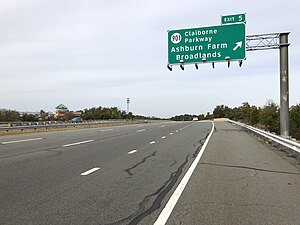
Broadlands, Virginia
Census-designated place in Virginia
Distance: Approx. 1619 meters
Latitude and longitude: 39.01805556,-77.52027778
Broadlands is a census-designated place (CDP) in Loudoun County, Virginia, United States. It is a 1,500-acre (610 ha) master-planned community started and developed by Van Metre Homes in the 1990s. It is built on wetlands and is certified as a Community Wildlife Habitat by the National Wildlife Federation.

Ryan, Virginia
Unincorporated community in Virginia, United States
Distance: Approx. 3988 meters
Latitude and longitude: 39.015,-77.49305556
Ryan is an unincorporated community in Loudoun County, Virginia, United States. The community was once at the corner of Shellhorn, Ryan, and Waxpool roads. It is now a part of the Ashburn communities.
Moorefield, Virginia
Census-designated place in Virginia
Distance: Approx. 4181 meters
Latitude and longitude: 39.00027778,-77.49638889
Moorefield is a census-designated place (CDP) in Loudoun County, Virginia, United States. As of the 2010 census, the CDP was named Moorefield Station, and the population was 77. As of 2019, the estimated population was 1,976.

Fleetwood Farm
United States historic place
Distance: Approx. 3821 meters
Latitude and longitude: 38.98884167,-77.56229722
Fleetwood Farm, also known as Peggy's Green, is a Federal style house in Loudoun County, Virginia. The house is conjectured to have been built around 1775 by William Ellzey, a lawyer originally from Virginia's Tidewater region. Ellzey, as a member of the gentry, was a participant in Loudoun County's pre-Revolutionary activities.
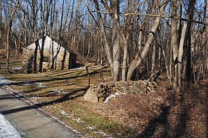
Francis-Gulick Mill
Archaeological site in Virginia, United States
Distance: Approx. 1918 meters
Latitude and longitude: 39.0275,-77.5575
Francis–Gulick Mill is a historic archaeological site located near Leesburg, Loudoun County, Virginia. The site includes a small stone miller's house foundation, stone remnants of a mill foundation, and the millrace and two millstones that are lying next to the miller's house foundations. The mill and miller's house may have been built as early as the late-18th century and were in use at least by the second decade of the 19th century.
Goose Creek Village, Virginia
Census-designated place in Virginia, United States
Distance: Approx. 3271 meters
Latitude and longitude: 39.04444444,-77.5225
Goose Creek Village is a census-designated place (CDP) in Loudoun County, Virginia, United States. It was first drawn as a CDP prior to the 2020 census.
Weather in this IP's area
scattered clouds
24 Celsius
24 Celsius
23 Celsius
25 Celsius
1022 hPa
59 %
1022 hPa
1011 hPa
10000 meters
5.14 m/s
60 degree
40 %
06:52:53
19:16:59