Country:
 Denmark
Region:
City:
Latitude and Longitude:
Time Zone:
Postal Code:
IP information under different IP Channel
ip-api
Country
Region
City
ASN
Time Zone
ISP
Blacklist
Proxy
Latitude
Longitude
Postal
Route
IPinfo
Country
Region
City
ASN
Time Zone
ISP
Blacklist
Proxy
Latitude
Longitude
Postal
Route
MaxMind
Country
Region
City
ASN
Time Zone
ISP
Blacklist
Proxy
Latitude
Longitude
Postal
Route
Luminati
Country
DKASN
Time Zone
Europe/Copenhagen
ISP
Telenor A/S
Latitude
Longitude
Postal
db-ip
Country
Region
City
ASN
Time Zone
ISP
Blacklist
Proxy
Latitude
Longitude
Postal
Route
ipdata
Country
Region
City
ASN
Time Zone
ISP
Blacklist
Proxy
Latitude
Longitude
Postal
Route
Popular places and events near this IP address

Valby
District of Copenhagen
Distance: Approx. 756 meters
Latitude and longitude: 55.66083333,12.50361111
Valby ([vælpyˀ] ) is one of the 10 official districts of Copenhagen Municipality, Denmark. It is in the southwestern corner of Copenhagen Municipality, and has a mixture of different types of housing. This includes apartment blocks, terraced housing, areas with single-family houses and allotments, plus the remaining part of the old Valby village, around which the district has formed, intermingled with past and present industrial sites.
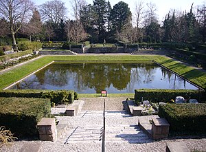
Vestre Cemetery (Copenhagen)
Cemetery in Copenhagen, Denmark
Distance: Approx. 947 meters
Latitude and longitude: 55.65777778,12.52916667
Vestre Cemetery (Danish: Vestre Kirkegård, meaning "Western Cemetery") is located in a large park setting in the Kongens Enghave district of Copenhagen, Denmark. With its 54 hectares it is the largest cemetery in Denmark. The cemetery is landscaped and serves as an important open space, in which people take a stroll, and look at the old graves and monuments.

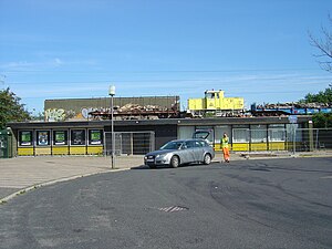
Valby railway station
Main line and suburban railway station in Copenhagen, Denmark
Distance: Approx. 712 meters
Latitude and longitude: 55.66388889,12.51444444
Valby station is a main line and S-train railway station serving the district of Valby in Copenhagen, Denmark. The station is located in the central part of the district where one of its main arteries Toftegårds Allé crosses the railway line. It is located in a highly populated area, close to the location of the historic village of Valby.

Copenhagen South railway station
Main line and commuter railway station in Copenhagen, Denmark
Distance: Approx. 590 meters
Latitude and longitude: 55.65236111,12.51638889
Copenhagen South station (Danish: København Syd Station, previously Ny Ellebjerg Station) is a main line and S-train railway station in the district of Valby in southwestern Copenhagen, Denmark. The station is located on numerous railway and branch lines passing through or diverging from the main lines at this station, and is gradually being developed into a major transport hub for public transport in Copenhagen.
Ellebjerg railway station
Former railway station in Copenhagen, Denmark
Distance: Approx. 933 meters
Latitude and longitude: 55.64944444,12.51
Ellebjerg station is a former station on the S-train network in Copenhagen, Denmark. It was in operation from 1972 until its closure in 2007. The former station is located where the Køge radial passes over Ellebjergvej.
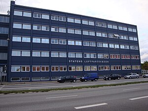
Civil Aviation Administration Denmark
Distance: Approx. 940 meters
Latitude and longitude: 55.65040556,12.52220833
Civil Aviation Administration Denmark (CAA-DK). (Danish: Statens Luftfartsvæsen, SLV) was the Danish government agency that oversaw all civil aviation in Denmark, including the autonomous areas of Greenland and the Faroe Islands. CAA-DK, with its head office in Copenhagen, was part of the Danish Ministry of Transport (Danish: Transportministeriet).
Copenhagen Hospitality College
Distance: Approx. 768 meters
Latitude and longitude: 55.6629,12.5217
Copenhagen Hospitality College (Danish: Hotel og Restaurantskolen, abbr. HRS) is a vocational college located in Copenhagen, Denmark. The school is Northern Europe's largest school specialising in hospitality courses and Denmark's largest food institute.

Spinderiet
Shopping centre in Copenhagen, Denmark
Distance: Approx. 864 meters
Latitude and longitude: 55.665,12.51055556
Spinderiet (lit. 'The Spinning Mill') is a shopping centre located next to Valby station in the Valby district of Copenhagen, Denmark. Inaugurated in 2008, it incorporates the converted buildings of a cotton mill from 1907. The mixed use development also contains office space and apartments.

Lyset
Housing development in Copenhagen, Denmark
Distance: Approx. 827 meters
Latitude and longitude: 55.6622,12.5039
Lyset (English: "The Light") is an area of building society houses located on the north side of Vigerslev Allé in the Valby district of Copenhagen, Denmark. The development consists of 106 houses situated along Carl Langes vej, Steenbergsvej, Fengersvej, Eschrichtsvej and Steinsvej, just west of Valby station and south of the railway line towards Roskilde.

Carl Jacobsens Vej
Street in Copenhagen, Denmark
Distance: Approx. 621 meters
Latitude and longitude: 55.6529,12.5197
Carl Jacobsens Vej is a street in the Valby district of Copenhagen, Denmark. It runs from Sjælør Boulevard on the rear side of Vestre Cemetery in the east to Gammel Køge Landevej in the west. The street is lined by a mixture of converted industrial complexes from the beginning of the 20th century, building society developments and modern apartment buildings from the 2010s.

Toftegårds Plads
Distance: Approx. 548 meters
Latitude and longitude: 55.6621,12.5172
Toftegårds Plads is the largest square in the Valby district of Copenhagen, Denmark. It is bisected by Vigerslev Allé and situated on the corner with Gammel Køge Landevej.
Mozarts Plads station
Copenhagen metro station
Distance: Approx. 951 meters
Latitude and longitude: 55.65666667,12.52916667
Mozarts Plads station is an underground Copenhagen Metro station located at the eponymous urban square in Copenhagen, Denmark. The station is on the M4 Line, between Sluseholmen and Copenhagen South.
Weather in this IP's area
moderate rain
9 Celsius
6 Celsius
8 Celsius
9 Celsius
1013 hPa
85 %
1013 hPa
1012 hPa
10000 meters
6.17 m/s
10.98 m/s
239 degree
38 %
07:32:51
18:20:02