129.134.134.130 - IP Lookup: Free IP Address Lookup, Postal Code Lookup, IP Location Lookup, IP ASN, Public IP
Country:
Region:
City:
Location:
Time Zone:
Postal Code:
ISP:
ASN:
language:
User-Agent:
Proxy IP:
Blacklist:
IP information under different IP Channel
ip-api
Country
Region
City
ASN
Time Zone
ISP
Blacklist
Proxy
Latitude
Longitude
Postal
Route
db-ip
Country
Region
City
ASN
Time Zone
ISP
Blacklist
Proxy
Latitude
Longitude
Postal
Route
IPinfo
Country
Region
City
ASN
Time Zone
ISP
Blacklist
Proxy
Latitude
Longitude
Postal
Route
IP2Location
129.134.134.130Country
Region
oregon
City
troutdale
Time Zone
America/Los_Angeles
ISP
Language
User-Agent
Latitude
Longitude
Postal
ipdata
Country
Region
City
ASN
Time Zone
ISP
Blacklist
Proxy
Latitude
Longitude
Postal
Route
Popular places and events near this IP address

Lewis and Clark State Recreation Site
State park in the U.S. state of Oregon
Distance: Approx. 821 meters
Latitude and longitude: 45.5409529,-122.3770355
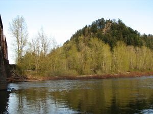
Lewis and Clark State Recreation Site is a state park in eastern Multnomah County, Oregon, near Troutdale and Corbett, and is administered by the Oregon Parks and Recreation Department. It is located on the Sandy River, near its confluence with the Columbia River. Broughton's Bluff marks the westernmost extent of the Columbia River Gorge at the site.

Troutdale Methodist Episcopal Church
United States historic place
Distance: Approx. 90 meters
Latitude and longitude: 45.53918,-122.386155
Troutdale Methodist Episcopal Church (Troutdale Full Gospel Church) is a historic church at 302 SE Harlow Street in Troutdale, Oregon. It was built in 1895 and added to the National Register of Historic Places in 1993.

Fred Harlow House
Historic house in Oregon, United States
Distance: Approx. 394 meters
Latitude and longitude: 45.53819444,-122.3825
The Fred Harlow House, located in Troutdale, Oregon, is listed on the National Register of Historic Places. The building sits within the 1.4-acre (0.57 ha) Harlow House Park.

Glenn Otto Park
Public park in Troutdale, Oregon, U.S.
Distance: Approx. 828 meters
Latitude and longitude: 45.5368,-122.3773
Glenn Otto Community Park is a 6.38-acre (2.58 ha) park in Troutdale in the U.S. state of Oregon. It is the most heavily used park in the Troutdale park system. The park is at 1102 E. Historic Columbia River Hwy, Troutdale, OR 97060 The park is along the Sandy River and Beaver Creek.

Bissinger Wool Pullery
Wool pullery in Troutdale, Oregon
Distance: Approx. 334 meters
Latitude and longitude: 45.54194444,-122.38527778
Bissinger Wool Pullery was a wool pullery business in Troutdale, Oregon. Adolph Bissinger, Samuel Bissinger, Louis Bissinger, and Louis Gerstle founded the business in the 1880s. The operation removed wool from sheep hides and processed the wool into bale, to be shipped out for further processing.

Sugarpine Drive-In
Restaurant in Troutdale, Oregon, U.S.
Distance: Approx. 751 meters
Latitude and longitude: 45.53777778,-122.37791667
Sugarpine Drive-In is a restaurant along the Historic Columbia River Highway in Troutdale, Oregon. KOIN included Sugarpine in a 2023 list of the Portland metropolitan area's top ten ice cream shops, based on Yelp reviews for business with no more than three locations.

Mayors Square
Public park in Troutdale, Oregon, U.S.
Distance: Approx. 141 meters
Latitude and longitude: 45.54055556,-122.3875
Mayors Square is a .17-acre (0.069 ha) public square and park in Troutdale, Oregon, United States. The park has a statue depicting former mayor Clara Latourell Larsson, and has been the site of the city's holiday tree and lighting ceremony.

Troutdale Centennial Arch
Arch in Troutdale, Oregon, U.S.
Distance: Approx. 271 meters
Latitude and longitude: 45.54083333,-122.39
The Troutdale Centennial Arch is a 60-foot (18 m) arch spanning the Historic Columbia River Highway in Troutdale, Oregon, United States. The arch rests on piers created by Michael Byrne and has bronze sculptures of salmon by Rip Caswell.

Helen Althaus Park
Public park in Troutdale, Oregon, U.S.
Distance: Approx. 360 meters
Latitude and longitude: 45.53722222,-122.39083333
Helen Althaus Park (formerly Watershed Park) is a 9.51-acre (3.85 ha) public park in Troutdale, Oregon, United States. Named after former city council member Helen Althaus, the park has a large underground reservoir which has been covered with a basketball court. In 2015, Oregon Fish and Wildlife was notified of the presence of a cougar in the park.

Depot Park
Park in Troutdale, Oregon, U.S.
Distance: Approx. 334 meters
Latitude and longitude: 45.54111111,-122.38388889
Depot Park is a public park in Troutdale, Oregon, United States. The 2.25-acre (0.91 ha) park is along the Union Pacific Railroad and Beaver Creek. It has hosted the Troutdale Open Air Market.

Depot Rail Museum
Museum in Troutdale, Oregon, U.S.
Distance: Approx. 299 meters
Latitude and longitude: 45.54097222,-122.38430556
The Depot Rail Museum is a museum in Troutdale, Oregon, United States. The building houses the Gateway to the Gorge Visitor Center.

Visionary Park
Park in Troutdale, Oregon, U.S.
Distance: Approx. 570 meters
Latitude and longitude: 45.53702778,-122.38075
Visionary Park is a public park in Troutdale, Oregon, United States. The park features Rip Caswell's 2016 sculpture Devoted Passion, which commemorates Sam Hill and Sam Lancaster.
Weather in this IP's area
scattered clouds
1 Celsius
-6 Celsius
-0 Celsius
2 Celsius
1010 hPa
79 %
1010 hPa
992 hPa
10000 meters
8.49 m/s
14.31 m/s
103 degree
40 %