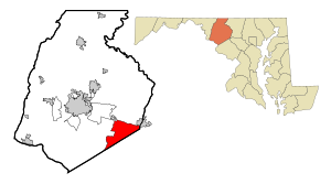
Country:
Region:
City:
Latitude and Longitude:
Time Zone:
Postal Code:
IP information under different IP Channel
ip-api
Country
Region
City
ASN
Time Zone
ISP
Blacklist
Proxy
Latitude
Longitude
Postal
Route
Luminati
Country
Region
md
City
newmarket
ASN
Time Zone
America/New_York
ISP
NIH-NET
Latitude
Longitude
Postal
IPinfo
Country
Region
City
ASN
Time Zone
ISP
Blacklist
Proxy
Latitude
Longitude
Postal
Route
db-ip
Country
Region
City
ASN
Time Zone
ISP
Blacklist
Proxy
Latitude
Longitude
Postal
Route
ipdata
Country
Region
City
ASN
Time Zone
ISP
Blacklist
Proxy
Latitude
Longitude
Postal
Route
Popular places and events near this IP address

Green Valley, Maryland
Census-designated place in Frederick County, Maryland, United States
Distance: Approx. 4837 meters
Latitude and longitude: 39.34166667,-77.25055556
Green Valley is an unincorporated area and census-designated place (CDP) in southern Frederick County, Maryland, United States. The population was 12,643 at the 2020 census. The area was listed as a census-designated place in 2000 but not listed as part of any CDP at the 2010 census.

New Market, Maryland
Town in Maryland
Distance: Approx. 357 meters
Latitude and longitude: 39.38361111,-77.27333333
New Market is a town in Frederick County, Maryland, United States. The population was 1,525 at the 2020 census. The town bills itself as the "Antiques capital of Maryland".
Linganore, Maryland
Census-designated place in Maryland
Distance: Approx. 4343 meters
Latitude and longitude: 39.41277778,-77.30138889
Linganore is a census-designated place (CDP) in Frederick County, in the U.S. state of Maryland. It consists of the area around Lake Linganore, a residential community governed by a homeowners association, located east of the city of Frederick. As of the 2020 census the CDP had a population of 12,351.
Monrovia, Maryland
Census-designated place in Maryland
Distance: Approx. 2892 meters
Latitude and longitude: 39.35694444,-77.27472222
Monrovia is an unincorporated community and census-designated place (CDP) in Frederick County, in the U.S. state of Maryland. As of the 2020 census it had a population of 2,702.

Old National Pike Milestones
United States historic place
Distance: Approx. 4200 meters
Latitude and longitude: 39.42027778,-77.26694444
The Old National Pike Milestones marked each mile of the old National Road in Maryland, an eastern coastal state of the United States, from its dominating city of Baltimore to major towns of western Maryland, as Frederick, and between it and Hagerstown, to Hancock, through to Cumberland in the western panhandle of the state in the foothills of the Appalachian Mountains. The surviving stones have been included in the National Register of Historic Places, maintained by the National Park Service of the U.S. Department of the Interior, and may be seen along the route variously designated as U.S. Route 40, Maryland Route 144, Alternate U.S. Route 40, and several other roads that trace the path of the original Old National Pike. From Baltimore to Cumberland, the road was surveyed and laid out with construction in several phases over different periods of time by several turnpike companies, chartered by the General Assembly of Maryland beginning in 1808.

New Market Historic District (New Market, Maryland)
Historic district in Maryland, United States
Distance: Approx. 55 meters
Latitude and longitude: 39.38277778,-77.27
The New Market Historic District is a national historic district in New Market, Frederick County, Maryland. The district encompasses the town located along what was originally the National Pike (now MD 144). About 90 percent of the buildings in the historic district date from the 19th century and include Federal-style buildings and Greek Revival buildings, with a number of Victorian buildings, a larger example being the Ramsburg House.
New London, Maryland
Unincorporated community in Maryland, U.S.
Distance: Approx. 4600 meters
Latitude and longitude: 39.42194444,-77.25305556
New London is an unincorporated community in Frederick County, Maryland, United States. Thomas Maynard House was listed on the National Register of Historic Places in 1979.
Sherwood Forest, Frederick County, Maryland
Unincorporated community in Maryland, U.S.
Distance: Approx. 2939 meters
Latitude and longitude: 39.3875,-77.23583333
Sherwood Forest is an unincorporated community in Frederick County, Maryland, United States.
Lake Linganore, Maryland
Unincorporated area in Maryland, United States
Distance: Approx. 4794 meters
Latitude and longitude: 39.415,-77.30611111
Lake Linganore is a community in Frederick County, in the U.S. state of Maryland, located just outside New Market. The population was 12,351 as of the 2020 census.
Oakdale High School (Maryland)
Public school in Maryland, United States
Distance: Approx. 3756 meters
Latitude and longitude: 39.395,-77.31
Oakdale High School is a public high school located in New Market, Maryland, United States, near the city of Frederick. It is part of the Frederick County Public Schools system.
New Market West, Maryland
Unincorporated area in Maryland
Distance: Approx. 1170 meters
Latitude and longitude: 39.38861111,-77.28055556
New Market West is a suburban housing community in Frederick County, in the U.S. state of Maryland. The community is located in the foothills of the Blue Ridge Mountains and is adjacent to the town of New Market.
Adventure Park USA
Amusement park in Monrovia, Maryland, US
Distance: Approx. 836 meters
Latitude and longitude: 39.379388,-77.278179
Adventure Park USA is a family entertainment center in Monrovia, Maryland, east of Frederick, Maryland, situated on 17.5 acres, which opened in 2005.
Weather in this IP's area
overcast clouds
11 Celsius
10 Celsius
10 Celsius
12 Celsius
1015 hPa
82 %
1015 hPa
996 hPa
10000 meters
2.57 m/s
310 degree
100 %
06:54:38
16:53:32