128.171.11.68 - IP Lookup: Free IP Address Lookup, Postal Code Lookup, IP Location Lookup, IP ASN, Public IP
Country:
Region:
City:
Location:
Time Zone:
Postal Code:
IP information under different IP Channel
ip-api
Country
Region
City
ASN
Time Zone
ISP
Blacklist
Proxy
Latitude
Longitude
Postal
Route
Luminati
Country
Region
hi
City
honolulu
ASN
Time Zone
Pacific/Honolulu
ISP
UNIVHAWAII
Latitude
Longitude
Postal
IPinfo
Country
Region
City
ASN
Time Zone
ISP
Blacklist
Proxy
Latitude
Longitude
Postal
Route
IP2Location
128.171.11.68Country
Region
hawaii
City
honolulu
Time Zone
Pacific/Honolulu
ISP
Language
User-Agent
Latitude
Longitude
Postal
db-ip
Country
Region
City
ASN
Time Zone
ISP
Blacklist
Proxy
Latitude
Longitude
Postal
Route
ipdata
Country
Region
City
ASN
Time Zone
ISP
Blacklist
Proxy
Latitude
Longitude
Postal
Route
Popular places and events near this IP address

Roman Catholic Diocese of Honolulu
Catholic ecclesiastical territory in Hawai'i
Distance: Approx. 627 meters
Latitude and longitude: 21.30888889,-157.82611111
The Roman Catholic Diocese of Honolulu (Latin: Diœcesis Honoluluensis) is a Latin Church ecclesiastical territory or diocese for the state of Hawaii in the United States. It is a suffragan diocese in the ecclesiastical province of the metropolitan Archdiocese of San Francisco. The mother church of the Diocese of Honolulu is the Cathedral Basilica of Our Lady of Peace in Honolulu.

Makiki
Neighborhood of Honolulu, Hawaii, United States
Distance: Approx. 1177 meters
Latitude and longitude: 21.30560833,-157.83010556
Makiki is an area of Honolulu, Hawaiʻi, located northeast of downtown Honolulu, stretching east to west from Punahou Street to Pensacola Street and north to south from Round Top Drive/Makiki Heights Drive to Lunalilo Freeway. Punchbowl, an extinct tuff cone, and Tantalus overlook the Makiki.
Honolulu Museum of Art Spalding House
Distance: Approx. 1115 meters
Latitude and longitude: 21.31194444,-157.83277778
The Honolulu Museum of Art Spalding House, formerly The Contemporary Museum, Honolulu, was integrated into the Honolulu Museum of Art under this name. It was the only museum in the state of Hawaii devoted exclusively to contemporary art. The Contemporary Museum had two venues: in residential Honolulu at the historic Spalding House, and downtown Honolulu at First Hawaiian Center.
Charles Montague Cooke Jr. House and Kūkaʻōʻō Heiau
Historic house in Hawaii, United States
Distance: Approx. 796 meters
Latitude and longitude: 21.30805556,-157.81666667
Charles Montague Cooke Jr. House and Kūkaʻōʻō Heiau is a property in Honolulu, Hawaii. The house, also known as Kualii (also spelled Kualiʻi), was built in 1911–1912 for Charles Montague Cooke Jr., and listed on the National Register of Historic Places in 1985.
John Guild House
Historic house in Hawaii, United States
Distance: Approx. 892 meters
Latitude and longitude: 21.30555556,-157.825
The John Guild House, now known as Manoa Valley Inn, at 2001 Vancouver Drive in Honolulu, Hawaii, was purchased in 1919 by John Guild, a Honolulu businessman. It had been built four years earlier by Iowa lumber dealer Milton Moore and has been refurbished and restored several times over its lifespan. It was listed on the National Register of Historic Places in 2002.
R.N. Linn House
Historic house in Hawaii, United States
Distance: Approx. 584 meters
Latitude and longitude: 21.30833333,-157.82444444
The R. N. Linn House, also known as the Robert A. and Eleanor C. Nordyke Residence, at 2013 Kakela Drive in Honolulu, Hawaiʻi, was built in 1928 in the style of architecture then emerging in Hawaiʻi during the 1920s. Although it is relatively modest cottage, it exhibits such typical elements of that style as a double-pitched hip roof (also known as a Dickey roof), exposed rafters, casement windows, an open floor plan, Chinese interior motifs, and a panoramic view. Its architect was J. Alvin Shadinger, who was noted especially for his interior designs.
Grace Cooke House
Historic house in Hawaii, United States
Distance: Approx. 272 meters
Latitude and longitude: 21.31083333,-157.82111111
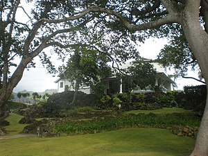
The Grace Cooke House, also known as the Harold St. John Residence, at 2365 Oʻahu Avenue in Honolulu, Hawaiʻi, is significant both for its American Craftsman bungalow architecture and landscaping and for its most famous resident, Harold St. John, a distinguished professor of botany at the University of Hawaiʻi.
George D. Oakley House
Historic house in Hawaii, United States
Distance: Approx. 858 meters
Latitude and longitude: 21.3075,-157.82777778
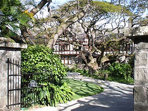
The George D. Oakley House at 2110 Kakela Place in Honolulu, Hawaiʻi, was built in 1929 in the English Cottage style of architecture popular in Hawaiʻi during the 1920s and 1930s. This house is one of the finest of only two dozen or so extant houses of similar style in the state. Signature elements of the style include asymmetrical massing, a roof shaped to resemble thatch, a gable with half-timbered facade, a king post truss ceiling, diamond-shaped casement windows, decorative as well as functional wrought iron, and even a tiny window in the chimney.
Dr. Archibald Neil Sinclair House
Historic house in Hawaii, United States
Distance: Approx. 365 meters
Latitude and longitude: 21.31444444,-157.81888889
The Dr. Archibald Neil Sinclair House on Puʻu Pueo ('Owl Hill') overlooking Mānoa Valley and Diamond Head on the island of Oʻahu was built in 1917 in a Colonial Revival style designed by a leading local architectural firms, Emory and Webb, who also designed the Hawaii Theatre and other fine buildings on the island. The large, sloping property has two entrances: one below the front lawn at 2726 Hillside Ave., the other above the house at 2725 Terrace Dr., Honolulu, Hawaiʻi.
Salvation Army Waiʻoli Tea Room
Former restaurant in Honolulu, Hawaii
Distance: Approx. 999 meters
Latitude and longitude: 21.31916667,-157.815
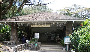
The Salvation Army Waiʻoli Tea Room was a Honolulu restaurant that operated from 1922 to 2014. After being closed for several years, it reopened in November 2018 as Waiʻoli Kitchen and Bake Shop. The restaurant is in a historic building at 2950 Mānoa Road, at the intersection of Oʻahu Avenue and Mānoa Road on the island of Oahu.
Hanahauʻoli School
Independent school in Honolulu, Hawaii
Distance: Approx. 1200 meters
Latitude and longitude: 21.30742,-157.83193
Hanahauʻoli School is an independent elementary school in Makiki, Hawaii. As of 2012, the school had 207 students with the youngest in Junior Kindergarten and the oldest in 6th grade. The current head of school is Lia Woo, an alumnus of the school.
Detweiler House
Building in Hawai'i, Honolulu
Distance: Approx. 727 meters
Latitude and longitude: 21.3093,-157.8278
Detweiler House is a Tropical Modern and Brutalist house in Honolulu, Hawaii. The house was built by Waialea Builders, with structural engineer Richard M. Libbey. It was designed by architect Walter Booser “Chip” Detweiler in 1973 to be his private residence.
Weather in this IP's area
scattered clouds
21 Celsius
21 Celsius
19 Celsius
22 Celsius
1018 hPa
86 %
1018 hPa
993 hPa
10000 meters
2.06 m/s
310 degree
40 %


