128.127.121.118 - IP Lookup: Free IP Address Lookup, Postal Code Lookup, IP Location Lookup, IP ASN, Public IP
Country:
Region:
City:
Location:
Time Zone:
Postal Code:
IP information under different IP Channel
ip-api
Country
Region
City
ASN
Time Zone
ISP
Blacklist
Proxy
Latitude
Longitude
Postal
Route
Luminati
Country
Region
b
City
bucharest
ASN
Time Zone
Europe/Bucharest
ISP
Orange Romania S.A.
Latitude
Longitude
Postal
IPinfo
Country
Region
City
ASN
Time Zone
ISP
Blacklist
Proxy
Latitude
Longitude
Postal
Route
IP2Location
128.127.121.118Country
Region
braila
City
braila
Time Zone
Europe/Bucharest
ISP
Language
User-Agent
Latitude
Longitude
Postal
db-ip
Country
Region
City
ASN
Time Zone
ISP
Blacklist
Proxy
Latitude
Longitude
Postal
Route
ipdata
Country
Region
City
ASN
Time Zone
ISP
Blacklist
Proxy
Latitude
Longitude
Postal
Route
Popular places and events near this IP address
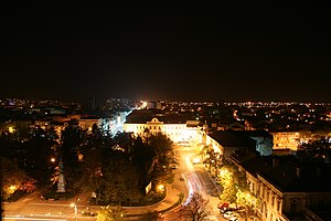
Brăila
City in Brăila County, Romania
Distance: Approx. 2042 meters
Latitude and longitude: 45.26919444,27.95747222
Brăila (, also US: , Romanian: [brəˈila] ) is a city in Muntenia, eastern Romania, a port on the Danube and the capital of Brăila County. The Sud-Est Regional Development Agency is located in Brăila. According to the 2021 Romanian census there were 154,686 people living within the city of Brăila, making it the 11th most populous city in Romania and the 9th largest of all cities on the Danube river.
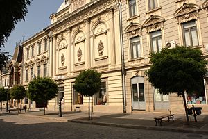
Maria Filotti Theatre
Distance: Approx. 954 meters
Latitude and longitude: 45.271725,27.97343611
The Maria Filotti is a theatre in Brăila, Romania.
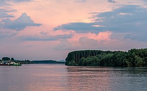
Smârdan, Tulcea
Commune in Tulcea, Romania
Distance: Approx. 2526 meters
Latitude and longitude: 45.28611111,28
Smârdan is a commune in Tulcea County, Northern Dobruja, Romania. It is composed of a single village, Smârdan. It is situated on the right bank of the Danube, opposite the city of Brăila.
Brăila Municipal Stadium
Romanian stadium
Distance: Approx. 2991 meters
Latitude and longitude: 45.25805833,27.94715
The Brăila Municipal Stadium (Romanian: Stadionul Municipal) is a multi-purpose stadium in Brăila, Romania, and is the home ground of Dacia Unirea Brăila. It holds 20,154 people. The stadium was opened on August 21, 1974 and was built on the ground of the old Vasile Roaită Stadium, a small stadium that had only one stand.

Church of the Holy Archangels Michael and Gabriel, Brăila
Orthodox church in Brăila, Romania
Distance: Approx. 871 meters
Latitude and longitude: 45.2712,27.9742
The Church of the Holy Archangels Michael and Gabriel (Romanian: Biserica Sfinții Arhangheli Mihail și Gavriil), located in Piața Traian in the center of Brăila, Romania, is a Romanian Orthodox church.
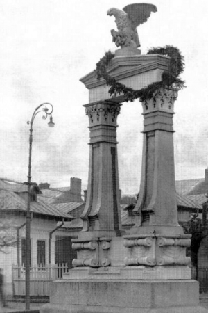
Battle of Galați
1918 battle between Romania and Russia
Distance: Approx. 2899 meters
Latitude and longitude: 45.27,28.02
The Battle of Galați was a military engagement between the formerly allied Romanian and Russian troops at the end of World War I, as the former sought to prevent the latter from retreating from the armistice line along with their equipment.

Greek Church, Brăila
Heritage site in Brăila County, Romania
Distance: Approx. 712 meters
Latitude and longitude: 45.2702,27.9757
The Greek Church (Romanian: Biserica Greacă) is a Romanian Orthodox church located at 3 Calea Călărașilor, Brăila, Romania. It is dedicated to the Feast of the Annunciation. In 1863, the local Greek community decided to build a church, with services in Greek.
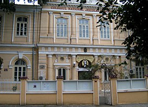
Nicolae Bălcescu National College
High school in Brăila, Romania
Distance: Approx. 1396 meters
Latitude and longitude: 45.2748,27.9697
Nicolae Bălcescu National College (Romanian: Colegiul Național Nicolae Bălcescu) is a high school located at 182 Alexandru Ioan Cuza Boulevard, Brăila, Romania.

Brăila railway station
Railway station of Brăila, Romania
Distance: Approx. 2694 meters
Latitude and longitude: 45.28141667,27.956
The Brăila railway station is the only railway station in Brăila, Romania. The station was built in 1869 by the Prussian company Strussberg, which did so in the model of those in Prussia. It was formally opened in September 1872 and gave Brăila more commercial and economic importance.

Palace of Agriculture, Brăila
20th-century palace in Brăila, Romania
Distance: Approx. 1214 meters
Latitude and longitude: 45.26388889,27.96833333
The Palace of Agriculture (Romanian: Palatul Agriculturii) is a palace of Romanian Revival architectural style in Brăila. Its construction started on 15 July 1923 and ended in 1929. The construction of the palace was first proposed by prefect Șerban Răducanu with the support of Alexandru C. Constantinescu, the Agriculture and Domains Minister at the time.

St. Nicholas Church, Brăila
Romanian Orthodox church in Brăila, Romania
Distance: Approx. 908 meters
Latitude and longitude: 45.26833333,27.97194444
The St. Nicholas Church (Romanian: Biserica Sfântul Nicolae) is a Romanian Orthodox church at 12 Ana Aslan Street in Brăila, Romania. It is the second oldest such building in the city, the first being the Church of the Holy Archangels Michael and Gabriel, and was built on the site of an older church that was burnt down by a fire.
Armenian Church, Brăila
Armenian Apostolic church in Brăila, Romania
Distance: Approx. 1103 meters
Latitude and longitude: 45.27395,27.97370917
The St. Mary Armenian Church (Romanian: Biserica Armeană Sfânta Maria) is an Armenian Apostolic church in Brăila, Romania. It was first established by the Armenian community of Brăila in 1828 and was made of green wood planks.
Weather in this IP's area
overcast clouds
3 Celsius
-3 Celsius
3 Celsius
3 Celsius
1034 hPa
72 %
1034 hPa
1033 hPa
10000 meters
9.39 m/s
14.84 m/s
11 degree
100 %
