128.127.120.188 - IP Lookup: Free IP Address Lookup, Postal Code Lookup, IP Location Lookup, IP ASN, Public IP
Country:
Region:
City:
Location:
Time Zone:
Postal Code:
IP information under different IP Channel
ip-api
Country
Region
City
ASN
Time Zone
ISP
Blacklist
Proxy
Latitude
Longitude
Postal
Route
Luminati
Country
Region
b
City
bucharest
ASN
Time Zone
Europe/Bucharest
ISP
Orange Romania S.A.
Latitude
Longitude
Postal
IPinfo
Country
Region
City
ASN
Time Zone
ISP
Blacklist
Proxy
Latitude
Longitude
Postal
Route
IP2Location
128.127.120.188Country
Region
timis
City
jimbolia
Time Zone
Europe/Bucharest
ISP
Language
User-Agent
Latitude
Longitude
Postal
db-ip
Country
Region
City
ASN
Time Zone
ISP
Blacklist
Proxy
Latitude
Longitude
Postal
Route
ipdata
Country
Region
City
ASN
Time Zone
ISP
Blacklist
Proxy
Latitude
Longitude
Postal
Route
Popular places and events near this IP address

Srpska Crnja
Village in Vojvodina, Serbia
Distance: Approx. 8241 meters
Latitude and longitude: 45.72055556,20.68638889
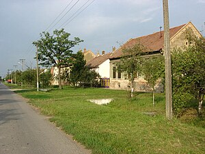
Srpska Crnja (Serbian Cyrillic: Српска Црња; Hungarian: Szerbcsernye; Romanian: Cernea Neamț) is a village in Serbia, situated in central-east Banat alongside the border with Romania. It is located in Nova Crnja municipality, Central Banat District, Province of Vojvodina. It is about 120 km (74.6 mi) away from the capital city of Belgrade, 113 km (70.2 mi) from Novi Sad, 9 km (5.6 mi) south-east of Kikinda and 6 km (3.7 mi) south-west of Jimbolia, Romania.

Jimbolia
Town in Timiș, Romania
Distance: Approx. 1586 meters
Latitude and longitude: 45.79305556,20.7375
Jimbolia (Romanian pronunciation: [ʒimˈboli.a]; Hungarian: Zsombolya; German: Hatzfeld; Serbian: Жомбољ, romanized: Žombolj; Banat Bulgarian: Džimbolj) is a town in Timiș County, Romania.

Banatsko Veliko Selo
Village in Vojvodina, Serbia
Distance: Approx. 9189 meters
Latitude and longitude: 45.81944444,20.60583333
Banatsko Veliko Selo (Serbian Cyrillic: Банатско Велико Село) is a village located in the municipality of Kikinda, North Banat District, Serbia. It is situated in the Autonomous Province of Vojvodina. The village has a population of 3,034 (2002 census), of which the majority are Serbs (96.30%).

Radojevo
Village in Vojvodina, Serbia
Distance: Approx. 7767 meters
Latitude and longitude: 45.74138889,20.78694444
Radojevo (Serbian Cyrillic: Радојево) is a village in Serbia. It is situated in the municipality of Nova Crnja, Central Banat District, Vojvodina province. The village has a Serb ethnic majority (78.98%) and its population is 1,385 people (2002 census).

Novi Kozarci
Place in Vojvodina, Serbia
Distance: Approx. 7749 meters
Latitude and longitude: 45.77555556,20.62
Novi Kozarci (Serbian Cyrillic: Нови Козарци) is a village in Serbia. It is located in the Municipality of Kikinda, North Banat District, Autonomous Province of Vojvodina. The village has an ethnic Serb majority (93.19%) and a population of 1,912 (2011 census).
Weather in this IP's area
clear sky
2 Celsius
-2 Celsius
2 Celsius
2 Celsius
1034 hPa
64 %
1034 hPa
1024 hPa
10000 meters
6.32 m/s
9.91 m/s
31 degree
7 %