Country:
 Pakistan
Region:
City:
Latitude and Longitude:
Time Zone:
Postal Code:
IP information under different IP Channel
ip-api
Country
Region
City
ASN
Time Zone
ISP
Blacklist
Proxy
Latitude
Longitude
Postal
Route
Luminati
Country
PKASN
Time Zone
Asia/Karachi
ISP
Multinet Pakistan Pvt. Ltd.
Latitude
Longitude
Postal
IPinfo
Country
Region
City
ASN
Time Zone
ISP
Blacklist
Proxy
Latitude
Longitude
Postal
Route
db-ip
Country
Region
City
ASN
Time Zone
ISP
Blacklist
Proxy
Latitude
Longitude
Postal
Route
ipdata
Country
Region
City
ASN
Time Zone
ISP
Blacklist
Proxy
Latitude
Longitude
Postal
Route
Popular places and events near this IP address
Mohammad Ali Jinnah University
University in Karachi, Pakistan
Distance: Approx. 4655 meters
Latitude and longitude: 24.8602,67.0699
The Mohammad Ali Jinnah University (Urdu: جامعہ محمد علی جناح), abbreviated as MAJU) is a private university located in Karachi, Sindh, Pakistan. Established in 1998, the university offers undergraduate and post-graduate programs with a strong emphasis on business management, applied sciences, engineering and computer science.
Malir River
River in Pakistan
Distance: Approx. 3510 meters
Latitude and longitude: 24.8,67.08333333
Malir River (Urdu: دریائے ملیر) is a seasonal river that flows in Karachi, Sindh, Pakistan. It passes through the city of Karachi from the northeast, through the center, and drains into the Arabian Sea. It is one of the two rivers passing through Karachi, the other being the Lyari River.
Azam Basti
Residential neighborhood of Karachi, Pakistan
Distance: Approx. 4107 meters
Latitude and longitude: 24.85,67.06666667
Azam Basti (Urdu: اعظم بستی) is a neighborhood in Karachi East district of Karachi, Pakistan. It was previously administered as part of Jamshed Town, which was disbanded in 2011. There are several ethnic groups in Azam Basti including Muhajirs, Punjabis, Sindhis, Kashmiris, Seraikis, Pakhtuns, Balochis, Memons, Bohras, Ismailis.
Nasir Colony
Distance: Approx. 3663 meters
Latitude and longitude: 24.81666667,67.13333333
Nasir Colony (Urdu: ناصر کالونی) is a neighbourhood in the Korangi District in eastern Karachi, Pakistan. It was previously part of Korangi Town, which was an administrative unit that was disbanded in 2011. There are several ethnic groups in Nasir Colony including Muhajirs, Punjabis, Sindhis, Kashmiris, Seraikis, Pakhtuns, Balochis, Memons, Christians, Bohras and Ismailis.
Chakra Goth
Area of Karachi, Pakistan
Distance: Approx. 3663 meters
Latitude and longitude: 24.81666667,67.13333333
Chakra Goth (Urdu: چکرا گوٹھ) is a neighbourhood in the Korangi District in eastern Karachi, Pakistan. It was previously part of Korangi Town, which was an administrative unit that was disbanded in 2011. There are several ethnic groups in Chakra Goth including Muhajirs, Punjabis, Sindhis, Kashmiris, Seraikis, Pakhtuns, Balochis, Bengalis, Memons, Bohras, Ismailis, Rohingyas, etc.
Zaman Town
Distance: Approx. 3663 meters
Latitude and longitude: 24.81666667,67.13333333
Zaman Town (Urdu: زمان ٹاؤن) is a neighbourhood in the Korangi District in eastern Karachi, Pakistan. It was previously part of Korangi Town, which was an administrative unit that was disbanded in 2011.
Clifton Cantonment
Cantonment in Sindh, Pakistan
Distance: Approx. 4536 meters
Latitude and longitude: 24.803896,67.063106
The Clifton Cantonment (Urdu: کلفٹن چھاؤنی) is a cantonment town within the city of Karachi, Sindh, Pakistan. It serves as a military base and residential establishment. It was established by the British Indian Army during 19th century British India, and was taken over by the Pakistan Army in 1947.
Institute of Business Management, Karachi
Private university and business school in Pakistan
Distance: Approx. 2529 meters
Latitude and longitude: 24.8127,67.1178
The Institute of Business Management (IoBM) is a private university and business school in Karachi, Pakistan. IoBM is composed of four colleges, the College of Business Management (CBM), the College of Economics and Social Development (CESD), the College of Computer Science and Information Systems (CCSIS) and the College of Engineering Sciences (CES). In January 1998, a bill was unanimously approved by the Provincial Assembly of Sindh for establishing a university known as the Institute of Business Management in the private sector.
Bhittai Colony
Distance: Approx. 1881 meters
Latitude and longitude: 24.81293,67.10771
Bhittai Colony (Urdu: بھٹائی کالونی); (Sindhi: ڀٽائي ڪالوني) is a neighborhood of Korangi Town in Karachi, Sindh, Pakistan. This neighborhood is named after the Sufi poet Shah Abdul Latif Bhittai. There are several ethnic groups including Muhajirs, Punjabis, Sindhis, Kashmiris, Seraikis, Pakhtuns, Balochis, Memons, Bohras and Ismailis.

1947 Korangi Creek crash
1947 aviation accident
Distance: Approx. 4408 meters
Latitude and longitude: 24.791435,67.116036
The Korangi Creek crash took place on 27 December 1947 when an Air India flight from Karachi to Bombay crashed shortly after takeoff. All 19 passengers and 4 crew members were killed. Poor visibility and malfunctioning instruments in the cockpit led the pilots to lose control.
DHA Suffa University
University in Sindh, Pakistan
Distance: Approx. 2481 meters
Latitude and longitude: 24.8147,67.0796
DHA Suffa University (DSU) (Urdu: ڈی ایچ اے جامعة الصفّہ) is a non-profit private sector university named after Suffah of Masjid-e-Nabwi. It is located in the Phase VII (extension) of Defence Housing Authority, Karachi, in Sindh, Pakistan. The university received its Charter in 2002 and started operations in 2012.
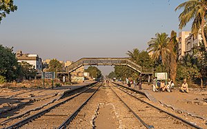
Chanesar railway station
Railway station in Pakistan
Distance: Approx. 4606 meters
Latitude and longitude: 24.8573,67.0671
Chanesar Halt railway station (Urdu: چینیسر ریلوے اسٹیشن, Sindhi: چنيسر ريلوي اسٽيشن), is an abandoned train station located in Karachi, Pakistan, near the village of Chanesar Goth.
Weather in this IP's area
smoke
26 Celsius
26 Celsius
26 Celsius
26 Celsius
1013 hPa
89 %
1013 hPa
1012 hPa
5000 meters
2.06 m/s
250 degree
06:39:26
17:50:48