124.41.203.140 - IP Lookup: Free IP Address Lookup, Postal Code Lookup, IP Location Lookup, IP ASN, Public IP
Country:
Region:
City:
Location:
Time Zone:
Postal Code:
IP information under different IP Channel
ip-api
Country
Region
City
ASN
Time Zone
ISP
Blacklist
Proxy
Latitude
Longitude
Postal
Route
Luminati
Country
Region
p3
City
kathmandu
ASN
Time Zone
Asia/Kathmandu
ISP
WorldLink Communications Pvt Ltd
Latitude
Longitude
Postal
IPinfo
Country
Region
City
ASN
Time Zone
ISP
Blacklist
Proxy
Latitude
Longitude
Postal
Route
IP2Location
124.41.203.140Country
Region
lumbini
City
tansen
Time Zone
Asia/Kathmandu
ISP
Language
User-Agent
Latitude
Longitude
Postal
db-ip
Country
Region
City
ASN
Time Zone
ISP
Blacklist
Proxy
Latitude
Longitude
Postal
Route
ipdata
Country
Region
City
ASN
Time Zone
ISP
Blacklist
Proxy
Latitude
Longitude
Postal
Route
Popular places and events near this IP address

Palpa District
District in Lumbini Province, Nepal
Distance: Approx. 332 meters
Latitude and longitude: 27.86666667,83.55
Palpa District (Nepali: पाल्पा जिल्ला, a part of Lumbini Province, is one of the seventy-seven districts of Nepal, a landlocked country of South Asia. The district, with Tansen as its headquarters, covers an area of 1,373 km2 (530 sq mi) and has a population (2021) of 245,027. Palpa District is not far from Pokhara and easily reached by bus.

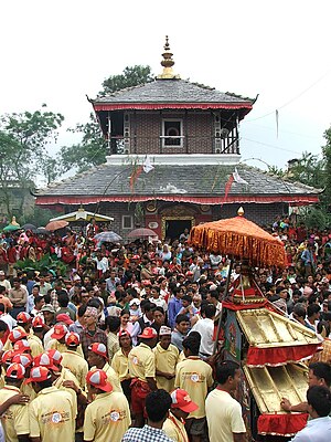
Tansen, Nepal
Place in Lumbini, Nepal
Distance: Approx. 332 meters
Latitude and longitude: 27.86666667,83.55
Tansen is a Municipality and the administrative center of Palpa District in the "hills" of central Nepal. It is located on the highway between Butwal and Pokhara, on the crest of the Mahabharat Range or Lesser Himalaya overlooking the valley of the Kaligandaki River to the north. The highway bypasses the town center on the west, protecting pedestrian amenities in the central maze of steep, narrow, winding alleys lined with Newari shophouses and temples.
Bandi Pokhara
Village development committee in Lumbini Zone, Nepal
Distance: Approx. 4930 meters
Latitude and longitude: 27.88333333,83.5
Bandi Pokhara is a village development committee in Palpa District in the Lumbini Zone of southern Nepal. At the time of the 1991 Nepal census it had a population of 2913 people living in 845 individual households.
Barandi
Place in Lumbini Zone, Nepal
Distance: Approx. 2217 meters
Latitude and longitude: 27.88333333,83.53333333
Barangdi is a village development committee in Palpa District in the Lumbini Zone of southern Nepal. At the time of the 1991 Nepal census it had a population of 2475 people living in 470 individual households.
Baughapokharathok
Village development committee in Lumbini Zone, Nepal
Distance: Approx. 2216 meters
Latitude and longitude: 27.8833,83.5333
BoughaPokharathok is a village development committee in Palpa District in the Lumbini Zone of southern Nepal. At the time of the 1991 Nepal census it had a population of 2238 people living in 432 individual households.
Baughagumba
Village development committee in Lumbini Zone, Nepal
Distance: Approx. 6428 meters
Latitude and longitude: 27.92,83.52
Boughagumba is a village development committee in Palpa District in the Lumbini Zone of southern Nepal. At the time of the 1991 Nepal census it had a population of 2811 people living in 499 individual households.
Chappani
Village development committee in Lumbini Zone, Nepal
Distance: Approx. 4138 meters
Latitude and longitude: 27.89,83.58
Chappani is a village development committee in Palpa District in the Lumbini Zone of southern Nepal. At the time of the 1991 Nepal census it had a population of 2751 people living in 461 individual households.
Chirtungdhara
Village development committee in Lumbini Zone, Nepal
Distance: Approx. 3376 meters
Latitude and longitude: 27.86,83.58
Chirtungdhara is a village development committee in Palpa District in the Lumbini Zone of southern Nepal. At the time of the 1991 Nepal census it had a population of 4259 people living in 747 individual households.
Khanigau
Village development committee in Lumbini Zone, Nepal
Distance: Approx. 5876 meters
Latitude and longitude: 27.92,83.55
Khanigaun is a village development committee in Palpa District in the Lumbini Zone of southern Nepal. At the time of the 1991 Nepal census it had a population of 2221. It is located on the bank of the Kaligandaki river on north.
Telgha
Village development committee in Lumbini Zone, Nepal
Distance: Approx. 4914 meters
Latitude and longitude: 27.83,83.52
Telgha is a village development committee in Palpa District in the Lumbini Zone of southern Nepal. At the time of the 1991 Nepal census it had a population of 3051 people living in 577 individual households.
Tansen Mission Hospital
Hospital in Palpa, Lumbini, Nepal
Distance: Approx. 1289 meters
Latitude and longitude: 27.8731031,83.558038
United Mission Hospital Tansen (Nepali: युनाईटेड मिशन अस्पताल तानसेन) is located in the Tansen Municipality Ward No. 1, Palpa District, Lumbini Province of Nepal. The hospital serves thousands of patients from western Nepal and northern India, and is part of a broader healthcare network.
Rana Ujeshwori Bhagwati temple
Hindu temple in Nepal
Distance: Approx. 277 meters
Latitude and longitude: 27.868,83.544
The Rana Ujeshwori Bhagwati temple is located inside the Tansen Durbar square in Palpa district of Nepal. The temple was built by Ujir Singh Thapa as an offering to Goddess Bhagwati on the occasion of victory by Nepal Army over British Raj in Anglo-Nepali War (1872 BS). The temple was destroyed by the earthquake of 1990 BS and was renovated by Pratap Shamsher Jung Bahadur Rana.
Weather in this IP's area
clear sky
16 Celsius
14 Celsius
16 Celsius
16 Celsius
1021 hPa
41 %
1021 hPa
917 hPa
10000 meters
2.12 m/s
1.7 m/s
175 degree
