124.232.138.66 - IP Lookup: Free IP Address Lookup, Postal Code Lookup, IP Location Lookup, IP ASN, Public IP
Country:
Region:
City:
Location:
Time Zone:
Postal Code:
IP information under different IP Channel
ip-api
Country
Region
City
ASN
Time Zone
ISP
Blacklist
Proxy
Latitude
Longitude
Postal
Route
Luminati
Country
ASN
Time Zone
Asia/Shanghai
ISP
No.293,Wanbao Avenue
Latitude
Longitude
Postal
IPinfo
Country
Region
City
ASN
Time Zone
ISP
Blacklist
Proxy
Latitude
Longitude
Postal
Route
IP2Location
124.232.138.66Country
Region
hunan
City
changsha
Time Zone
Asia/Shanghai
ISP
Language
User-Agent
Latitude
Longitude
Postal
db-ip
Country
Region
City
ASN
Time Zone
ISP
Blacklist
Proxy
Latitude
Longitude
Postal
Route
ipdata
Country
Region
City
ASN
Time Zone
ISP
Blacklist
Proxy
Latitude
Longitude
Postal
Route
Popular places and events near this IP address

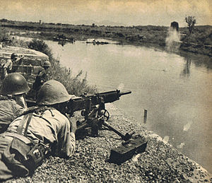
Battle of Changsha (1939)
First of four attempts by Japan to take the city of Changsha during the second Sino-Japanese War
Distance: Approx. 29 meters
Latitude and longitude: 28.2,112.967
The First Battle of Changsha (17 September 1939 – 6 October 1939; Chinese: 第一次長沙會戰) was the first of four attempts by Japan to take the city of Changsha, Hunan, during the second Sino-Japanese War.

Battle of Changsha (1941)
Japan's second attempt at taking the city of Changsha, China
Distance: Approx. 29 meters
Latitude and longitude: 28.2,112.967
The (Second) Battle of Changsha (6 September – 8 October 1941; Chinese: 第二次長沙會戰) was Japan's second attempt at taking the city of Changsha, China, the capital of Hunan Province, as part of the Second Sino-Japanese War. The Japanese were repulsed again, and the battle ended with a Chinese victory.

Battle of Changsha (1941–1942)
Battle of World War II
Distance: Approx. 29 meters
Latitude and longitude: 28.2,112.967
The Third Battle of Changsha (24 December 1941 – 15 January 1942; Chinese: 第三次長沙會戰) was the first major offensive in China by Imperial Japanese forces following the Japanese attack on the Western Allies and the attack on Pearl Harbor, and Japan's third of four attempts to capture the Chinese city of Changsha. It was conducted with the purpose of severing Chinese lines of communication with British Hong Kong, and seizing control of Changsha's food production. The offensive resulted in failure for the Japanese, as Chinese forces were able to lure them into a trap and encircle them.

Battle of Changsha (1944)
Japanese invasion of Hunan, China during the Second Sino-Japanese War
Distance: Approx. 29 meters
Latitude and longitude: 28.2,112.967
The Battle of Changsha of 1944 (also known as the Battle of Hengyang or Campaign of Changsha-Hengyang; Chinese: 長衡會戰) was an invasion of the Chinese province of Hunan by Japanese troops near the end of the Second Sino-Japanese War. As such, it encompasses three separate conflicts: an invasion of the city of Changsha and two invasions of Hengyang. The Japanese military transferred the bulk of their troops from the Japanese homeland and Manchuria as part of Operation "Ichi-Go" or "Tairiku Datsu Sakusen" which roughly translates as 'Operation to Break through the Continent'.

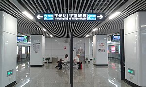
Changsha Metro
Rapid transit system in Changsha, Hunan, China
Distance: Approx. 965 meters
Latitude and longitude: 28.2035,112.9577
The Changsha Metro (officially 长沙轨道交通; chángshā guǐdào jiāotōng; usually called 长沙地铁; chángshā dìtiě) is a rapid transit system in Changsha and Xiangtan. The first operational line, Line 2, commenced service on April 29, 2014, making Changsha the 18th city in mainland China to open a rapid transit system.
Former Residence of Jia Yi
Traditional folk houses in Hunan, China
Distance: Approx. 991 meters
Latitude and longitude: 28.192593,112.972302
The Former Residence of Jia Yi or Jia Yi's Former Residence (simplified Chinese: 贾谊故居; traditional Chinese: 賈誼故居; pinyin: Jiǎ Yí Gùjū) was built during the Qing dynasty (1644–1911). It is located in Tianxin District of Changsha, Hunan, China. It has an area of about 2,490 m2 (26,800 sq ft) and a building area of about 350 m2 (3,800 sq ft).

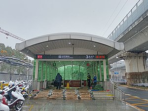
Yingwanzhen station
Metro station in Changsha, China
Distance: Approx. 967 meters
Latitude and longitude: 28.20349,112.95767
Yingwanzhen station (simplified Chinese: 溁湾镇站; traditional Chinese: 濚灣鎮站; pinyin: Yíngwānzhèn Zhàn) is a subway station in Changsha, Hunan, China, operated by the Changsha subway operator Changsha Metro.

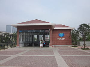
Juzizhou station
Metro station in Changsha, China
Distance: Approx. 262 meters
Latitude and longitude: 28.201402,112.968845
Juzizhou station is a subway station in Changsha, Hunan, China, operated by the Changsha subway operator Changsha Metro.

Xiangjiang Middle Road station
Metro station in Changsha, China
Distance: Approx. 907 meters
Latitude and longitude: 28.2011,112.975861
Xiangjiang Middle Road station is a subway station in Changsha, Hunan, China, operated by the Changsha subway operator Changsha Metro.

Changsha IFS Tower
Supertall skyscraper in Changsha, Hunan, China
Distance: Approx. 833 meters
Latitude and longitude: 28.19541944,112.97341944
Changsha IFS Tower is a pair of skyscrapers in Changsha, Hunan, China, with Tower 1 rising 452 meters and Tower 2 rising 315 meters. Construction started in 2013 and completed in 2017. It is the 16th tallest building in the world and the tallest in Hunan.

Shangshuangtang station
Metro station in Changsha, China
Distance: Approx. 965 meters
Latitude and longitude: 28.2035,112.9577
Shangshuangtang station is a metro station in Changsha, China. It opened on 28 June 2016.

Orange Isle Bridge
Bridge in Hunan, China
Distance: Approx. 327 meters
Latitude and longitude: 28.20166667,112.96944444
The Orange Isle Bridge (Chinese: 橘子洲大桥) is an arch bridge over the Xiang River in Changsha, Hunan, China. It connects Yuelu District and Furong District.
Weather in this IP's area
overcast clouds
6 Celsius
4 Celsius
6 Celsius
6 Celsius
1026 hPa
22 %
1026 hPa
1020 hPa
10000 meters
2.17 m/s
3.81 m/s
316 degree
100 %
