124.19.94.8 - IP Lookup: Free IP Address Lookup, Postal Code Lookup, IP Location Lookup, IP ASN, Public IP
Country:
Region:
City:
Location:
Time Zone:
Postal Code:
IP information under different IP Channel
ip-api
Country
Region
City
ASN
Time Zone
ISP
Blacklist
Proxy
Latitude
Longitude
Postal
Route
Luminati
Country
Region
nsw
City
sydney
ASN
Time Zone
Australia/Sydney
ISP
SingTel Optus Pty Ltd
Latitude
Longitude
Postal
IPinfo
Country
Region
City
ASN
Time Zone
ISP
Blacklist
Proxy
Latitude
Longitude
Postal
Route
IP2Location
124.19.94.8Country
Region
new south wales
City
macquarie park
Time Zone
Australia/Sydney
ISP
Language
User-Agent
Latitude
Longitude
Postal
db-ip
Country
Region
City
ASN
Time Zone
ISP
Blacklist
Proxy
Latitude
Longitude
Postal
Route
ipdata
Country
Region
City
ASN
Time Zone
ISP
Blacklist
Proxy
Latitude
Longitude
Postal
Route
Popular places and events near this IP address

Macquarie Centre
Shopping mall in New South Wales, Australia
Distance: Approx. 836 meters
Latitude and longitude: -33.7768102,151.1204625
Macquarie Centre is a shopping centre in the suburb of Macquarie Park in the Northern Sydney region of Sydney and is located opposite the main campus of Macquarie University.
North Ryde, New South Wales
Suburb of Sydney, New South Wales, Australia
Distance: Approx. 1464 meters
Latitude and longitude: -33.79242,151.11954
North Ryde is a suburb located in the Northern Sydney region of Sydney, New South Wales, Australia. North Ryde is located 15 kilometres north-west of the Sydney central business district, in the local government area of the City of Ryde. One of Australia's major business districts, North Ryde is home to many multi-national corporations such as Microsoft, Hewlett-Packard, Oracle, Dimension Data and Honeywell.

Macquarie Park railway station
Sydney Metro railway station
Distance: Approx. 437 meters
Latitude and longitude: -33.785095,151.128391
Macquarie Park railway station is located on the Sydney Metro network, serving the suburb of Macquarie Park. It was formerly part of Sydney Trains' T1 Northern Line, before being converted to service the Metro North West & Bankstown Line.

Macquarie University railway station
Sydney Metro railway station
Distance: Approx. 997 meters
Latitude and longitude: -33.777337,151.118075
Macquarie University railway station is a Sydney Metro station located on the Metro North West & Bankstown Line, serving the Sydney suburb of Macquarie Park including the nearby Macquarie University and Macquarie Centre, as well as parts of the suburb of Marsfield. It was formerly part of Sydney Trains' T1 Northern Line, before being converted to metro use as part of the Sydney Metro network. It is the only train station in Australia which bears the name of a university.

Macquarie Park, New South Wales
Suburb of Sydney, New South Wales, Australia
Distance: Approx. 561 meters
Latitude and longitude: -33.7772,151.12412
Macquarie Park () is a suburb in the Northern Sydney region of Sydney, New South Wales, Australia. Macquarie Park is located 13 kilometres north-west of the Sydney central business district in the local government area of the City of Ryde. Macquarie Park was part of the suburb of North Ryde until it was gazetted as a suburb in its own right on 5 February 1999, and many businesses still use North Ryde as the address.
Christie Park (Sydney, Australia)
Sports ground in the Lower North Shore, Sydney, Australia
Distance: Approx. 1418 meters
Latitude and longitude: -33.77083333,151.11888889
Christie Park is a sportsground located in the Northern Suburbs Sydney suburb of Macquarie Park. Christie Park is the home to FNSW NPL team, NWS Spirit FC. The park is owned by Ryde Council and leased to North West Sydney Football (formerly GHFA). The ground is used for semi-professional competitions such as NPL and WNPL. It is also used for the amateur men's & women's competition run by NWSF. Christie Park is also the home of the local refereeing association the North West Sydney Football Referees Association (NWSFRA).
Black Christmas bushfires
Series of fires in 2001–2002 in New South Wales
Distance: Approx. 1036 meters
Latitude and longitude: -33.78361111,151.13861111
In Australia, during winter and spring 2001, low rainfall across combined with a hot, dry December created ideal conditions for bushfires. On the day of Christmas Eve, firefighters from the Grose Vale Rural Fire Service (RFS) brigade attended a blaze in rugged terrain at the end of Cabbage Tree Rd, Grose Vale, believed to have been caused by power lines in the Grose Valley. On Christmas Day, strong westerly winds fuelled more than 100 bushfires across the state, creating a plume of smoke that extended across Sydney.
De Burghs Bridge
Bridge in Sydney, Australia
Distance: Approx. 935 meters
Latitude and longitude: -33.775659,151.135396
De Burghs Bridge is a road bridge that carries the Lane Cove Road, part of the A3, across the Lane Cove River in Macquarie Park, Sydney, Australia. The bridge stretches from Macquarie Park in the south to West Pymble in the north.
Macquarie University Hospital
Hospital in New South Wales, Australia
Distance: Approx. 1255 meters
Latitude and longitude: -33.773525,151.117871
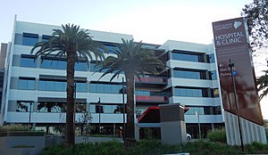
The Macquarie University Hospital (abbreviated MUH) is a private teaching hospital owned by Macquarie University. The hospital is located within Macquarie University and is the first private hospital to be located on a university campus in Australia. The hospital is located near Macquarie University railway station and is also within the university's Research Park.
Australian School of Advanced Medicine
Distance: Approx. 1297 meters
Latitude and longitude: -33.77305556,151.11777778
The Australian School of Advanced Medicine is the first and only medical school in Australia to award degrees for sub-specialties in surgery in addition to PhD research opportunities for doctors. The school is based within the University Clinic Building adjacent and connected to the Macquarie University Hospital. The school has used successful teaching hospitals (particularly Johns Hopkins and the Mayo Clinic) as models for its development and operations.
Morling College
Distance: Approx. 1300 meters
Latitude and longitude: -33.779,151.114
Morling College is a Baptist college in Macquarie Park, New South Wales. It is affiliated with the Australian Baptist Ministries. It is an approved teaching institution of the Australian College of Theology and a registered teaching institution of the University of Divinity, and is a member of the South Pacific Association of Bible Colleges.
Lachlan's Square Village
Shopping mall in New South Wales, Australia
Distance: Approx. 1388 meters
Latitude and longitude: -33.79268,151.13366
Lachlan's Square Village is a shopping centre in the suburb of Macquarie Park in Northern Sydney.
Weather in this IP's area
few clouds
22 Celsius
23 Celsius
22 Celsius
23 Celsius
1016 hPa
75 %
1016 hPa
1009 hPa
10000 meters
5.66 m/s
30 degree
20 %


