Country:
Region:
City:
Latitude and Longitude:
Time Zone:
Postal Code:
IP information under different IP Channel
ip-api
Country
Region
City
ASN
Time Zone
ISP
Blacklist
Proxy
Latitude
Longitude
Postal
Route
Luminati
Country
ASN
Time Zone
Asia/Bangkok
ISP
ServeNET Solution Limited Partnership
Latitude
Longitude
Postal
IPinfo
Country
Region
City
ASN
Time Zone
ISP
Blacklist
Proxy
Latitude
Longitude
Postal
Route
db-ip
Country
Region
City
ASN
Time Zone
ISP
Blacklist
Proxy
Latitude
Longitude
Postal
Route
ipdata
Country
Region
City
ASN
Time Zone
ISP
Blacklist
Proxy
Latitude
Longitude
Postal
Route
Popular places and events near this IP address

Krungthep Bridge
Bascule bridge in Bangkok, Thailand
Distance: Approx. 1430 meters
Latitude and longitude: 13.70111111,100.49166667
The Krungthep Bridge (Thai: สะพานกรุงเทพ, RTGS: Saphan Krung Thep, pronounced [sā.pʰāːn krūŋ tʰêːp]) is a bascule bridge (drawbridge) spanning the Chao Phraya river in Bangkok, Thailand. It was the third bridge to be built across the Chao Phraya river. It was constructed by Fuji Car Manufacturing Co., Ltd, with a budget of 31,912,500 baht.

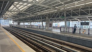
Talat Phlu BTS station
Distance: Approx. 767 meters
Latitude and longitude: 13.71417222,100.47669722
Talat Phlu station (Thai: สถานีตลาดพลู, pronounced [sā.tʰǎː.nīː tā.làːt pʰlūː]) is a BTS skytrain station on the Silom Line in Thon Buri District, Bangkok, Thailand. The station is on Ratchaphruek Road, surrounded by residences, small shops, and office towers. It is an interchange station with Ratchaphruek BRT station.

Pho Nimit BTS station
Distance: Approx. 1281 meters
Latitude and longitude: 13.71916667,100.48591667
Pho Nimit BTS station (Thai: สถานีโพธิ์นิมิตร, pronounced [sā.tʰǎː.nīː pʰōː ní(ʔ).mít]) is a BTS skytrain station, on the Silom Line in Khwaeng Bukkhalo, Thon Buri District, Bangkok, Thailand. The station is located on Ratchaphruek Road. It is surrounded by residences, small shops and office towers.
Wutthakat BTS station
Distance: Approx. 1153 meters
Latitude and longitude: 13.7123,100.471
Wutthakat BTS station (Thai: สถานีวุฒากาศ, pronounced [sā.tʰǎː.nīː wút.tʰāː.kàːt]) is a BTS skytrain station, on the Silom Line at the Thon Buri and Chom Thong District boundary, Bangkok, Thailand. The station is located on Ratchaphruek Road over the Khlong Dan canal. It is surrounded by residential buildings, small shops and office towers.

Dao Khanong
Khwaeng in Thailand
Distance: Approx. 417 meters
Latitude and longitude: 13.70497222,100.48063889
Dao Khanong (Thai: ดาวคะนอง, also spelled: ดาวคนอง; pronounced [dāːw kʰā.nɔ̄ːŋ]) is a khwaeng (sub-district) of Thon Buri district, Bangkok's Thonburi side. It is also the name of the surrounding area.

Talat Phlu
Community and marketplace in Bangkok, Thailand
Distance: Approx. 1161 meters
Latitude and longitude: 13.716489,100.473861
Talat Phlu or Talad Phlu (Thai: ตลาดพลู, pronounced [tā.làːt pʰlūː]) is a community and marketplace by the canal Khlong Bangkok Yai in Talat Phlu subdistrict, Thon Buri district, Thonburi side of Bangkok.

Mahai Sawan Road
Road in Bangkok, Thailand
Distance: Approx. 674 meters
Latitude and longitude: 13.70470278,100.485675
Mahai Sawan Road (Thai: ถนนมไหสวรรย์, RTGS: Thanon Mahai Sawan, pronounced [tʰā.nǒn mā.hǎj.sā.wǎn]) is a short road and intersection in Bangkok. It runs from Mahai Sawan intersection in Thon Buri District through Bukkhalo intersection and Krungthep Bridge across Chao Phraya River to Phra Nakhon side (east bank of the river) and ends at Thanon Tok, connecting Charoen Krung Road and Rama III Road in Bang Kho Laem District. It was named after the first governor of Thonburi province (now Thonburi), Mahai Sawan (พระยามไหสวรรย์) or Ko Sombatsiri (กอ สมบัติศิริ).

Samre, Bangkok
Khwaeng in Thailand
Distance: Approx. 1141 meters
Latitude and longitude: 13.70961111,100.49151111
Samre (Thai: สำเหร่, pronounced [sǎm.rèː]), also spelled Sam Re and Samray, is a subdistrict (khwaeng) of Thon Buri District, Bangkok, Thailand. It is also the name of a neighbourhood around the area.
Bukkhalo
Khwaeng in Thailand
Distance: Approx. 608 meters
Latitude and longitude: 13.71413889,100.48047222
Bukkhalo (Thai: บุคคโล, pronounced [bùk.kʰā.lōː]) is a khwaeng (sub-district) of Thon Buri District, Bangkok. Its name is also the name of surrounding area.

Somdech Phra Pinklao Hospital
Hospital in Thailand, Thailand
Distance: Approx. 650 meters
Latitude and longitude: 13.710108,100.486837
Somdech Phra Pinklao Hospital (Thai: โรงพยาบาลสมเด็จพระปิ่นเกล้า) is a hospital located in Thon Buri District, Bangkok, Thailand. It is a military hospital operated by the Naval Medical Department (NMD), The Royal Thai Navy particularly for personnel of the Royal Thai Navy, but also for the general public. It is the location of the headquarters of the NMD. It has a CPIRD Medical Education Center which trains medical students for the Faculty of Medicine, Burapha University.

Talat Phlu railway station
Railway station in Bangkok, Thailand
Distance: Approx. 1396 meters
Latitude and longitude: 13.7209,100.478
Talat Phlu railway station is a railway station located in Talat Phlu subdistrict, Thon Buri district, Bangkok. It is a class 2 railway station and serves Talat Phlu community. It is located in a different location to Talat Phlu BTS station.

Talat Phlu subdistrict
Khwaeng in Thailand
Distance: Approx. 1161 meters
Latitude and longitude: 13.71648889,100.47386111
Talat Phlu (Thai: ตลาดพลู, pronounced [tā.làːt pʰlūː]) is a khwaeng (sub-district) in Thon Buri district, Bangkok. It encompasses a historic district and a bustling day and night marketplace known as Talat Phlu.
Weather in this IP's area
broken clouds
27 Celsius
30 Celsius
27 Celsius
29 Celsius
1011 hPa
88 %
1011 hPa
1010 hPa
10000 meters
2.24 m/s
3.54 m/s
350 degree
82 %
06:15:22
17:48:31

