123.51.9.155 - IP Lookup: Free IP Address Lookup, Postal Code Lookup, IP Location Lookup, IP ASN, Public IP
Country:
Region:
City:
Location:
Time Zone:
Postal Code:
ISP:
ASN:
language:
User-Agent:
Proxy IP:
Blacklist:
IP information under different IP Channel
ip-api
Country
Region
City
ASN
Time Zone
ISP
Blacklist
Proxy
Latitude
Longitude
Postal
Route
db-ip
Country
Region
City
ASN
Time Zone
ISP
Blacklist
Proxy
Latitude
Longitude
Postal
Route
IPinfo
Country
Region
City
ASN
Time Zone
ISP
Blacklist
Proxy
Latitude
Longitude
Postal
Route
IP2Location
123.51.9.155Country
Region
western australia
City
bunbury
Time Zone
Australia/Perth
ISP
Language
User-Agent
Latitude
Longitude
Postal
ipdata
Country
Region
City
ASN
Time Zone
ISP
Blacklist
Proxy
Latitude
Longitude
Postal
Route
Popular places and events near this IP address
Bunbury, Western Australia
City in Western Australia
Distance: Approx. 415 meters
Latitude and longitude: -33.32722222,115.63694444
Bunbury (Nyungar: Goomburrup) is a coastal city in the Australian state of Western Australia, approximately 175 kilometres (109 mi) south of the state capital, Perth. It is the state's third most populous city after Perth and Mandurah, with a population of approximately 75,000. Located at the south of the Leschenault Estuary, Bunbury was established in 1836 on the orders of Governor James Stirling, and named in honour of its founder, Lieutenant (at the time) Henry Bunbury.

Anglican Diocese of Bunbury
Diocese of the Anglican Church of Australia
Distance: Approx. 584 meters
Latitude and longitude: -33.33138889,115.63777778
The Anglican Diocese of Bunbury is a diocese of the Anglican Church of Australia which was founded in 1904 and covers the south of the State of Western Australia. Together with Perth and North West Australia, it is one of the three diocese of the Province of Western Australia. The diocese's cathedral since 1962 is St Boniface Cathedral in Bunbury.

City of Bunbury
Local government area of Western Australia
Distance: Approx. 1437 meters
Latitude and longitude: -33.34,115.642
The City of Bunbury is a local government area in the South West region of Western Australia, covering an area of 65.7 square kilometres (25.4 sq mi) along the coast about 180 kilometres (112 mi) south of Perth, the capital of Western Australia. The City of Bunbury is one of four local governments comprising the Greater Bunbury urban area. As at the 2016 Census, the City of Bunbury had an estimated population of almost 32,000.

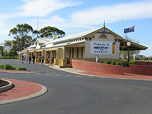
Old Bunbury railway station
Former railway station in Bunbury, Western Australia
Distance: Approx. 415 meters
Latitude and longitude: -33.32427,115.63849
The Old Bunbury railway station was the main railway station for Bunbury, Western Australia from 1894 until 1996. It was the terminus for the Australind passenger railway service from Perth. It was replaced in May 1985 by the current Bunbury Terminal in East Bunbury.
Bunbury Senior High School
Public co-educational high school in Australia
Distance: Approx. 782 meters
Latitude and longitude: -33.3269,115.633
Bunbury Senior High School is a comprehensive public co-educational high day school, located in Bunbury, a regional centre in the South West region, 175 kilometres (109 mi) south of Perth, Western Australia. The School provides four specialised study programs to students: Gifted education, VASP (Visual Art Specialist Program), BEST (Bunbury Elite Sporting Training), and Music Mastery.

Bunbury (suburb)
Suburb of Bunbury, Western Australia
Distance: Approx. 1450 meters
Latitude and longitude: -33.34,115.63922222
Bunbury is a suburb of the Western Australian city of Bunbury, and includes the city's central business district (CBD). The CBD is located primarily on Victoria Street. Blair Street is the major road linking the southern and eastern suburbs of Bunbury to the CBD, and has a large number of businesses and retail outlets situated along it.

Vittoria, Western Australia
Suburb of Bunbury, Western Australia
Distance: Approx. 1383 meters
Latitude and longitude: -33.31666667,115.63333333
Vittoria is a suburb of the city of Bunbury comprising the Bunbury port. The suburb is located in the local government area of the City of Bunbury.

St Patrick's Cathedral, Bunbury
Cathedral in Bunbury, Western Australia
Distance: Approx. 450 meters
Latitude and longitude: -33.32894694,115.63709194
St Patrick's Cathedral (also referred to as Bunbury Cathedral) is a religious building which is the main place of Catholic worship in the city of Bunbury, Western Australia, and is the seat of the Bishop of the Diocese of Bunbury. The first stone was laid in 1919. The church was opened for worship two years later, as a parish church.

Electoral district of Burns Beach
State electoral district of Western Australia
Distance: Approx. 1760 meters
Latitude and longitude: -33.33,115.66
Burns Beach is an electoral district of the Legislative Assembly of Western Australia. It is located in Perth's northern suburbs, and named after the suburb of Burns Beach.
Rose Hotel, Bunbury
Historic hotel in Bunbury, Western Australia
Distance: Approx. 475 meters
Latitude and longitude: -33.32455,115.6373
The Rose Hotel is a historic hotel in Bunbury, Western Australia. Both the hotel itself and the adjacent bottle shop are heritage listed buildings. It is located at the corner of Wellington Street and Victoria Street, in Bunbury's central business district.

Prince of Wales Hotel, Bunbury
Distance: Approx. 290 meters
Latitude and longitude: -33.3264,115.6384
The Prince of Wales Hotel is a heritage-listed hotel in Bunbury, Western Australia. Located at 41 Stephen Street in Bunbury's central business district, it originally opened in a house in 1882. A second building was added in 1892, and extensive renovations in 1906 joined the two structures.

St Boniface Cathedral, Bunbury
Church in Bunbury, Western Australia
Distance: Approx. 583 meters
Latitude and longitude: -33.331419,115.637864
St Boniface Cathedral is an Anglican cathedral in Bunbury, a coastal city in the south west region of Western Australia. It was consecrated in 1962.
Weather in this IP's area
clear sky
23 Celsius
22 Celsius
23 Celsius
23 Celsius
1013 hPa
35 %
1013 hPa
1012 hPa
10000 meters
10.23 m/s
9.82 m/s
193 degree
2 %

