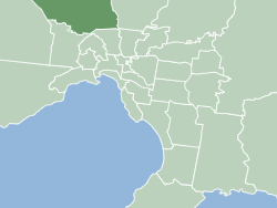
Country:
Region:
City:
Latitude and Longitude:
Time Zone:
Postal Code:
IP information under different IP Channel
ip-api
Country
Region
City
ASN
Time Zone
ISP
Blacklist
Proxy
Latitude
Longitude
Postal
Route
Luminati
Country
Region
vic
City
melbourne
ASN
Time Zone
Australia/Melbourne
ISP
Symbio Networks
Latitude
Longitude
Postal
IPinfo
Country
Region
City
ASN
Time Zone
ISP
Blacklist
Proxy
Latitude
Longitude
Postal
Route
db-ip
Country
Region
City
ASN
Time Zone
ISP
Blacklist
Proxy
Latitude
Longitude
Postal
Route
ipdata
Country
Region
City
ASN
Time Zone
ISP
Blacklist
Proxy
Latitude
Longitude
Postal
Route
Popular places and events near this IP address

City of Hume
Local government area in Victoria, Australia
Distance: Approx. 2044 meters
Latitude and longitude: -37.68333333,144.91666667
The City of Hume is a local government area located within the metropolitan area of Melbourne, Victoria, Australia. It includes the outer north-western suburbs and a number of rural localities between 13 and 40 kilometres from the Melbourne city centre. It has an area of 504 square kilometres, and in June 2018 it had a population of 224,394.

Glenroy, Victoria
Suburb of Melbourne, Victoria, Australia
Distance: Approx. 1982 meters
Latitude and longitude: -37.706,144.924
Glenroy ( glen-ROY) is a suburb in Melbourne, Victoria, Australia, 12 km (7.5 mi) north of Melbourne's Central Business District, located within the City of Merri-bek local government area. Glenroy recorded a population of 23,792 at the 2021 census. Glenroy is located in the northwest of the City of Merri-bek, and is bounded by the Western Ring Road in the north, the Moonee Ponds Creek in the west, New Road, Victoria Street and Rhodes Parade in the south and West Street, Hilton Street, Box Forest Road and the Upfield railway line in the east.

Glenroy railway station
Railway station in Melbourne, Australia
Distance: Approx. 1385 meters
Latitude and longitude: -37.7046,144.9173
Glenroy railway station is a commuter railway station on the Craigieburn line, which is part of the Melbourne railway network. It serves the northern suburb of Glenroy, in Melbourne, Victoria, Australia. Glenroy station is a below ground premium station, featuring two side platforms.

Jacana railway station
Railway station in Glenroy, Melbourne, Victoria, Australia
Distance: Approx. 1140 meters
Latitude and longitude: -37.6951,144.9158
Jacana railway station is a commuter railway station on the Craigieburn line, which is part of the Melbourne railway network. It serves the northern suburb of Glenroy, in Melbourne, Victoria, Australia. Jacana station is a ground level unstaffed station, featuring an island platform.

Tullamarine Freeway
Distance: Approx. 1548 meters
Latitude and longitude: -37.69591,144.88632
The Tullamarine Freeway (commonly referred to as The Tulla), is a major urban freeway in Melbourne, Victoria, Australia, linking Melbourne Airport to the Melbourne City Centre. It carries up to 210,000 vehicles per day and is one of Australia's busiest freeways. The entire stretch of the Tullamarine Freeway bears the designation M2 (previously Metro Route 43 from 1989 to early 2018).

Gowanbrae, Victoria
Suburb of Melbourne, Victoria, Australia
Distance: Approx. 561 meters
Latitude and longitude: -37.702,144.899
Gowanbrae is a suburb in Melbourne, Victoria, Australia, 13 km (8.1 mi) north-west of Melbourne's Central Business District, located within the City of Merri-bek local government area. Gowanbrae recorded a population of 2,971 at the 2021 census. Gowanbrae is bounded by the Western Ring Road in the north and west, the Tullamarine Freeway in the west, the Albion-Jacana railway line in the south and Moonee Ponds Creek in the east.
Strathmore Heights, Victoria
Suburb of Melbourne, Victoria, Australia
Distance: Approx. 1715 meters
Latitude and longitude: -37.713,144.897
Strathmore Heights is a suburb in Melbourne, Victoria, Australia, 12 km (7.5 mi) north-west of Melbourne's Central Business District, located within the City of Moonee Valley local government area. Strathmore Heights recorded a population of 1,047 at the 2021 census. Strathmore Heights is located between Essendon Airport, the Albion–Jacana freight railway line, Moonee Ponds Creek and the Moonee Ponds Creek Trail.
Gladstone Park, Victoria
Suburb of Melbourne, Victoria, Australia
Distance: Approx. 1552 meters
Latitude and longitude: -37.688,144.892
Gladstone Park is a suburb in Melbourne, Victoria, Australia, 15 km (9.3 mi) north-west of Melbourne's Central Business District, located within the City of Hume local government area. Gladstone Park recorded a population of 8,213 at the 2021 census. Gladstone Park is bounded by the Tullamarine Freeway and Mickleham Road to the west, Broadmeadows Road to the north, the Jacana Valley to the east and the Western Ring Road to the south.
Electoral district of Glenroy
Electoral district on Victoria, Australia
Distance: Approx. 1164 meters
Latitude and longitude: -37.7,144.91666667
Electoral district of Glenroy was an electoral district of the Legislative Assembly in the Australian state of Victoria.
Electoral district of Tullamarine
Former state electoral district of Victoria, Australia
Distance: Approx. 1792 meters
Latitude and longitude: -37.7,144.88333333
Electoral district of Tullamarine was an electoral district of the Legislative Assembly in the Australian state of Victoria. The district centred on the suburb of Tullamarine, about 17 km north-west of Melbourne.
Gladstone Park Secondary College
School in Gladstone Park, Victoria, Australia
Distance: Approx. 1538 meters
Latitude and longitude: -37.68861111,144.89138889
Gladstone Park Secondary College is a public state school in Melbourne, Australia founded in 1974.
Hillcrest Secondary College
School
Distance: Approx. 2156 meters
Latitude and longitude: -37.68083333,144.91361111
Hillcrest Secondary College was a Victorian Government secondary college. The college was located in Broadmeadows a largely working class suburb of Melbourne, Australia. Hillcrest provided a comprehensive education from years 7 through to 12 offering both VCE and VCAL qualifications at Year 11 and 12 levels.
Weather in this IP's area
moderate rain
16 Celsius
16 Celsius
15 Celsius
17 Celsius
1011 hPa
88 %
1011 hPa
1003 hPa
10000 meters
2.57 m/s
310 degree
75 %
06:02:07
20:07:22