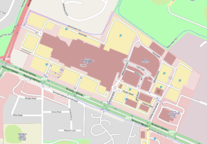
Country:
Region:
City:
Latitude and Longitude:
Time Zone:
Postal Code:
IP information under different IP Channel
ip-api
Country
Region
City
ASN
Time Zone
ISP
Blacklist
Proxy
Latitude
Longitude
Postal
Route
Luminati
Country
Region
nsw
City
sydney
ASN
Time Zone
Australia/Sydney
ISP
Symbio Networks
Latitude
Longitude
Postal
IPinfo
Country
Region
City
ASN
Time Zone
ISP
Blacklist
Proxy
Latitude
Longitude
Postal
Route
db-ip
Country
Region
City
ASN
Time Zone
ISP
Blacklist
Proxy
Latitude
Longitude
Postal
Route
ipdata
Country
Region
City
ASN
Time Zone
ISP
Blacklist
Proxy
Latitude
Longitude
Postal
Route
Popular places and events near this IP address
Wantirna, Victoria
Suburb of Melbourne, Victoria, Australia
Distance: Approx. 1299 meters
Latitude and longitude: -37.844,145.229
Wantirna is an eastern suburb in Melbourne, Victoria, Australia, 27 km east of Melbourne's Central Business District, located within the City of Knox local government area. Wantirna recorded a population of 14,237 at the 2021 census. Its name is derived from the local Aboriginal people’s expression for, "a gurgling stream".

Westfield Knox
Shopping mall in Victoria, Australia
Distance: Approx. 1754 meters
Latitude and longitude: -37.86887972,145.24134833
Westfield Knox (formerly known as Knox City Shopping Centre) is a shopping centre, outdoor entertainment and professional services complex in the outer eastern Melbourne suburb of Wantirna South, in the Australian state of Victoria. The centre opened on 9 November 1977 with 88 stores and 2300 parking spaces. There are over 350 stores and over 6300 free car parking spaces.

The Knox School (Australia)
School in Wantirna South, Victoria, Australia
Distance: Approx. 1432 meters
Latitude and longitude: -37.8647,145.2191
The Knox School is an independent, co-educational, non-denominational day school, located in the eastern Melbourne suburb of Wantirna South, Victoria, Australia. The school is a member of the Eastern Independent Schools of Melbourne association.
Wantirna College
Government secondary school in Victoria, Australia
Distance: Approx. 90 meters
Latitude and longitude: -37.85638889,145.23083333
Wantirna College is a state-government secondary school in Wantirna, Victoria, Australia. It was founded in 1980 when the surrounding area was developed from fruit orchards into housing estates. The school services Wantirna and Wantirna South, as well as parts of Boronia, and Bayswater.

Melbourne Australia Temple
Distance: Approx. 2156 meters
Latitude and longitude: -37.868774,145.212622
The Melbourne Australia Temple is the 90th operating temple of the Church of Jesus Christ of Latter-day Saints (LDS Church).

Koomba Park
Park in Wantirna, Australia
Distance: Approx. 1680 meters
Latitude and longitude: -37.8525,145.2119
Koomba Park is one of the parks comprising the Dandenong Valley Parklands in the eastern suburbs of Melbourne, Australia. It consists of 92 hectares (230 acres) of which 33 hectares (82 acres) are publicly accessible, and is bounded by Dandenong Creek, Boronia Road, EastLink, Mountain Highway and Burwood Highway in a clockwise direction. It is managed primarily by VicRoads and Parks Victoria.
Heathmont College
Public, secondary school in Heathmont, Victoria, Australia
Distance: Approx. 1927 meters
Latitude and longitude: -37.83833333,145.23222222
Heathmont College is a coeducational government secondary college located in Heathmont, Victoria. It is located between Waters Grove, Marlborough Road and Hardy Crescent.
Electoral district of Wantirna
Former state electoral district in Victoria, Australia
Distance: Approx. 668 meters
Latitude and longitude: -37.85,145.23333333
The Electoral district of Wantirna was an electoral district of the Victorian Legislative Assembly. It was first created after the Electoral district of Scoresby was abolished in 1976. Geoff Hayes was the last member for Scoresby in its first incarnation, and the first for Wantirna.
St Andrews Christian College
School in Wantirna South, Victoria, Australia
Distance: Approx. 2384 meters
Latitude and longitude: -37.87388889,145.24472222
St Andrews Christian College is an independent, co-educational school situated in the eastern Melbourne suburb of Wantirna South. The school was founded in 1983 by the Presbyterian Church of Victoria, and takes students from Prep to Year 12. The College expresses a Christian and biblical perspective and approach in its curriculum and culture.

Australian Jazz Museum
Jazz music museum and archive in Victoria, Australia
Distance: Approx. 1992 meters
Latitude and longitude: -37.8583,145.2082
The Australian Jazz Museum (AJM), incorporating the Victorian Jazz Archive (VJA), is located in Wantirna, Victoria. It is an incorporated association arising out of a meeting held in Sydney on 23 June 1996 to address the growing concern among the jazz community that the rich Australian jazz heritage was at risk of being lost. The inaugural meeting of the Australian Jazz Museum was held at the then Whitehorse Hotel, Melbourne, on Sunday 18 August 1996.
Melbourne School of Theology
Distance: Approx. 1940 meters
Latitude and longitude: -37.85972222,145.20916667
The Melbourne School of Theology (MST) is an evangelical Christian theological college with its main campus in Wantirna, an eastern suburb of Melbourne, Victoria, Australia. It offers undergraduate and post-graduate programs in biblical studies, pastoral studies, theology and related fields. The school has a Chinese department, known as MST Chinese, in which undergraduate and graduate courses are taught in both Mandarin and Cantonese which also has a postgraduate research section known as MST Centre for the Study of Chinese Christianity.
Eastern College Australia
Distance: Approx. 1960 meters
Latitude and longitude: -37.859742,145.208941
Eastern College Australia is a non-denominational Christian Private Higher Education and Vocational Education provider in Melbourne, Australia. Eastern exists to equip individuals through provision of accredited teaching, training and research that contribute to the transformation of church (local and global), society and marketplace through the lives of its graduates. The college offers a wide range of courses, including Education, Arts, and Theology degrees.
Weather in this IP's area
overcast clouds
18 Celsius
17 Celsius
16 Celsius
20 Celsius
1018 hPa
41 %
1018 hPa
1004 hPa
10000 meters
2.26 m/s
5.18 m/s
271 degree
100 %
06:03:53
20:01:59