123.51.21.158 - IP Lookup: Free IP Address Lookup, Postal Code Lookup, IP Location Lookup, IP ASN, Public IP
Country:
Region:
City:
Location:
Time Zone:
Postal Code:
ISP:
ASN:
language:
User-Agent:
Proxy IP:
Blacklist:
IP information under different IP Channel
ip-api
Country
Region
City
ASN
Time Zone
ISP
Blacklist
Proxy
Latitude
Longitude
Postal
Route
db-ip
Country
Region
City
ASN
Time Zone
ISP
Blacklist
Proxy
Latitude
Longitude
Postal
Route
IPinfo
Country
Region
City
ASN
Time Zone
ISP
Blacklist
Proxy
Latitude
Longitude
Postal
Route
IP2Location
123.51.21.158Country
Region
victoria
City
bittern
Time Zone
Australia/Melbourne
ISP
Language
User-Agent
Latitude
Longitude
Postal
ipdata
Country
Region
City
ASN
Time Zone
ISP
Blacklist
Proxy
Latitude
Longitude
Postal
Route
Popular places and events near this IP address

Balnarring Beach, Victoria
Town in Victoria, Australia
Distance: Approx. 3920 meters
Latitude and longitude: -38.359,145.136
Balnarring Beach is a town on the Mornington Peninsula in Melbourne, Victoria, Australia, 2 km (1.2 mi) south of Balnarring and approximately 65 km (40 mi) south-east of Melbourne's Central Business District, located within the Shire of Mornington Peninsula local government area. Balnarring Beach recorded a population of 471 at the 2021 census. In 2006 it was rated by the Keep Australia Beautiful Council as 'Australia's Cleanest Beach', out of 317 beaches in five states.

Bittern, Victoria
Town in Victoria, Australia
Distance: Approx. 963 meters
Latitude and longitude: -38.339,145.175
Bittern is a town on the Mornington Peninsula in Melbourne, Victoria, Australia, 61 km (38 mi) south-east of Melbourne's Central Business District, located within the Shire of Mornington Peninsula local government area. Bittern recorded a population of 4,276 at the 2021 census. Bittern is part of an urban enclave on Western Port comprising Bittern, Hastings, Crib Point, Somerville, and Tyabb.
Crib Point, Victoria
Town in Victoria, Australia
Distance: Approx. 4520 meters
Latitude and longitude: -38.363,145.202
Crib Point is a town on the Mornington Peninsula in Melbourne, Victoria, Australia, 64 km (40 mi) south-east of Melbourne's Central Business District, located within the Shire of Mornington Peninsula local government area. Crib Point recorded a population of 3,343 at the 2021 census. The town is part of an urban enclave on Western Port comprising Bittern, Crib Point, Hastings, Tyabb, and Somerville.
Hastings, Victoria
Town in Victoria, Australia
Distance: Approx. 3610 meters
Latitude and longitude: -38.306,145.189
Hastings (Parre Eurruc-Eurruc in Boonwurrung) is a town on the Mornington Peninsula in Melbourne, Victoria, Australia, 58 km (36 mi) south-east of Melbourne's Central Business District, located within the Shire of Mornington Peninsula local government area. Hastings recorded a population of 10,369 at the 2021 census. Hastings is part of an urban enclave on Western Port comprising Hastings, Bittern, Crib Point, Tyabb, and Somerville.

HMAS Cerberus (naval base)
Australian naval base
Distance: Approx. 4149 meters
Latitude and longitude: -38.367,145.187
HMAS Cerberus is a Royal Australian Navy (RAN) base that serves as the primary training establishment for RAN personnel. The base is located adjacent to Crib Point on the Mornington Peninsula, south of the Melbourne City Centre, Victoria, Australia. The base is also an official bounded locality of the Shire of Mornington Peninsula and is the only naval base to have a specific listing in the Australian census.

Hastings railway station, Melbourne
Railway station in Melbourne, Australia
Distance: Approx. 3514 meters
Latitude and longitude: -38.3056,145.186
Hastings railway station is a commuter railway station on the Stony Point line, part of the Melbourne railway network. It opened on 10 September 1889 and serves the town of the same name in Victoria, Australia. The station, along with the line, was closed on 22 June 1981, but both were reopened on 27 September 1984.

Bittern railway station
Railway station in Melbourne, Australia
Distance: Approx. 1074 meters
Latitude and longitude: -38.3371,145.178
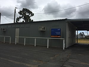
Bittern railway station is a commuter railway station on the Stony Point line, part of the Melbourne railway network. It serves the town of Bittern in Victoria, Australia. Bittern is a ground level unstaffed station, featuring one side platform.

Morradoo railway station
Railway station in Melbourne, Australia
Distance: Approx. 3017 meters
Latitude and longitude: -38.3538,145.1893
Morradoo railway station is a commuter railway station on the Stony Point line, part of the Melbourne railway network. It serves the town of Crib Point in Victoria, Australia. Morradoo is a ground level unstaffed station, featuring one side platform.

Shire of Hastings
Local government area in Victoria, Australia
Distance: Approx. 3981 meters
Latitude and longitude: -38.3,145.18333333
The Shire of Hastings was a local government area about 60 kilometres (37 mi) south-southeast of Melbourne, the state capital of Victoria, Australia, encompassing the eastern extremity of the Mornington Peninsula. The shire covered an area of 304.6 square kilometres (117.6 sq mi), and existed from 1960 until 1994.
Sandstone Island
Place in Victoria, Australia
Distance: Approx. 3754 meters
Latitude and longitude: -38.32972222,145.20944444
Sandstone Island is a small island located approximately one kilometre southeast of the Hastings foreshore in Western Port, Victoria, Australia. Sandstone Island has an area of approximately 19 hectares and is adjacent to Jacks Beach. The island is situated in an area where significant mangrove communities exist.
Victorian Maritime Centre
Distance: Approx. 4487 meters
Latitude and longitude: -38.34723056,145.21491944
The Victorian Maritime Centre is an Australian maritime museum near Melbourne, Victoria, Australia. It is currently located at the former BP administration building at Crib Point, Victoria. There are plans to establish a larger maritime centre in Hastings, Victoria.
Westernport Refinery
Distance: Approx. 4404 meters
Latitude and longitude: -38.349,145.213
Westernport Refinery was an oil refinery operated by BP at Crib Point adjacent to Westernport Bay in the Australian state of Victoria. It was constructed from 1963 and started operations in 1966. Its last day of operation was 1 April 1985.
Weather in this IP's area
scattered clouds
16 Celsius
16 Celsius
16 Celsius
19 Celsius
1019 hPa
70 %
1019 hPa
1016 hPa
10000 meters
6.26 m/s
6.88 m/s
173 degree
38 %

