Country:
Region:
City:
Latitude and Longitude:
Time Zone:
Postal Code:
IP information under different IP Channel
ip-api
Country
Region
City
ASN
Time Zone
ISP
Blacklist
Proxy
Latitude
Longitude
Postal
Route
Luminati
Country
Region
tas
City
hobart
ASN
Time Zone
Australia/Hobart
ISP
Symbio Networks
Latitude
Longitude
Postal
IPinfo
Country
Region
City
ASN
Time Zone
ISP
Blacklist
Proxy
Latitude
Longitude
Postal
Route
db-ip
Country
Region
City
ASN
Time Zone
ISP
Blacklist
Proxy
Latitude
Longitude
Postal
Route
ipdata
Country
Region
City
ASN
Time Zone
ISP
Blacklist
Proxy
Latitude
Longitude
Postal
Route
Popular places and events near this IP address
Sandy Bay, Tasmania
Suburb of Hobart, Tasmania, Australia
Distance: Approx. 843 meters
Latitude and longitude: -42.901,147.327
Sandy Bay is a prestigious suburb of the city of Hobart, Tasmania, Australia, located immediately south of the central business district and adjoining Battery Point. Sandy Bay is bordered by the Derwent River to the east and is known for its beaches, including Nutgrove Beach, Long Beach, and Lords Beach. Sandy Bay is one of Hobart's most affluent suburbs, home to some of Tasmania's most expensive real estate.

South Hobart, Tasmania
Suburb of Hobart, Tasmania, Australia
Distance: Approx. 466 meters
Latitude and longitude: -42.8925,147.31611111
South Hobart is one of Hobart's inner suburbs. It is bound by Dynnyrne, Fern Tree, West Hobart and the Hobart City Centre.
Tasmanian University Student Association
Distance: Approx. 959 meters
Latitude and longitude: -42.90322222,147.32419444
The Tasmanian University Student Association (TUSA), formerly known as Tasmania University Union (TUU), is the peak body of student representation for tertiary students attending the University of Tasmania and was established in 1899. The Student Association is a student-led collective that is dedicated to two core principles: student leadership, and the student community.

St Michael's Collegiate School
School in Hobart, Tasmania, Australia
Distance: Approx. 816 meters
Latitude and longitude: -42.88805556,147.32388889
St Michael's Collegiate School, colloquially known as Collegiate, is an independent Anglican early learning, primary and secondary day and boarding school for girls. It is located in Hobart, Tasmania, Australia.
Macquarie Street, Hobart
Street in Hobart, Tasmania, Australia
Distance: Approx. 825 meters
Latitude and longitude: -42.8879,147.3236
Macquarie Street a major one way street passing through the outskirts of the Hobart City Centre in Tasmania, Australia. Macquarie street is named after Lachlan Macquarie, who oversaw the planning of Hobart’s inner city grid layout. The street forms a One-way couplet with nearby Davey Street connecting traffic from the Southern Outlet in the south with traffic from the Tasman Highway to the east and the Brooker Highway to the north of the city.
Jane Franklin Hall
Residential college of the University of Tasmania
Distance: Approx. 349 meters
Latitude and longitude: -42.89494444,147.31641667
Jane Franklin Hall in Hobart, Australia is an independent non-denominational residential college of the University of Tasmania. Familiarly referred to as "Jane", it was founded by the Tasmanian Council of Churches in 1950 as a residential college for women before becoming co-educational in 1973. Jane is a non-denominational Christian institution supported by chaplains of various Christian traditions and is the only college in the Oxbridge style attached to the university.
Anglesea Barracks
Australian Defence Organisation barracks in central Hobart, Tasmania, Australia
Distance: Approx. 799 meters
Latitude and longitude: -42.888745,147.325496
Anglesea Barracks is an Australian Defence Force barracks in central Hobart, Tasmania. The site was chosen in December 1811 by Lachlan Macquarie and construction began on the first buildings to occupy the site in 1814. It is the oldest Australian Army barracks still in use and celebrated its bicentenary in December 2011.
Dynnyrne, Tasmania
Suburb of Hobart, Tasmania, Australia
Distance: Approx. 864 meters
Latitude and longitude: -42.90111111,147.31416667
Dynnyrne is a residential locality in the local government area (LGA) of Hobart in the Hobart LGA region of Tasmania. The locality is about 3 kilometres (1.9 mi) south-west of the town of Hobart. The 2016 census recorded a population of 1577 for the state suburb of Dynnyrne.

Print Radio Tasmania
Radio reading service in Hobart, Australia
Distance: Approx. 549 meters
Latitude and longitude: -42.89027778,147.32263889
Print Radio Tasmania (callsign 7RPH) is a radio station based in Hobart, Tasmania. It is a reading and information service for those persons unable to read or easily access information in print. The station is run by an elected Committee of Management, two paid positions, Broadcast Manager and an Administration / Volunteer Coordinator backed by a dedicated group of volunteers.

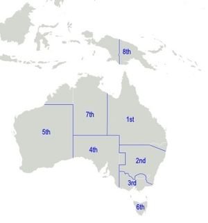
6th Military District (Australia)
Distance: Approx. 804 meters
Latitude and longitude: -42.8887,147.3255
The 6th Military District was an administrative district of the Australian Army. During the Second World War, the 6th Military District covered all of Tasmania, with its headquarters at Hobart. Around the start of the Second World War, the 6th Military District became part of Southern Command, along with the 3rd and 4th Military Districts in Victoria and South Australia.
Army Museum of Tasmania
Military Museum in Hobart, Tasmania
Distance: Approx. 799 meters
Latitude and longitude: -42.88874444,147.32549722
The Army Museum of Tasmania (formerly known as the Military Museum of Tasmania) is located within Anglesea Barracks in Hobart, Tasmania, Australia. Anglesea Barracks, constructed in 1814. The Barracks is included on the Commonwealth Heritage List.
Darcy Street
Stadium in Hobart, Australia
Distance: Approx. 956 meters
Latitude and longitude: -42.8958,147.30902
Darcy Street, officially the South Hobart Oval, is a multi-use stadium in Hobart, Australia. It is mainly used for soccer and is the home ground for South Hobart FC. The stadium has a capacity of 1,500 people.
Weather in this IP's area
broken clouds
12 Celsius
11 Celsius
11 Celsius
12 Celsius
1013 hPa
66 %
1013 hPa
1008 hPa
10000 meters
4.12 m/s
330 degree
75 %
05:44:12
20:04:57


