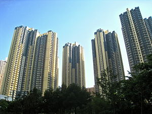
Country:
 Hong Kong (China)
Region:
City:
Latitude and Longitude:
Time Zone:
Postal Code:
IP information under different IP Channel
ip-api
Country
Region
City
ASN
Time Zone
ISP
Blacklist
Proxy
Latitude
Longitude
Postal
Route
IPinfo
Country
Region
City
ASN
Time Zone
ISP
Blacklist
Proxy
Latitude
Longitude
Postal
Route
MaxMind
Country
Region
City
ASN
Time Zone
ISP
Blacklist
Proxy
Latitude
Longitude
Postal
Route
Luminati
Country
HKASN
Time Zone
Asia/Hong_Kong
ISP
HK Broadband Network Ltd.
Latitude
Longitude
Postal
db-ip
Country
Region
City
ASN
Time Zone
ISP
Blacklist
Proxy
Latitude
Longitude
Postal
Route
ipdata
Country
Region
City
ASN
Time Zone
ISP
Blacklist
Proxy
Latitude
Longitude
Postal
Route
Popular places and events near this IP address

Tai Wo Hau station
MTR station in the New Territories, Hong Kong
Distance: Approx. 519 meters
Latitude and longitude: 22.3708,114.125
Tai Wo Hau (Chinese: 大窩口; Cantonese Yale: Daaih wō háu) is an MTR station between Tsuen Wan and Kwai Hing stations on the Tsuen Wan line. It serves the areas of Kwai Yin Court and Tai Wo Hau Estate in the Kwai Tsing District, and some resited villages (such as Kwan Mun Hau Tsuen) in the Tsuen Wan District of Hong Kong. These villages were originally in Tsuen Wan town centre, being moved for new town development.

Sheng Kung Hui Lam Woo Memorial Secondary School
Secondary school in Hong Kong
Distance: Approx. 587 meters
Latitude and longitude: 22.36494444,114.130425
Sheng Kung Hui Lam Woo Memorial Secondary School (LWMSS, Traditional Chinese: 聖公會林護紀念中學) is an Anglican secondary school located at Kwai Shing Circuit, Kwai Chung, the New Territories, Hong Kong. The school was founded in 1970 by Hong Kong Sheng Kung Hui (Anglican Church in Hong Kong) and was named after Mr. Lam Woo for his donations to promote education.
Daughters of Mary Help of Christians Siu Ming Catholic Secondary School
Public school
Distance: Approx. 558 meters
Latitude and longitude: 22.36534722,114.12865278
Daughters of Mary Help of Christians Siu Ming Catholic Secondary School (天主教母佑會蕭明中學), founded in 1973, is a girls' secondary school in Kwai Chung, Hong Kong. It is administered under the Grant Code and using English as a medium of instruction, or being an "EMI school".

CCC Chuen Yuen College
Secondary school in Kwai Chung, New Territories
Distance: Approx. 272 meters
Latitude and longitude: 22.3685,114.1281
CCC Chuen Yuen College (Chinese: 中華基督教會全完中學) is a Chinese Christian secondary school in Hong Kong. Established in 1969 and located in the Kwai Chung district of the New Territories, the school consists of a 50,000-square-foot (4,600 m2), six-storey school building and a new wing which was opened in 2004. Facilities of the school include of 24 conventional class rooms, eleven special purpose rooms, an assembly hall that seats a thousand people, and a basketball court.
Kwai Chung Estate
Public housing estate in Kwai Chung, Hong Kong
Distance: Approx. 419 meters
Latitude and longitude: 22.3673779,114.1273056
Kwai Chung Estate (Chinese: 葵涌邨) is a public housing estate in Kwai Chung, New Territories, Hong Kong. It is the largest public housing estate in Kwai Tsing District and consists of sixteen residential buildings completed between 1997 and 2008.

Kwai Hing Estate
Public housing estate in Kwai Chung, Hong Kong
Distance: Approx. 535 meters
Latitude and longitude: 22.365822,114.132148
Kwai Hing Estate (Chinese: 葵興邨) is a public housing estate in Kwai Hing, Kwai Chung, New Territories, Hong Kong. It was built in the valley of Gin Drinkers Bay, later the town centre of Kwai Chung. Kwai Hing station is named after the name of the estate.

Ho Pui Tsuen (Tsuen Wan District)
Village in Hong Kong
Distance: Approx. 410 meters
Latitude and longitude: 22.371578,114.126311
Ho Pui Tsuen (Chinese: 河背村) or Ho Pui New Village is a village in Tai Wo Hau, Tsuen Wan District, Hong Kong.
Ham Tin Tsuen, Tai Wo Hau
Distance: Approx. 220 meters
Latitude and longitude: 22.372006,114.129137
Ham Tin Tsuen (Chinese: 咸田村) or Ham Tin New Village (咸田村) is a village in Tai Wo Hau, Tsuen Wan District, Hong Kong.

Hoi Pa
Distance: Approx. 303 meters
Latitude and longitude: 22.37208,114.127874
Hoi Pa (Chinese: 海壩) is an area and village in Tsuen Wan District, Hong Kong.
Yeung Uk Tsuen, Tsuen Wan District
Distance: Approx. 482 meters
Latitude and longitude: 22.37187,114.125682
Yeung Uk Tsuen (Chinese: 楊屋村) or Yeung Uk New Village is a village in the Tai Wo Hau area of Tsuen Wan District, Hong Kong.
Ta Chuen Ping
Distance: Approx. 527 meters
Latitude and longitude: 22.373921,114.133169
Ta Chuen Ping or Da Chuen Ping (Chinese: 打磚坪村) is a village in the Tsuen Wan District of Hong Kong.
Yau Ma Hom
Village in Hong Kong
Distance: Approx. 392 meters
Latitude and longitude: 22.371561,114.133508
Yau Ma Hom or Yau Ma Hom Resite Village (Chinese: 油麻磡村) is a village in the Tsuen Wan District of Hong Kong.
Weather in this IP's area
overcast clouds
29 Celsius
35 Celsius
28 Celsius
30 Celsius
1005 hPa
82 %
1005 hPa
1000 hPa
10000 meters
2.68 m/s
50 degree
100 %
06:10:51
18:25:19