122.8.109.203 - IP Lookup: Free IP Address Lookup, Postal Code Lookup, IP Location Lookup, IP ASN, Public IP
Country:
Region:
City:
Location:
Time Zone:
Postal Code:
IP information under different IP Channel
ip-api
Country
Region
City
ASN
Time Zone
ISP
Blacklist
Proxy
Latitude
Longitude
Postal
Route
Luminati
Country
Region
va
City
reston
ASN
Time Zone
America/New_York
ISP
NEPTUNE-NETWORKS
Latitude
Longitude
Postal
IPinfo
Country
Region
City
ASN
Time Zone
ISP
Blacklist
Proxy
Latitude
Longitude
Postal
Route
IP2Location
122.8.109.203Country
Region
jiangxi
City
shangrao
Time Zone
Asia/Shanghai
ISP
Language
User-Agent
Latitude
Longitude
Postal
db-ip
Country
Region
City
ASN
Time Zone
ISP
Blacklist
Proxy
Latitude
Longitude
Postal
Route
ipdata
Country
Region
City
ASN
Time Zone
ISP
Blacklist
Proxy
Latitude
Longitude
Postal
Route
Popular places and events near this IP address

Shangrao
Prefecture-level city in Jiangxi, People's Republic of China
Distance: Approx. 2542 meters
Latitude and longitude: 28.4551,117.9431
Shangrao (simplified Chinese: 上饶; traditional Chinese: 上饒; pinyin: Shàngráo) is a medium-sized prefecture-level city located in the northeast of Jiangxi province, People's Republic of China. The city borders the province of Anhui to the north, the province of Zhejiang to the east, and the province of Fujian to the south. Also, the city's western reaches extend into Poyang Lake.

Xinzhou, Shangrao
District in Jiangxi, People's Republic of China
Distance: Approx. 2511 meters
Latitude and longitude: 28.431,117.966
Xinzhou District (Chinese: 信州区; pinyin: Xìnzhōu Qū) is an urban district and the seat of the city of Shangrao, Jiangxi province, China.

Guangxin, Shangrao
District in Jiangxi, People's Republic of China
Distance: Approx. 5990 meters
Latitude and longitude: 28.449,117.908
Guangxin District (simplified Chinese: 广信区; traditional Chinese: 廣信區; pinyin: Guǎngxìn qū) formerly, Shangrao County (simplified Chinese: 上饶县; traditional Chinese: 上饒縣; pinyin: Shàngráo Xiàn), is a district in the northeast of Jiangxi province, People's Republic of China, bordering Fujian province to the south. It is under the jurisdiction of the prefecture-level city of Shangrao.
Xuri Subdistrict
Subdistrict in Jiangxi, People's Republic of China
Distance: Approx. 1494 meters
Latitude and longitude: 28.46666667,117.96666667
Xuri Subdistrict (Chinese: 旭日街道; pinyin: Xùrì Jiēdào) is a subdistrict in Shangrao County, Jiangxi, China. As of 2018, it has 21 residential communities under its administration.

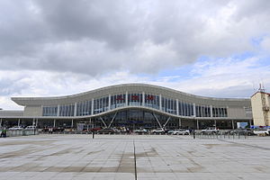
Shangrao railway station
Railway station in Shangrao, China
Distance: Approx. 5520 meters
Latitude and longitude: 28.49416667,118.00111111
Shangrao railway station (Chinese: 上饶站) is a railway station located in Xinzhou District, Shangrao, Jiangxi Province, People's Republic of China. It serves the railway junction of Hangzhou–Changsha section of Shanghai–Kunming High-Speed Railway (Hukun HSR) and Hefei–Fuzhou High-Speed Railway (Hefu HSR). This station has platforms on both the north–south Hefei–Fuzhou high-speed railway and the west–east Hangzhou–Changsha high-speed railway.

Shangrao Sanqingshan Airport
Airport
Distance: Approx. 8174 meters
Latitude and longitude: 28.38027778,117.96138889
Shangrao Sanqingshan Airport (IATA: SQD, ICAO: ZSSR) is an airport serving the city of Shangrao in the northeast of Jiangxi province, China. The airport is 8 kilometres (5.0 mi) from the city center (16 km by road) and 47 kilometres (29 mi) from Mount Sanqing National Park, the World Heritage Site after which it is named. In addition to Shangrao, the airport also serves the nearby cities of Yingtan and Fuzhou, Jiangxi.
Weather in this IP's area
clear sky
11 Celsius
8 Celsius
11 Celsius
11 Celsius
1031 hPa
22 %
1031 hPa
1016 hPa
10000 meters
1.19 m/s
2.69 m/s
258 degree