Country:
 New Zealand
Region:
City:
Latitude and Longitude:
Time Zone:
Postal Code:
IP information under different IP Channel
ip-api
Country
Region
City
ASN
Time Zone
ISP
Blacklist
Proxy
Latitude
Longitude
Postal
Route
IPinfo
Country
Region
City
ASN
Time Zone
ISP
Blacklist
Proxy
Latitude
Longitude
Postal
Route
MaxMind
Country
Region
City
ASN
Time Zone
ISP
Blacklist
Proxy
Latitude
Longitude
Postal
Route
Luminati
Country
NZRegion
wko
City
waikatoregion
ASN
Time Zone
Pacific/Auckland
ISP
Global-Gateway Internet
Latitude
Longitude
Postal
db-ip
Country
Region
City
ASN
Time Zone
ISP
Blacklist
Proxy
Latitude
Longitude
Postal
Route
ipdata
Country
Region
City
ASN
Time Zone
ISP
Blacklist
Proxy
Latitude
Longitude
Postal
Route
Popular places and events near this IP address

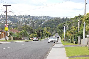
Birkenhead, New Zealand
Suburb in Auckland, New Zealand
Distance: Approx. 2115 meters
Latitude and longitude: -36.80749,174.723051
Birkenhead is a suburb of Auckland, in northern New Zealand. It is located on the North Shore of the Waitematā Harbour, 4 kilometres (2.5 mi) northwest of the Auckland City Centre. The area has been settled by Tāmaki Māori since at least the 14th century, and is the location of Te Matarae ō Mana, a fortified pā for Te Kawerau ā Maki that overlooked an important seasonal shark fishery.
Birkdale, New Zealand
Suburb of Auckland
Distance: Approx. 2328 meters
Latitude and longitude: -36.8006,174.7042
Birkdale is a suburb of the contiguous Auckland metropolitan area located in New Zealand. Originally called Parkview, comprising the area from Balmain Rd to the Birkdale (now Beach Haven) wharf, it was renamed Birkdale at a meeting of the Birkenhead Borough Council in 1889, after the suburb of Birkenhead in England of the same name. It now comprises statistical area units such as 'Birkdale North' and 'Birkdale South'.

Chatswood, New Zealand
Suburb in Auckland, New Zealand
Distance: Approx. 996 meters
Latitude and longitude: -36.8159,174.7157
Chatswood is a suburb in the city of Auckland, New Zealand, in the middle-eastern side of North Shore. It contains a primary school and many parks. To the south of Chatswood is Kendall's Bay, a small bay of the Waitematā Harbour.

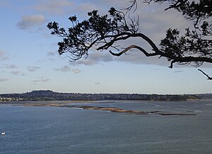
Watchman Island
Island in New Zealand
Distance: Approx. 2695 meters
Latitude and longitude: -36.8349,174.732
Watchman Island (Te Kākāwhakaara in Māori, officially Watchman Island / Te Kākāwhakaara) is a tiny sandstone island in the Waitematā Harbour of Auckland, New Zealand. It lies approximately 600 metres north of the Herne Bay suburb.
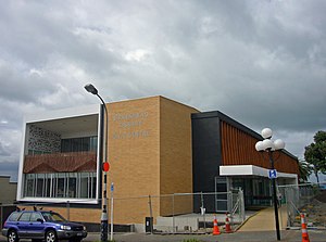
Birkenhead Public Library
Public library in New Zealand
Distance: Approx. 1875 meters
Latitude and longitude: -36.81571944,174.72669167
Birkenhead Public Library (Te Whare Matauranga o Birkenhead in Māori) is a New Zealand library, part of the Auckland Libraries system located on Auckland's North Shore. Founded in 1949 it predominantly serves the areas of Birkenhead, Beach Haven, Birkdale, Kauri Park, Chelsea, and Birkenhead East, a population of about 26,000, including six primary schools, two intermediate schools, and two colleges. Typical of medium-sized public libraries in New Zealand, it is able to provide an extensive range of modern library resources and services through its integration into a wider urban network, and through its association with the National Library, while retaining its own distinct, local connections such as the Archives Collection of the Chelsea Sugar Refinery.
Chelsea Sugar Refinery
Sugar refinery in Auckland, New Zealand
Distance: Approx. 1525 meters
Latitude and longitude: -36.821,174.724
New Zealand Sugar Company Limited is a long-established business and landmark in Birkenhead, New Zealand, located on the northern shore of Auckland's Waitemata Harbour. The company is also known colloquially as "Chelsea Sugar", taking reference from the company's branded sugar "Chelsea", and the site is also colloquially known as the "Chelsea Sugar Refinery", or "sugar works". The refinery was established in 1884, and remains New Zealand's main source of sugar products (for both home use and for the food and beverage industry).
Meola Reef
Lava flow in Auckland, New Zealand
Distance: Approx. 2450 meters
Latitude and longitude: -36.84293,174.712616
Meola Reef, or Te Tokaroa in Māori ('toka'='rock', 'roa'='long'), is a lava flow forming a reef peninsula across part of Auckland's Waitemata Harbour, New Zealand. The reef extends for over 2 kilometres across the harbour, to within 500 metres of Kauri Point on the northern shore.

Northcote College
Secondary school in Auckland, New Zealand
Distance: Approx. 2729 meters
Latitude and longitude: -36.809637,174.733762
Northcote College is a New Zealand secondary school for boys and girls (co-educational) located in Northcote, Auckland. The school caters for Form 3 (Year 9) to Form 7 (Year 13). It was founded in 1877 and is the oldest secondary school on the North Shore.
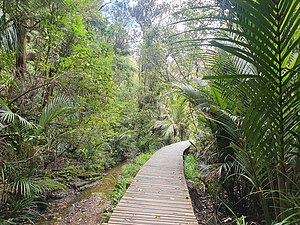
Le Roys Bush
Forest on the North Shore, New Zealand
Distance: Approx. 2438 meters
Latitude and longitude: -36.8129,174.7321
Le Roys Bush is a public reserve between Birkenhead and Northcote in Auckland, New Zealand.

Kauri Point Armament Depot
Distance: Approx. 445 meters
Latitude and longitude: -36.82083333,174.70194444
The Defence Armament Depot, named the Kauri Point Armament Depot until 2010, is a New Zealand Defence Force munitions storage facility in the Auckland suburb of Chatswood which was originally built for the Royal New Zealand Navy. The Depot has access to Waitematā Harbour. The armament depot was established in 1935, and was considerably expanded during the Second World War.
Boat Rock
Distance: Approx. 1535 meters
Latitude and longitude: -36.829855,174.693281
Boat Rock is a tiny sandstone island in the Waitematā Harbour of Auckland, New Zealand. Boat Rock is a vanishing island, which is submerged at high tide.

Upper Waitematā Harbour
Section of the Waitematā Harbour in New Zealand
Distance: Approx. 2098 meters
Latitude and longitude: -36.8117,174.6867
The Upper Waitematā Harbour is an estuary of the Waitematā Harbour in the Auckland Region of New Zealand. It flows south-east from the town of Riverhead, and was historically the border between Waitakere City and North Shore City in Auckland.
Weather in this IP's area
broken clouds
15 Celsius
15 Celsius
15 Celsius
16 Celsius
1007 hPa
74 %
1007 hPa
998 hPa
10000 meters
6.26 m/s
10.28 m/s
270 degree
75 %
06:13:55
18:15:32