122.56.233.15 - IP Lookup: Free IP Address Lookup, Postal Code Lookup, IP Location Lookup, IP ASN, Public IP
Country:
Region:
City:
Location:
Time Zone:
Postal Code:
IP information under different IP Channel
ip-api
Country
Region
City
ASN
Time Zone
ISP
Blacklist
Proxy
Latitude
Longitude
Postal
Route
Luminati
Country
Region
auk
City
auckland
ASN
Time Zone
Pacific/Auckland
ISP
Spark New Zealand Trading Ltd.
Latitude
Longitude
Postal
IPinfo
Country
Region
City
ASN
Time Zone
ISP
Blacklist
Proxy
Latitude
Longitude
Postal
Route
IP2Location
122.56.233.15Country
Region
auckland
City
glen eden
Time Zone
Pacific/Auckland
ISP
Language
User-Agent
Latitude
Longitude
Postal
db-ip
Country
Region
City
ASN
Time Zone
ISP
Blacklist
Proxy
Latitude
Longitude
Postal
Route
ipdata
Country
Region
City
ASN
Time Zone
ISP
Blacklist
Proxy
Latitude
Longitude
Postal
Route
Popular places and events near this IP address

Glen Eden railway station
Railway station in New Zealand
Distance: Approx. 771 meters
Latitude and longitude: -36.9103,174.6533
Glen Eden railway station is located on the Western Line of the AT Metro rail network in Auckland, New Zealand. The station building is a local historical landmark, and was restored and relocated from the eastern to the western side of the railway corridor in 2001. A restaurant is currently located in the old station building.

Fruitvale Road railway station
Railway station in New Zealand
Distance: Approx. 1662 meters
Latitude and longitude: -36.9107,174.6671
Fruitvale Road railway station is on the Western Line of the Auckland railway network. It is near local schools, including two major high schools. The station was opened on 28 September 1953.

Konini
Suburb in Auckland, New Zealand
Distance: Approx. 1230 meters
Latitude and longitude: -36.927,174.645
Konini is a suburb in West Auckland, New Zealand, under the local governance of Auckland Council.

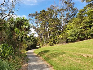
Glen Eden, New Zealand
Suburb of Auckland, New Zealand
Distance: Approx. 4 meters
Latitude and longitude: -36.91666667,174.65
Glen Eden is a suburb of West Auckland, New Zealand, located at the foothills of Waitākere Ranges. Originally known as Waikumete, the suburb gained the name Glen Eden in 1921. The suburb is in the Waitākere Ward, one of the thirteen administrative areas of Auckland governed by Auckland Council.

Glen Eden Intermediate School
School
Distance: Approx. 856 meters
Latitude and longitude: -36.9241,174.6526
Glen Eden Intermediate School (G.E.I.S) is an intermediate school located in the suburb of Kaurilands in Auckland, New Zealand. The roll fluctuates around 1050 student and there is an enrollment scheme (school zone) in place. In-zone suburbs include Titirangi, Laingholm, Woodlands Park most of Glen Eden, Konini and Kaurilands.
Croydon Road railway station
Defunct railway station in New Zealand
Distance: Approx. 1039 meters
Latitude and longitude: -36.9115,174.6597
Croydon Road railway station was a train station in Auckland, New Zealand. It opened circa December 1911. It was on the Western Line and was between Fruitvale Road station and Glen Eden station.

Westbrook railway station, Auckland
Defunct railway station in New Zealand
Distance: Approx. 1529 meters
Latitude and longitude: -36.90574,174.63965
Westbrook railway station was a station on the Western Line in Auckland, New Zealand, between Waikomiti station and Glen Eden station. It was opened on 6 September 1957. It was closed at the same time as the Croydon Road and St George's Street stations, also on the Western Line, on a six-month trial basis on 18 August 1980, with the closure being made permanent on 16 August 1981.

Kelston Girls' College
School in New Zealand
Distance: Approx. 1649 meters
Latitude and longitude: -36.90676,174.66374
Kelston Girls’ College (KGC) is a single-sex girls state secondary school in Kelston, a suburb in West Auckland, New Zealand. It was created in 1963 when the roll of Kelston High School (formed in 1954) became too large for the site on the corner of Archibald and Great North Roads. The boys moved to a new site further down Archibald Road and the original site became the home of Kelston Girls' High School (now Kelston Girls' College).

Waitākere Ranges Local Board
Local board of Auckland Council in New Zealand
Distance: Approx. 651 meters
Latitude and longitude: -36.91101757,174.65172823
Waitākere Ranges Local Board is one of the 21 local boards of the Auckland Council, and is one of the two boards overseen by the council's Waitākere Ward councillors. The board's administrative area includes the suburbs of Titirangi, Glen Eden and Konini and the towns of Te Henga (Bethells Beach), Piha, Karekare, Huia and Laingholm, and covers the area from Waitākere Ranges to O'Neill Bay. The total population residing in the board's area, in the 2013 New Zealand census, was 48,396.

Kaurilands
Suburb in Auckland, New Zealand
Distance: Approx. 1477 meters
Latitude and longitude: -36.9294,174.6548
Kaurilands is a suburb of West Auckland, which is under the local governance of Auckland Council. The area was subdivided and developed in the 1920s.

Playhouse Theatre, Glen Eden
Theatre in Auckland, New Zealand
Distance: Approx. 648 meters
Latitude and longitude: -36.9109,174.6494
The Playhouse Theatre is a performing arts centre situated in Glen Eden, New Zealand. The building was constructed in 1937 following a fire that destroyed the Glen Eden Town Hall that was on the site at the time. The Theatre has continued to serve West Auckland, initially for civic and community functions and events, moving into cinema and theatre productions by the 1970s when the name of the building officially changed to The Playhouse Theatre.

Studio West (film studio)
New Zealand film and television production facility
Distance: Approx. 1659 meters
Latitude and longitude: -36.9061,174.6369
Studio West is a motion picture and television production facility in West Auckland, New Zealand. Opening in 1996, the studio became the primary filming location for the United States television series Power Rangers in 2002. The eight acre site, 20 minutes from the Auckland City Centre, features four sound stages, including the largest purpose-build sound-stage in Auckland, which opened in 2022.
Weather in this IP's area
scattered clouds
23 Celsius
23 Celsius
21 Celsius
23 Celsius
1011 hPa
65 %
1011 hPa
1006 hPa
10000 meters
4.47 m/s
8.05 m/s
190 degree
49 %