Country:
Region:
City:
Latitude and Longitude:
Time Zone:
Postal Code:
IP information under different IP Channel
ip-api
Country
Region
City
ASN
Time Zone
ISP
Blacklist
Proxy
Latitude
Longitude
Postal
Route
Luminati
Country
Region
auk
City
auckland
ASN
Time Zone
Pacific/Auckland
ISP
Spark New Zealand Trading Ltd.
Latitude
Longitude
Postal
IPinfo
Country
Region
City
ASN
Time Zone
ISP
Blacklist
Proxy
Latitude
Longitude
Postal
Route
db-ip
Country
Region
City
ASN
Time Zone
ISP
Blacklist
Proxy
Latitude
Longitude
Postal
Route
ipdata
Country
Region
City
ASN
Time Zone
ISP
Blacklist
Proxy
Latitude
Longitude
Postal
Route
Popular places and events near this IP address

Morningside, Auckland
Suburb in Auckland, New Zealand
Distance: Approx. 797 meters
Latitude and longitude: -36.87883,174.732731
Morningside is a suburb of Auckland, New Zealand. It lies four kilometres south-west of the city centre, close to Eden Park and Western Springs Reserve.

Mount Albert Grammar School
State secondary, day and boarding school in Auckland, New Zealand
Distance: Approx. 259 meters
Latitude and longitude: -36.88458889,174.72533333
Mount Albert Grammar School, commonly known as MAGS, is a co-educational state secondary school in Mount Albert in Auckland, New Zealand. It teaches students in year levels 9 to 13. As of August 2021, Mount Albert Grammar School is the second largest school in New Zealand, behind Rangitoto College.

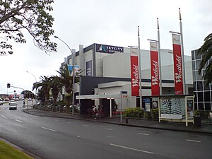
Westfield St Lukes
Shopping mall in Mount Albert, Auckland
Distance: Approx. 502 meters
Latitude and longitude: -36.883139,174.733332
Westfield St Lukes, one of the big three shopping centres in the western suburbs of Auckland, New Zealand, stands on St Lukes Road in the suburb of St Lukes, Mount Albert. It receives about 6 million shopper visits annually. With 43,000 m2 gross floor area (2002 data), it features a Farmers, Kmart, Countdown, an Event Cinemas 8 screen cinema complex and over 160 shops.
Marist College, Auckland
State integrated school in Auckland, New Zealand
Distance: Approx. 430 meters
Latitude and longitude: -36.8817,174.7257
Marist College (originally called Marist Sisters College) is an integrated Catholic girls high school located in Mount Albert, Auckland, New Zealand. It teaches from year 7 through to year 13 with an education "founded on the Catholic faith", and as of 2019 had a student roll of 760.

Ōwairaka / Mount Albert
Scoria cone in Auckland, New Zealand
Distance: Approx. 950 meters
Latitude and longitude: -36.8905666,174.72011269
Ōwairaka / Mount Albert, also known as Te Ahi-kā-a-Rakataura, is a volcanic peak and Tūpuna Maunga (ancestral mountain) which dominates the landscape of the Ōwairaka and Mount Albert suburbs of Auckland.

Eden RFC
Rugby union club in Sandringham, Auckland, New Zealand
Distance: Approx. 1012 meters
Latitude and longitude: -36.8805104,174.738087
Eden Rugby Club (formally known as Eden Rugby Football Club) is a rugby union club based in Auckland, New Zealand. The club was established in 1922 and is affiliated with the Auckland Rugby Football Union.
Mount Albert School
State co-educational primary (year 1-6) school
Distance: Approx. 818 meters
Latitude and longitude: -36.878,174.731
Mount Albert School is a primary school in the suburb of Mount Albert, Auckland, New Zealand that caters for boys and girls from Year 1 to Year 6. it currently has a roll of 495 and its current principal is Marian Caulfield.

Murder of Janak Patel
Stabbing and robbery at New Zealand store
Distance: Approx. 722 meters
Latitude and longitude: -36.89086,174.73167
On 23 November 2022, a dairy worker named Janak Patel was murdered during a robbery at the Rose Cottage Superette in Sandringham, Auckland, New Zealand. Police subsequently arrested three men in connection with the robbery and killing. The killing of Patel attracted significant attention from domestic media and political figures including Prime Minister Jacinda Ardern, Police Minister Chris Hipkins, and ACT Party leader David Seymour against the backdrop of an alleged recent crime wave targeting dairies and other retailers across New Zealand.

Gribblehirst Park
Park in Auckland, New Zealand
Distance: Approx. 1004 meters
Latitude and longitude: -36.880445,174.7379291
Gribblehirst Park is a park in central Auckland, New Zealand, close to the suburbs of Sandringham and Morningside. Originally the park was known as Cabbage Tree Swamp.

Ferndale House
Historic house in Auckland, New Zealand
Distance: Approx. 826 meters
Latitude and longitude: -36.882496,174.719463
Ferndale House is a 19th-century house in Mount Albert, Auckland, New Zealand, which is listed by Heritage New Zealand as a Category II structure. The house was built in the 1860s for the Garlick family, major figures in the Methodist community in Mount Albert, later becoming a hub for the Plunket Society in the 1940s and a community centre.

Alberton, Auckland
Historic house in Auckland, New Zealand
Distance: Approx. 643 meters
Latitude and longitude: -36.890017,174.724626
Alberton is a 19th-century house in Mount Albert, Auckland, New Zealand, which is listed by Heritage New Zealand as a Category I structure. The house was built in the 1860s for the Garlick family, major figures in the Methodist community in Mount Albert, later becoming a hub for the Plunket Society in the 1940s and a community centre.

St Lukes, New Zealand
Suburb in Auckland, New Zealand
Distance: Approx. 362 meters
Latitude and longitude: -36.88313,174.73152
St Lukes is a suburb of New Zealand's largest city, Auckland. It is under the local governance of the Auckland Council. After Westfield St Lukes opened in 1972, the area developed into a major commercial area of the Auckland isthmus.
Weather in this IP's area
broken clouds
15 Celsius
14 Celsius
13 Celsius
15 Celsius
1022 hPa
68 %
1022 hPa
1018 hPa
10000 meters
2.57 m/s
20 degree
76 %
06:07:57
20:01:55