Country:
 India
IndiaRegion:
City:
Latitude and Longitude:
Time Zone:
Postal Code:
IP information under different IP Channel
ip-api
Country
Region
City
ASN
Time Zone
ISP
Blacklist
Proxy
Latitude
Longitude
Postal
Route
IPinfo
Country
Region
City
ASN
Time Zone
ISP
Blacklist
Proxy
Latitude
Longitude
Postal
Route
MaxMind
Country
Region
City
ASN
Time Zone
ISP
Blacklist
Proxy
Latitude
Longitude
Postal
Route
Luminati
Country
INASN
Time Zone
Asia/Kolkata
ISP
BHARTI Airtel Ltd.
Latitude
Longitude
Postal
db-ip
Country
Region
City
ASN
Time Zone
ISP
Blacklist
Proxy
Latitude
Longitude
Postal
Route
ipdata
Country
Region
City
ASN
Time Zone
ISP
Blacklist
Proxy
Latitude
Longitude
Postal
Route
Popular places and events near this IP address

Mumbai North Lok Sabha constituency
Lok Sabha constituency in Maharashtra
Distance: Approx. 2255 meters
Latitude and longitude: 19.21,72.85
Mumbai North Lok Sabha constituency (formerly, Bombay City North Lok Sabha constituency) is one of the 48 Lok Sabha (parliamentary) constituencies of Maharashtra state in western India.
Mumbai North Central Lok Sabha constituency
Lok Sabha Constituency in Maharashtra
Distance: Approx. 3263 meters
Latitude and longitude: 19.2,72.8
Mumbai North Central Lok Sabha constituency is a Lok Sabha (parliamentary) constituency of Maharashtra state in western India.

Global Vipassana Pagoda
Meditation hall in Maharashtra, India
Distance: Approx. 3009 meters
Latitude and longitude: 19.22805556,72.80605278
The Global Vipassana Pagoda is a Meditation dome hall with a capacity to seat around 8,000 Vipassana meditators (the largest such meditation hall in the world) near Gorai, in the north western part of Mumbai, Maharashtra, India. The Global Vipassana Pagoda is declared as one of the "One of Seven Wonders of Maharashtra" by Maharashtra Tourism Development Corporation (MTDC) in partnership with ABP Majha, a Marathi news channel; after they reviewed 350 destinations. The results of this selection were declared on 6th June 2013.
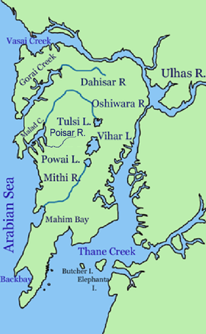
Poisar River
River in Maharashtra, India
Distance: Approx. 3162 meters
Latitude and longitude: 19.1833,72.833
Poisar River is a river in Mumbai, India. It begins in the Sanjay Gandhi National Park and empties into the Marve Creek and finally into the Arabian Sea. The river is now nothing more than an urban stream when it begins and is contaminated with industrial effluents and sewage.

Kandivli
Suburb in Mumbai Suburban, Maharashtra, India
Distance: Approx. 1221 meters
Latitude and longitude: 19.204511,72.837639
Kandivali (Pronunciation: [kaːn̪d̪iʋəliː]) formerly Khandolee is a suburb in the north of Mumbai, Maharashtra, India and has a large Marathi, Koli, Gujarati population followed by others. British records highlight a fact which is different from what is suggested in the rest of the article. The area names that ends with "vali" were the actual valleys to the small hills surrounding the area, and that's how we have Kandolee Valley to Kandivali.

Gorai Creek
Distance: Approx. 2455 meters
Latitude and longitude: 19.23305556,72.82416667
The Gorai Creek is a creek off the coast of suburban Mumbai. It lies between Borivali (West) and Gorai Village. A ferry ride across the creek to Essel World, Gorai Beach and the Global Vipassana Pagoda takes around 10 to 15 minutes.

Charkop
Suburban in Mumbai Suburban, Maharashtra, India
Distance: Approx. 571 meters
Latitude and longitude: 19.216182,72.830575
Charkop is a locality in the suburb of Kandivali (West), North Mumbai, India. Charkop's original name is 'Char Khop'( चार खोप ) meaning a place of 4 huts or a small village with four houses in Marathi. Koli people or the fishermen are considered to be the indigenous residents of Charkop.
Raghuleela Mall, Kandivali
Shopping mall in Mumbai, India
Distance: Approx. 2170 meters
Latitude and longitude: 19.213467,72.849128
Raghuleela Mega Mall is a mall in Kandivali, a suburb of Mumbai. Developed by Raghuleela Properties Pvt. Ltd., the mall has a gross leasable area of 400,000 sq ft (37,000 m2) on four floors and more than 800 shops.

Charkop Assembly constituency
Constituency of the Maharashtra legislative assembly in India
Distance: Approx. 1115 meters
Latitude and longitude: 19.211,72.818
Charkop Assembly constituency is one of the 288 Vidhan Sabha (Legislative Assembly) constituencies in Maharashtra state in western India. It is a segment of the Mumbai North Lok Sabha constituency.

Malad West Assembly constituency
Constituency of the Maharashtra legislative assembly in India
Distance: Approx. 2193 meters
Latitude and longitude: 19.192,72.825
Malad West Assembly constituency is a constituency of the Maharashtra Legislative Assembly, located in the metropolis of Mumbai. It is one of the 26 Vidhan Sabha constituencies located in suburban Mumbai.
Babai, Rajasthan
Village in Rajasthan, India
Distance: Approx. 2515 meters
Latitude and longitude: 19.226525,72.84637778
Babai is a town in the Neem Ka Thana district of the state of Rajasthan, India. It is located in the foothills of the Arawali mountain range at 420 meters above sea level. It has a fort with a moat surrounding it, The town has a population of 2237.

Borivali West metro station
Mumbai Metro's Yellow Line 2A metro station
Distance: Approx. 2600 meters
Latitude and longitude: 19.2317,72.84083
Borivali West is an elevated metro station on the North-South corridor of the Yellow Line 2A of Mumbai Metro in Mumbai, India. This station is located in Borivali, Mumbai. This station is owned by the Mumbai Metropolitan Region Development Authority (MMRDA), and was inaugurated on 2 April 2022.
Weather in this IP's area
haze
27 Celsius
30 Celsius
27 Celsius
27 Celsius
1009 hPa
78 %
1009 hPa
1008 hPa
3000 meters
1.54 m/s
10 degree
40 %
06:26:42
18:39:47