Country:
 India
IndiaRegion:
City:
Latitude and Longitude:
Time Zone:
Postal Code:
IP information under different IP Channel
ip-api
Country
Region
City
ASN
Time Zone
ISP
Blacklist
Proxy
Latitude
Longitude
Postal
Route
IPinfo
Country
Region
City
ASN
Time Zone
ISP
Blacklist
Proxy
Latitude
Longitude
Postal
Route
MaxMind
Country
Region
City
ASN
Time Zone
ISP
Blacklist
Proxy
Latitude
Longitude
Postal
Route
Luminati
Country
INASN
Time Zone
Asia/Kolkata
ISP
BHARTI Airtel Ltd.
Latitude
Longitude
Postal
db-ip
Country
Region
City
ASN
Time Zone
ISP
Blacklist
Proxy
Latitude
Longitude
Postal
Route
ipdata
Country
Region
City
ASN
Time Zone
ISP
Blacklist
Proxy
Latitude
Longitude
Postal
Route
Popular places and events near this IP address

Bombay Talkies
Movie studio in Mumbai, India
Distance: Approx. 946 meters
Latitude and longitude: 19.17903,72.84292
Bombay Talkies was a movie studio founded in 1934. During its period of operation, Bombay Talkies produced 40 movies in Malad, a suburb of the Indian city of Bombay. The studio was established in 1934 by Himanshu Rai and Devika Rani.

Malad
Suburb in Mumbai Suburban, Maharashtra, India
Distance: Approx. 1376 meters
Latitude and longitude: 19.186111,72.848611
Malad (Pronunciation: [maːlaːɖ]) is a suburb located in North Mumbai. Malad has a railway station on the Western line (Mumbai Suburban Railway) of the Mumbai Suburban Railway, lying between Kandivali station to the north and Goregaon station to the south. The railway tracks of the Western Line divide Malad into Malad (West) and Malad (East).
Sunder Nagar
Region in Maharashtra, India
Distance: Approx. 1210 meters
Latitude and longitude: 19.175,72.842
Sunder Nagar is a small area lying within the suburban region of Malad–Goregaon in Mumbai, India. It lies in west of the arterial Swami Vivekanand Road and is mostly a residential neighbourhood. It was built up in the 1970s during the city's population and construction boom.
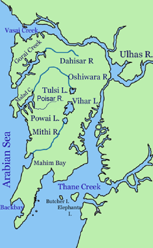
Poisar River
River in Maharashtra, India
Distance: Approx. 298 meters
Latitude and longitude: 19.1833,72.833
Poisar River is a river in Mumbai, India. It begins in the Sanjay Gandhi National Park and empties into the Marve Creek and finally into the Arabian Sea. The river is now nothing more than an urban stream when it begins and is contaminated with industrial effluents and sewage.
Bangur Nagar
Neighbourhood in Mumbai City, Maharashtra, India
Distance: Approx. 1898 meters
Latitude and longitude: 19.167362,72.832252
Bangur Nagar is a residential area in Goregaon West, Mumbai, India. It was developed by the Bangur Group of Kolkata in the mid-1970s. Bangur Nagar has more than 20 co-operative housing societies, most over 30 years old.

Kandivli
Suburb in Mumbai Suburban, Maharashtra, India
Distance: Approx. 2281 meters
Latitude and longitude: 19.204511,72.837639
Kandivali (Pronunciation: [kaːn̪d̪iʋəliː]) formerly Khandolee is a suburb in the north of Mumbai, Maharashtra, India and has a large Marathi, Koli, Gujarati population followed by others. British records highlight that the area names that end with "vali" are actual valleys through the small hills surrounding the area.
Filmistan
Indian film studio in Mumbai
Distance: Approx. 2357 meters
Latitude and longitude: 19.165114,72.845626
Filmistan is an Indian film studio based in Goregaon, Mumbai. Spread over five acres, near Patkar College on S.V. Road, the studio has seven shooting floors, and a temple and garden for outdoor locations. Patkar College's reputation has increased due to this studio.

Malad West Assembly constituency
Constituency of the Maharashtra legislative assembly in India
Distance: Approx. 1428 meters
Latitude and longitude: 19.192,72.825
Malad West Assembly constituency is a constituency of the Maharashtra Legislative Assembly, located in the metropolis of Mumbai. It is one of the 26 Vidhan Sabha constituencies located in suburban Mumbai.
Children's Academy
Private school
Distance: Approx. 1959 meters
Latitude and longitude: 19.185312,72.854285
Children's Academy is a Mumbai-based chain of private co-educational English-medium day schools in Malad and Kandivali in Mumbai. The first school was founded in 1970 by Shri V.V. Bhat in Malad. Currently the schooling of pupils is through affiliations by choice of ICSE of Council for the Indian School Certificate Examinations, New Delhi.
The ITA School of Performing Arts
Distance: Approx. 1553 meters
Latitude and longitude: 19.1749,72.8468
The Indian Television Academy (ITA) School of Performing Arts is a school formed as an initiative of The Indian Television Academy and founded by Anu Ranjan and Shashi Ranjan in 2001. It was created with the aim of standardizing the Indian television industry.
Jashbhai Maganbhai Patel College of Commerce
Distance: Approx. 1926 meters
Latitude and longitude: 19.16724,72.83982
Jashbhai Maganbhai Patel College of Commerce is an educational institution located in Goregaon (West), Mumbai, India. It is also known as Sanskardham Kelvani Mandal's Jashbhai Maganbhai Patel College of Commerce (SKM JMPC). The Sanskardham Kelavani Mandal (S.K.M.) was established in the year 1959 by (Late) Shri.
Lower Malad metro station
Mumbai Metro's Yellow Line 2A metro station
Distance: Approx. 1244 meters
Latitude and longitude: 19.17295,72.83645
Lower Malad is an elevated metro station on the North-South corridor of the Yellow Line 2A of Mumbai Metro in Mumbai, India. This station is located in Goregaon, Mumbai. This station is owned by the Mumbai Metropolitan Region Development Authority (MMRDA), and was inaugurated on 19 January 2023.
Weather in this IP's area
haze
31 Celsius
38 Celsius
31 Celsius
32 Celsius
1005 hPa
74 %
1005 hPa
1004 hPa
5000 meters
5.66 m/s
250 degree
40 %
06:33:41
18:13:33