122.145.117.197 - IP Lookup: Free IP Address Lookup, Postal Code Lookup, IP Location Lookup, IP ASN, Public IP
Country:
 Japan
JapanRegion:
City:
Location:
Time Zone:
Postal Code:
ISP:
ASN:
language:
User-Agent:
Proxy IP:
Blacklist:
IP information under different IP Channel
ip-api
Country
Region
City
ASN
Time Zone
ISP
Blacklist
Proxy
Latitude
Longitude
Postal
Route
db-ip
Country
Region
City
ASN
Time Zone
ISP
Blacklist
Proxy
Latitude
Longitude
Postal
Route
IPinfo
Country
Region
City
ASN
Time Zone
ISP
Blacklist
Proxy
Latitude
Longitude
Postal
Route
IP2Location
122.145.117.197Country
jpRegion
aichi
City
toyohashi
Time Zone
Asia/Tokyo
ISP
Language
User-Agent
Latitude
Longitude
Postal
ipdata
Country
Region
City
ASN
Time Zone
ISP
Blacklist
Proxy
Latitude
Longitude
Postal
Route
Popular places and events near this IP address

Toyohashi Station
Railway station in Toyohashi, Aichi Prefecture, Japan
Distance: Approx. 486 meters
Latitude and longitude: 34.76277778,137.38166667
Toyohashi Station (豊橋駅, Toyohashi-eki) is an interchange railway station in Toyohashi, Aichi, Japan, operated by Central Japan Railway Company (JR Tōkai) and the private railway operator Nagoya Railroad (Meitetsu).

FM Toyohashi
Community radio station in Toyohashi, Japan
Distance: Approx. 2572 meters
Latitude and longitude: 34.75365833,137.40596111
FM Toyohashi (エフエム豊橋) (JOZZ6AA-FM, 84.3 MHz) is a community FM radio station in Toyohashi, Aichi Prefecture, Japan. It is the third "community FM radio station" opened in Japan. Its broadcast reach an area roughly bounded by Hamamatsu, Shizuoka in the east, and Gamagori and Shinshiro, Aichi in the west.

Siege of Yoshida Castle
Siege in 1575 as part of the Sengoku Period's civil wars and unrest in Japan
Distance: Approx. 1009 meters
Latitude and longitude: 34.77014722,137.39335
The 1575 siege of Yoshida Castle was undertaken by Takeda Katsuyori against the forces of Tokugawa Ieyasu during the Sengoku Period of Japanese history. This would be one of many battles fought by the Tokugawa and Takeda samurai clans during Japan's Sengoku period (1467-1603).

Toyohashi
Core city in Chūbu, Japan
Distance: Approx. 816 meters
Latitude and longitude: 34.76916667,137.39152778
Toyohashi (豊橋市, Toyohashi-shi) is a city in Aichi Prefecture, Japan. As of 1 December 2019, the city had an estimated population of 377,453 in 160,516 households and a population density of 1,400 persons per km2. The total area of the city was 261.86 square kilometres (101.10 sq mi).

Toyohashi Sozo College
Distance: Approx. 2572 meters
Latitude and longitude: 34.7762,137.4088
Toyohashi SOZO University (豊橋創造大学, Toyohashi sōzō daigaku) is a private university in Toyohashi, Aichi, Japan. The predecessor of the school, Toyohashi Junior College, was founded in 1983. In 1996, Toyohashi Sozo College was established as a single-faculty institution and later expanded into a university with multiple faculties in 2006.

Funamachi Station
Railway station in Toyohashi, Aichi Prefecture, Japan
Distance: Approx. 1336 meters
Latitude and longitude: 34.7759,137.3732
Funamachi Station (船町駅, Funamachi-eki) is a railway station in the city of Toyohashi, Aichi Prefecture, Japan, operated by Central Japan Railway Company (JR Tōkai).

Shimoji Station
Railway station in Toyohashi, Aichi Prefecture, Japan
Distance: Approx. 1933 meters
Latitude and longitude: 34.781,137.3705
Shimoji Station (下地駅, Shimoji-eki) is a railway station in the city of Toyohashi, Aichi Prefecture, Japan, operated by Central Japan Railway Company (JR Tōkai).

Bombing of Toyohashi
Distance: Approx. 111 meters
Latitude and longitude: 34.766,137.383
The bombing of Toyohashi (豊橋空襲, Toyohashi kūshū) was a strategic bombing operation on the night of 19 June 1945 against the city of Toyohashi, Japan. The air raid was part of the Allies' air raids on Japan during the Pacific War.

Toyohashi City Museum of Art and History
Distance: Approx. 1099 meters
Latitude and longitude: 34.76916667,137.39472222
The Toyohashi City Museum of Art and History (豊橋市美術博物館, Toyohashi-shi Bijutsu Hakubutsukan) is a purpose-built municipal art museum and local cultural museum in Toyohashi, Aichi Prefecture, Japan. It opened in 1979. The permanent collections of the museum are concentrated around five themes: Archaeological finds from local shell middens, kofun and ancient ceramic kilns in the Toyohashi area.

Shin-Toyohashi Station
Railway station in Toyohashi, Aichi Prefecture, Japan
Distance: Approx. 532 meters
Latitude and longitude: 34.76222222,137.38294444
Shin-Toyohashi Station (新豊橋駅, Shin-Toyohashi-eki) is a railway station in the city of Toyohashi, Aichi Prefecture, Japan, operated by the Public–private partnership Toyohashi Railroad. The station is physically adjacent to Toyohashi Station.

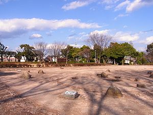
Yoshida Castle (Mikawa Province)
Distance: Approx. 1009 meters
Latitude and longitude: 34.77014722,137.39335
Yoshida Castle (吉田城, Yoshida-jō) is a Japanese castle located in Toyohashi, southeastern Aichi Prefecture, Japan. At the end of the Edo period, Yoshida Castle was home to the Inaba clan, daimyō of Tateyama Domain. The castle was also known as Imabashi Castle (今橋城, Imabashi-jō), and later as Toyohashi Castle.
Shingū ruins
Distance: Approx. 2154 meters
Latitude and longitude: 34.78527778,137.37527778
The Shingū ruins (真宮遺跡, Shingū iseki) archaeological site containing a ruins of a village complex which was inhabited from the late Jōmon period through the Kamakura period, located in the Shingū neighborhood of the city of Okazaki, Aichi in the Tōkai region of Japan. It was designated a National Historic Site of Japan in 1976.
Weather in this IP's area
moderate rain
5 Celsius
4 Celsius
5 Celsius
5 Celsius
1009 hPa
50 %
1009 hPa
1001 hPa
10000 meters
2.24 m/s
3.13 m/s
230 degree
100 %