121.50.163.124 - IP Lookup: Free IP Address Lookup, Postal Code Lookup, IP Location Lookup, IP ASN, Public IP
Country:
Region:
City:
Location:
Time Zone:
Postal Code:
IP information under different IP Channel
ip-api
Country
Region
City
ASN
Time Zone
ISP
Blacklist
Proxy
Latitude
Longitude
Postal
Route
Luminati
Country
ASN
Time Zone
Asia/Tokyo
ISP
Internet Initiative Japan Inc.
Latitude
Longitude
Postal
IPinfo
Country
Region
City
ASN
Time Zone
ISP
Blacklist
Proxy
Latitude
Longitude
Postal
Route
IP2Location
121.50.163.124Country
Region
gunma
City
maebashi
Time Zone
Asia/Tokyo
ISP
Language
User-Agent
Latitude
Longitude
Postal
db-ip
Country
Region
City
ASN
Time Zone
ISP
Blacklist
Proxy
Latitude
Longitude
Postal
Route
ipdata
Country
Region
City
ASN
Time Zone
ISP
Blacklist
Proxy
Latitude
Longitude
Postal
Route
Popular places and events near this IP address

Gunma Prefecture
Prefecture of Japan
Distance: Approx. 1000 meters
Latitude and longitude: 36.39,139.06
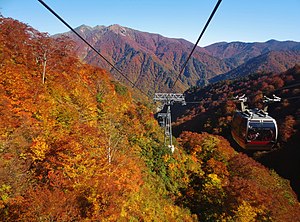
Gunma Prefecture (群馬県, Gunma-ken) is a landlocked prefecture of Japan located in the Kantō region of Honshu. Gunma Prefecture has a population of 1,937,626 (1 October 2019) and has a geographic area of 6,362 km2 (2,456 sq mi). Gunma Prefecture borders Niigata Prefecture and Fukushima Prefecture to the north, Nagano Prefecture to the southwest, Saitama Prefecture to the south, and Tochigi Prefecture to the east.
Shibukawa, Gunma
City in Kantō, Japan
Distance: Approx. 789 meters
Latitude and longitude: 36.38944444,139.06333333
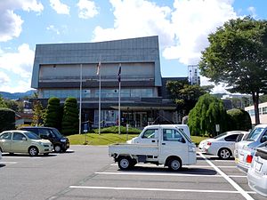
Shibukawa (渋川市, Shibukawa-shi) is a city in Gunma Prefecture, Japan. As of 31 August 2020, the city had an estimated population of 76,098 in 32,439 households, and a population density of 320 inhabitants per square kilometre (830/sq mi). The total area of the city is 240.27 square kilometres (92.77 sq mi).
Seta District, Gunma
Distance: Approx. 741 meters
Latitude and longitude: 36.3892,139.064
Seta (勢多郡, Seta-gun) was a district located in northeastern Gunma Prefecture (Kozuke Province), Japan. Before the day before the dissolution on May 4, 2009, the district contained one village. Fujimi (富士見村) Before Meiji, the district covered the entire foothills of Mount Akagi.

Yamada Green Dome Maebashi
Distance: Approx. 1824 meters
Latitude and longitude: 36.39761111,139.05777778
Yamada Green Dome Maebashi (ヤマダグリーンドーム前橋, Yamada Gurīn Dōmu Maebashi) is an arena in Maebashi, Japan. With a capacity of 8,000, it is primarily used for indoor sports. One of its primary functions is as a velodrome - when it is known as Maebashi Velodrome (前橋競輪場, Maebashi Keirinjyō) - holding parimutuel Keirin races throughout the year.

Maebashi
Capital city of Gunma Prefecture, Japan
Distance: Approx. 792 meters
Latitude and longitude: 36.3895,139.06341667
Maebashi (前橋市, Maebashi-shi) is the capital city of Gunma Prefecture, in the northern Kantō region of Japan. As of 31 August 2020, the city had an estimated population of 335,352 in 151,171 households, and a population density of 1100 persons per km2. The total area of the city is 311.59 km2 (120.31 sq mi).

Maebashi Station
Railway station in Maebashi, Gunma Prefecture, Japan
Distance: Approx. 588 meters
Latitude and longitude: 36.3837,139.0735
Maebashi Station (前橋駅, Maebashi-eki) is a passenger railway station in the city of Maebashi, Gunma Prefecture, Japan, operated by East Japan Railway Company (JR East). It is one of two main railway stations of central Maebashi; the other is Chūō Maebashi Station of the private railway operator Jōmō Electric Railway. In 2020, the station was renovated into an "Ecoste" station, a station with a focus on environmental conservation.

Shin-Maebashi Station
Railway station in Maebashi, Gunma Prefecture, Japan
Distance: Approx. 1843 meters
Latitude and longitude: 36.37903056,139.0470361
Shin-Maebashi Station (新前橋駅, Shin-Maebashi-eki) is a passenger railway station in the city of Maebashi, Gunma Prefecture, Japan, operated by East Japan Railway Company (JR East).

Chūō-Maebashi Station
Railway station in Maebashi, Gunma Prefecture, Japan
Distance: Approx. 1149 meters
Latitude and longitude: 36.391,139.0751
Chūō-Maebashi Station (中央前橋駅, Chūō-Maebashi-eki) is a passenger railway station in the city of Maebashi, Gunma Prefecture, Japan, operated by the private railway operator Jōmō Electric Railway Company.

Jōtō Station (Gunma)
Railway station in Maebashi, Gunma Prefecture, Japan
Distance: Approx. 1580 meters
Latitude and longitude: 36.3913,139.0813
Jōtō Station (城東駅, Jōtō-eki) is a passenger railway station in the city of Maebashi, Gunma Prefecture, Japan, operated by the private railway operator Jōmō Electric Railway Company.

Gunma Prefectural Government Building
Skyscraper in Maebashi, Gunma Prefecture, Japan
Distance: Approx. 1065 meters
Latitude and longitude: 36.39125,139.06097222
The Gunma Prefectural Government Building (群馬県庁舎, Gunma-ken Shōsha) is a skyscraper located in Maebashi, Gunma Prefecture, Japan. Construction of the 154-metre, 33-storey skyscraper was finished in 1999. It is the tallest building in Gunma Prefecture.

Maebashi Castle
Castle in Gunma prefecture, Japan
Distance: Approx. 1151 meters
Latitude and longitude: 36.39237222,139.06158056
Maebashi Castle (前橋城, Maebashi-jō) is a castle located in Maebashi, central Gunma Prefecture, Japan. At the end of the Edo period, Maebashi Castle was home to a branch of the Matsudaira clan, daimyō of Maebashi domain, although the castle was ruled by a large number of different clans over its history. The castle was also known as "Mayabashi-jō" (厩橋城), after the former name of Maebashi.
Maebashi Tōshō-gū
Japanese Shinto shrine
Distance: Approx. 1361 meters
Latitude and longitude: 36.39462,139.06228
Maebashi Tōshō-gū (前橋東照宮) is a Shinto Shrine dedicated to Tokugawa Ieyasu in the city of Maebashi, Gunma Prefecture, Japan. It was established in 1624.
Weather in this IP's area
clear sky
1 Celsius
-1 Celsius
1 Celsius
1 Celsius
1015 hPa
65 %
1015 hPa
984 hPa
10000 meters
1.86 m/s
3.58 m/s
309 degree

