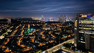
Country:
 Malaysia
Region:
City:
Latitude and Longitude:
Time Zone:
Postal Code:
IP information under different IP Channel
ip-api
Country
Region
City
ASN
Time Zone
ISP
Blacklist
Proxy
Latitude
Longitude
Postal
Route
IPinfo
Country
Region
City
ASN
Time Zone
ISP
Blacklist
Proxy
Latitude
Longitude
Postal
Route
MaxMind
Country
Region
City
ASN
Time Zone
ISP
Blacklist
Proxy
Latitude
Longitude
Postal
Route
Luminati
Country
MYRegion
10
City
petalingjaya
ASN
Time Zone
Asia/Kuala_Lumpur
ISP
Binariang Berhad
Latitude
Longitude
Postal
db-ip
Country
Region
City
ASN
Time Zone
ISP
Blacklist
Proxy
Latitude
Longitude
Postal
Route
ipdata
Country
Region
City
ASN
Time Zone
ISP
Blacklist
Proxy
Latitude
Longitude
Postal
Route
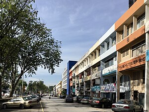
Popular places and events near this IP address
Bandar Utama
Township in Petaling, Selangor, Malaysia
Distance: Approx. 1695 meters
Latitude and longitude: 3.1378804,101.6105594
Bandar Utama Damansara is a residential township located within the Sungai Buloh mukim (subdivision) of the Petaling District, Selangor, Malaysia. It is a residential suburb and home to the popular 1 Utama Shopping Centre. Bandar Utama Damansara, together with neighbouring Kampung Sungai Kayu Ara, form the PJU 6 section of the city of Petaling Jaya.
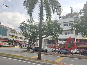
Damansara Jaya
Township in Selangor, Malaysia
Distance: Approx. 346 meters
Latitude and longitude: 3.12761111,101.62276389
Damansara Jaya is a township in Petaling Jaya, Petaling District, Selangor, Malaysia, situated in the Sungai Buloh mukim. Consisting of Section SS22 and SS22A, it covers an estimated area of 1.21 km2 (0.47 sq mi) and has an estimated population of 12,000 residents. In 2001, its recorded population was 8,450 residents.
Damansara Utama
Suburb of Petaling Jaya, Malaysia
Distance: Approx. 1123 meters
Latitude and longitude: 3.1349888,101.6246825
Damansara Utama is a suburb of Petaling Jaya, Selangor, Malaysia. The suburb is divided into two sections, SS20 in the east and SS21 in the west which are separated in the middle by the Damansara–Puchong Expressway, a heavily used six-lane expressway. It has a population of about 142,000 people.
Al Mujaheddin Mosque
Mosque in Petaling, Selangor, Malaysia
Distance: Approx. 1441 meters
Latitude and longitude: 3.13894444,101.62044444
The Al Mujaheddin Mosque (Malay: Masjid Al Mujaheddin), also Masjid Mujahidin, is a mosque in Damansara Utama, Selangor, Malaysia. Located near the roundabout of Damansara Utama where Damansara Uptown is, the Al Mujaheddin Mosque is more than just a place of worship. In the compound, there is an Islamic school going by the name SRA Al-Mujahiddeen.

Taman Bahagia LRT station
Distance: Approx. 1916 meters
Latitude and longitude: 3.11055556,101.6125
Taman Bahagia LRT station is a 2-storey LRT train station with a car park in Petaling Jaya, Malaysia that is served by rapidKL's Kelana Jaya Line. The station was constructed between 1995 and 1998 on a piece of land that was previously occupied by the Taman Gelora row of 25 single-storey terraced houses. The owners and residences started to move out of their homes in June 1995.
Kampung Sungai Kayu Ara
Distance: Approx. 1161 meters
Latitude and longitude: 3.13272,101.6121074
Kampung Sungai Kayu Ara is a small village in the Petaling Jaya Utara (PJU6) section of Petaling Jaya, Selangor, Malaysia. This village is located between Bandar Utama Damansara, Damansara Jaya and Damansara Utama. It shares the postcode 47400 with Damansara Utama which lies to the east and adjacent to PJU6.
Bukit Kiara Muslim Cemetery
Cemetery in Kuala Lumpur, Malaysia
Distance: Approx. 1535 meters
Latitude and longitude: 3.133,101.632
The Bukit Kiara Muslim Cemetery is a cemetery in Kuala Lumpur, Malaysia. It is located at Damansara near Taman Tun Dr Ismail. This cemetery can be seen from the Damansara Link of the Sprint Expressway.

Taman Tun Dr Ismail MRT station
MRT station in Petaling Jaya, Selangor, Malaysia
Distance: Approx. 1633 meters
Latitude and longitude: 3.13608889,101.63076667
The Taman Tun Dr Ismail (TTDI) station, also known as TTDI-Deloitte due to sponsorship reasons, is a mass rapid transit station on the MRT Kajang Line serving the suburb of Taman Tun Dr Ismail, Kuala Lumpur and Damansara Utama, Petaling Jaya, Selangor, Malaysia. The station's location was however the third choice, after two earlier locations received objections during the public display of the line (mandatory under existing laws). The original location of the TTDI MRT Station was next to the TTDI fire station, which was objected and forced Prasarana (project owner pre- establishment of MRT Corp) to propose shifting it next to the TTDI Wet Market, some 300 metres away.

SS2, Petaling Jaya
Inner Suburb in Petaling Jaya, Selangor, Malaysia
Distance: Approx. 888 meters
Latitude and longitude: 3.11805556,101.62083333
SS2, Petaling Jaya is an inner suburb in Petaling Jaya, one of the biggest cities in Malaysia's most developed state of Selangor. It is located 4 km northwest of Petaling Jaya's central business district of Seksyen 52 (also known as Petaling Jaya New Town). Its local government is the Petaling Jaya City Council (MBPJ).

Kayu Ara LRT station
Distance: Approx. 1056 meters
Latitude and longitude: 3.1349,101.6168
The Kayu Ara LRT station is a light rapid transit (LRT) station that serves the suburb of Damansara Utama and Kampung Sungai Kayu Ara in Petaling Jaya Selangor, Malaysia. It will be one of the stations on the Shah Alam line. The station is located right next the Kayu Ara River.

BU 11 LRT station
Distance: Approx. 1772 meters
Latitude and longitude: 3.1331549,101.6058634
The BU11 LRT station is a Light Rapid Transit (LRT) station that serve the suburb of BU11 Bandar Utama, Petaling Jaya Malaysia serves as one of the stations on the Shah Alam line. The station is located next to SPRINT Highway Damansara Toll Plaza.The station is an elevated rapid transit station in forming part of the Klang Valley Integrated Transit System. The station is marked as Station No.
Old Town, Petaling Jaya
Inner Suburb in Petaling Jaya, Selangor, Malaysia
Distance: Approx. 888 meters
Latitude and longitude: 3.11805556,101.62083333
Old Town is the oldest urban area within the city of Petaling Jaya, a combined area of four inner suburbs within one of the biggest cities in Malaysia's most developed state of Selangor. Once the site a squatter resettlement scheme in the 1950s, the area soon became the beginning of Malaysia's first post-war new town. It is about 1km south of the city's central business district.
Weather in this IP's area
thunderstorm
27 Celsius
27 Celsius
25 Celsius
27 Celsius
1007 hPa
83 %
1007 hPa
1001 hPa
10000 meters
2.57 m/s
230 degree
20 %
07:04:18
19:11:55