120.89.81.158 - IP Lookup: Free IP Address Lookup, Postal Code Lookup, IP Location Lookup, IP ASN, Public IP
Country:
 New Zealand
Region:
City:
Location:
Time Zone:
Postal Code:
ISP:
ASN:
language:
User-Agent:
Proxy IP:
Blacklist:
IP information under different IP Channel
ip-api
Country
Region
City
ASN
Time Zone
ISP
Blacklist
Proxy
Latitude
Longitude
Postal
Route
db-ip
Country
Region
City
ASN
Time Zone
ISP
Blacklist
Proxy
Latitude
Longitude
Postal
Route
IPinfo
Country
Region
City
ASN
Time Zone
ISP
Blacklist
Proxy
Latitude
Longitude
Postal
Route
IP2Location
120.89.81.158Country
nzRegion
greater wellington
City
kelburn
Time Zone
ISP
Language
User-Agent
Latitude
Longitude
Postal
ipdata
Country
Region
City
ASN
Time Zone
ISP
Blacklist
Proxy
Latitude
Longitude
Postal
Route
Popular places and events near this IP address

Wellington region
Region of New Zealand
Distance: Approx. 5 meters
Latitude and longitude: -41.28333333,174.76666667
Greater Wellington, also known as the Wellington region (Māori: Te Upoko o te Ika), is a non-unitary region of New Zealand that occupies the southernmost part of the North Island. The region covers an area of 8,049 square kilometres (3,108 sq mi), and has a population of 550,600 (June 2024). The region takes its name from Wellington, New Zealand's capital city and the region's seat.

Wellington Province
Provinces of New Zealand in North Island
Distance: Approx. 5 meters
Latitude and longitude: -41.28333333,174.76666667
Wellington Province, governed by the Wellington Provincial Council, was one of the provinces of New Zealand from 1853 until the abolition of provincial government in 1876. It covered much of the southern half of the North Island until November 1858, when Hawke's Bay Province split off, taking about a third of its area.

Space Place at Carter Observatory
Historic observatory in Wellington, New Zealand
Distance: Approx. 121 meters
Latitude and longitude: -41.28437,174.76697
Space Place at Carter Observatory (or simply Space Place) is an observatory in Wellington, New Zealand, located at the top of the Wellington Botanic Garden. The site was originally home to the Wellington City Observatory (nicknamed "The Tin Shed"), established in 1924. This was demolished and replaced by the Carter Observatory, which officially opened on 20 December 1941.

Wellington Botanic Garden
Public botanical garden in Wellington, New Zealand
Distance: Approx. 74 meters
Latitude and longitude: -41.2829,174.766
Wellington Botanic Garden ki Paekākā is a botanical garden close to central Wellington in New Zealand. It covers 25 ha (62 acres) of land in a valley between Thorndon and Kelburn, with Glenmore Street as a boundary along the valley floor. One of the access points is from the top of the Wellington Cable Car.

Wellington Cable Car
Funicular railway in Wellington, New Zealand
Distance: Approx. 247 meters
Latitude and longitude: -41.28534722,174.767825
The Wellington Cable Car (Māori: Te Waka Taura o Pōneke) is a funicular railway in Wellington, New Zealand, between Lambton Quay, the main shopping street, and Kelburn, a suburb in the hills commanding views overlooking the central city and Wellington Harbour, rising 120 m (394 ft) over a length of 609 m (1,998 ft). The one way trip takes approximately five minutes. The Wellington Cable Car is widely recognised as a top visitor attraction in Wellington.

Thomas King Observatory
Distance: Approx. 167 meters
Latitude and longitude: -41.28456,174.76779
The Thomas King Observatory stands at the top of the Botanic Garden in Wellington, New Zealand, as part of the Carter Observatory. In the past it has housed research, preservation of heritage, education and promotion of astronomy to the public.

Hunter Building
University building in Wellington, New Zealand
Distance: Approx. 557 meters
Latitude and longitude: -41.288,174.769
The Hunter Building is the original building of Victoria University of Wellington's Kelburn campus in Wellington, New Zealand. It is a major landmark in the Wellington region and closely associated and considered a symbol of the university. The distinct architecture of the building is a notable example of Edwardian Gothic-revival, with red brick and Oamaru stone façade, along with grand internal entrances, staircases and original university library.
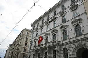
List of ambassadors of Turkey to Austria
Distance: Approx. 351 meters
Latitude and longitude: -41.280185,174.767322
The Turkish Ambassador to Austria has their residence in Vienna.

Dominion Observatory, Wellington
Historic observatory in Wellington
Distance: Approx. 158 meters
Latitude and longitude: -41.28413889,174.76822222
The Dominion Observatory is a historic observatory in the Botanic Gardens in Wellington, New Zealand. It was the second observatory in Wellington. It was built in 1907 and originally named the Hector Observatory after James Hector until 1925.

Wellington Town Belt
Distance: Approx. 543 meters
Latitude and longitude: -41.27851,174.76793
Wellington town belt and Outer green belt is a pair of strips of tree-filled wilderness spaces near and around central Wellington, New Zealand's capital city. The inner strip, the town belt, is an elongated U-shape. It was set aside by the city's founders in 1840.

Weir House (Victoria University of Wellington)
Residential college in Wellington, New Zealand
Distance: Approx. 310 meters
Latitude and longitude: -41.283757,174.770358
Weir House is a residential college of Victoria University of Wellington, located in the city of Wellington in New Zealand. It is home to over 160 undergraduates, and is the second oldest of the residential colleges, after Victoria House.

Randell Cottage Writers' Residency
New Zealand literary residency
Distance: Approx. 544 meters
Latitude and longitude: -41.27858333,174.76838889
The Randell Cottage Writers' Residency is a literary residency in New Zealand. It is awarded annually to one New Zealand writer and one French writer, comprising six months' rent-free accommodation at Randell Cottage in Wellington and a stipend (as of 2021 set at NZ$27,450). The recipients are usually mid-career writers.
Weather in this IP's area
light rain
19 Celsius
19 Celsius
19 Celsius
19 Celsius
1016 hPa
73 %
1016 hPa
1007 hPa
10000 meters
7.72 m/s
360 degree
100 %