Country:
Region:
City:
Latitude and Longitude:
Time Zone:
Postal Code:
IP information under different IP Channel
ip-api
Country
Region
City
ASN
Time Zone
ISP
Blacklist
Proxy
Latitude
Longitude
Postal
Route
Luminati
Country
Region
tn
City
erode
ASN
Time Zone
Asia/Kolkata
ISP
National Internet Backbone
Latitude
Longitude
Postal
IPinfo
Country
Region
City
ASN
Time Zone
ISP
Blacklist
Proxy
Latitude
Longitude
Postal
Route
db-ip
Country
Region
City
ASN
Time Zone
ISP
Blacklist
Proxy
Latitude
Longitude
Postal
Route
ipdata
Country
Region
City
ASN
Time Zone
ISP
Blacklist
Proxy
Latitude
Longitude
Postal
Route
Popular places and events near this IP address

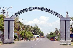
Gobichettipalayam
Town in Tamil Nadu, India
Distance: Approx. 306 meters
Latitude and longitude: 11.45488889,77.4365
Gobichettipalayam (Tamil: [koːbitɕtɕeʈʈippaːɭaɪjam]) is a town and municipality in Erode district of the Indian state of Tamil Nadu. It is the administrative headquarters of Gobichettipalayam taluk. It is situated at the centre of the South Indian Peninsula at 213 metres (699 ft) above sea level, surrounded by Western Ghats.

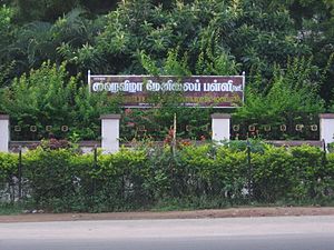
Diamond Jubilee Higher Secondary School
Government aided school in Gobichettipalayam, Tamil Nadu, India
Distance: Approx. 335 meters
Latitude and longitude: 11.45361111,77.43833333
Diamond Jubilee Higher Secondary School (DJHSS) is a boys-only secondary school in Gobichettipalayam, in the Erode District of Tamil Nadu, India. It was established to commemorate the Diamond Jubilee of Queen Victoria in 1898.
Karattadipalayam
Town panchayat in Tamil Nadu, India
Distance: Approx. 335 meters
Latitude and longitude: 11.45361111,77.43833333
Karattadipalayam is a village in Gobichettipalayam Taluk of Erode district in Tamil Nadu. It is part of the Lakkampatti town panchayat. Gobi Arts and Science College, an autonomous institution affiliated to Bharathiar University, is situated in Karattadipalayam.
Gobichettipalayam Lok Sabha constituency
Former constituency of the Indian parliament in Tamil Nadu
Distance: Approx. 335 meters
Latitude and longitude: 11.45361111,77.43833333
Gobichettipalayam was a Lok Sabha constituency in Tamil Nadu. It ceased to exist and was renamed as Tiruppur constituency after the delimination by Election Commission in 2008. Former Union Minister C Subramaniam lost to P.A. Saminathan Mudaliyar in 1967 from Gobichettipalayam.

Gobichettipalayam Assembly constituency
State Legislative Assembly Constituency in Tamil Nadu
Distance: Approx. 335 meters
Latitude and longitude: 11.45361111,77.43833333
Gobichettipalayam is a state assembly constituency in Erode district in Tamil Nadu. Its State Assembly Constituency number is 106. It comes under Tiruppur Lok Sabha constituency.
Gobichettipalayam Municipality
Distance: Approx. 335 meters
Latitude and longitude: 11.45361111,77.43833333
The Gobichettipalayam Municipality is the civic body that governs the town of Gobichettipalayam in Tamil Nadu, India.
Gobichettipalayam division
Distance: Approx. 335 meters
Latitude and longitude: 11.45361111,77.43833333
Gobichettipalayam division is one of the two revenue divisions in Erode district of Tamil Nadu State, India. This Division comprises six Taluks divided into nine CD blocks. The six taluks are as follows: Anthiyur taluk Bhavani taluk Gobichettipalayam taluk Nambiyur taluk Sathyamangalam taluk Thalavadi taluk.

P.K.R. Arts College for Women
Distance: Approx. 1153 meters
Latitude and longitude: 11.461781,77.447851
P.K.R. Arts College for Women (P.K.R.) is an Autonomous arts and science college affiliated to Bharathiar University located in Gobichettipalayam, Tamil Nadu, India. It was founded in 1994.
Nanjagoundenpalayam
Suburb in Erode, Tamil Nadu, India
Distance: Approx. 335 meters
Latitude and longitude: 11.45361111,77.43833333
Nanjagoundampalayam or Pariyur Nanjagoundenpalayam is a suburb which forms a part of Gobichettipalayam urban agglomeration in Tamil Nadu. The majority of the village comes under the jurisdiction of Gobichettipalayam Municipality while some parts are governed by the Pariyur village panchayat. As the naming suggests, the population is dominated by the Kongu Vellalar or Gounder community.

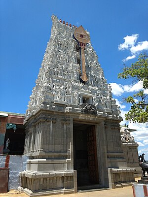
Pachaimalai Subramanya Swamy Temple
Temple in Tamil Nadu, India
Distance: Approx. 1139 meters
Latitude and longitude: 11.44888889,77.44555556
Pachaimalai Arulmigu Subramanya Swamy Temple, also known as the Pachaimalai Balamurugan Temple, is one of the two major hill temples located in Gobichettipalayam, Tamil Nadu, India. The temple is dedicated to the Lord Murugan. The temple is constructed in the Tamil style of architecture and is located on top of a small hillock in the outskirts of the town of Gobichettipalayam near Pudupalayam, Tamil Nadu.
Kullampalayam
Panchayat village in India
Distance: Approx. 2533 meters
Latitude and longitude: 11.44694444,77.45972222
Kullampalayam is a panchayat village in Gobichettipalayam taluk in Erode District of Tamil Nadu state, India. It is about 1.2 km from Gobichettipalayam and 34 km from District Capital Erode. The village is located on the road connecting Gobichettipalayam with Erode.
Modachur
Panchayat village in India
Distance: Approx. 2770 meters
Latitude and longitude: 11.43194444,77.43527778
Modachur is a panchayat village in Gobichettipalayam taluk in Erode District of Tamil Nadu state, India. It is a suburb of Gobichettipalayam and 36 km from district headquarters Erode. It is located on the southern side of the town of Gobichettipalayam along the SH 81.
Weather in this IP's area
light rain
30 Celsius
36 Celsius
30 Celsius
30 Celsius
1010 hPa
74 %
1010 hPa
985 hPa
10000 meters
1.52 m/s
1.99 m/s
68 degree
75 %
06:14:22
17:53:41