Country:
 India
IndiaRegion:
City:
Latitude and Longitude:
Time Zone:
Postal Code:
IP information under different IP Channel
ip-api
Country
Region
City
ASN
Time Zone
ISP
Blacklist
Proxy
Latitude
Longitude
Postal
Route
IPinfo
Country
Region
City
ASN
Time Zone
ISP
Blacklist
Proxy
Latitude
Longitude
Postal
Route
MaxMind
Country
Region
City
ASN
Time Zone
ISP
Blacklist
Proxy
Latitude
Longitude
Postal
Route
Luminati
Country
INRegion
tn
City
coonoor
ASN
Time Zone
Asia/Kolkata
ISP
National Internet Backbone
Latitude
Longitude
Postal
db-ip
Country
Region
City
ASN
Time Zone
ISP
Blacklist
Proxy
Latitude
Longitude
Postal
Route
ipdata
Country
Region
City
ASN
Time Zone
ISP
Blacklist
Proxy
Latitude
Longitude
Postal
Route
Popular places and events near this IP address
Sathyabama Institute of Science and Technology
Private STEM deemed university in Chennai, Tamil Nadu
Distance: Approx. 2957 meters
Latitude and longitude: 12.87305556,80.22194444
Sathyabama Institute of Science and Technology (SIST), formerly Sathyabama University, is a private, STEM-intensive, multi-disciplinary deemed university in Chennai, Tamil Nadu, India. Established in 1987, it is accredited with 'A++' grade by the National Assessment and Accreditation Council (NAAC) and 'Category 1 University' by the University Grants Commission (UGC), the highest ratings by both boards. It is also an ISO 9001:2008 certified institution, and has the distinction of being one of the very few universities in India to have successfully built and launched its own space satellite, in association with ISRO. Sathyabama Institute of Science and Technology spans across a 140-acre campus located along the IT Corridor.

Injambakkam
Neighbourhood in Tamil Nadu, India
Distance: Approx. 3547 meters
Latitude and longitude: 12.9162,80.2488
Injambakkam is a locality in the south of Chennai in the Indian state of Tamil Nadu. Being a part of the Walajabad block of the district, its panchayat is part of Walajabad panchayat union.
Jalladiampet
City in Tamil Nadu, India
Distance: Approx. 2691 meters
Latitude and longitude: 12.92027778,80.20805556
Jaladianpet is a census town in Chennai district in the Indian state of Tamil Nadu.
Sholinganallur
Neighbourhood in Tamil Nadu, India
Distance: Approx. 763 meters
Latitude and longitude: 12.90015,80.22791
Sholinganallur, also spelled Solinganalloor or Sozhinganalloor, is a southern suburb of Chennai, India.
St. Joseph's College of Engineering
College in Chennai, India
Distance: Approx. 3402 meters
Latitude and longitude: 12.86944444,80.21583333
St. Joseph's College of Engineering is a higher education institution in Chennai, India. It is under the administration of the Jeppiaar Educational Trust.
Karapakkam
Neighbourhood in Chennai district, Tamil Nadu, India
Distance: Approx. 1856 meters
Latitude and longitude: 12.914136,80.229285
Karapakkam is an area of Chennai, in Tamil Nadu, India. It is one of the stops on the Old Mahabalipuram Road, or commonly referred to as OMR. It is situated between the IT Hubs of Thoraipakkam and Sholinganallur. It is parallel to Injambakkam on the ECR Highway.
Perumbakkam
Town in Tamil Nadu, India
Distance: Approx. 2502 meters
Latitude and longitude: 12.9053,80.1986
Perumbakkam is a suburb of the southern Indian city of Chennai in Chengalpattu district.
St. Marys School of Management
Distance: Approx. 3225 meters
Latitude and longitude: 12.870636,80.22029
The Jeppiaar Educational Trust under the leadership of Founder-Chairman and Managing Trustee Dr.Jeppiaar, was formed in 1987. St. Marys School of Management is one of the institutions of the Jeppiaar Educational Trust and was established in 1996.

Indian Maritime University
Maritime college in India
Distance: Approx. 3424 meters
Latitude and longitude: 12.8725,80.23583333
The Indian Maritime University, abbreviated as IMU, is a public central university directly under the Ministry of Ports, Shipping and Waterways, in India. It deals with a wide range of topics related to the sea, ranging from oceanography to maritime law and history, and including practical topics such as search and rescue at sea and the transportation of dangerous goods. It is India's prestigious national institute for the training of Merchant navy Officers.
Bollineni Hillside
Township in Chennai Metropolitan Area, Tamil Nadu, India
Distance: Approx. 2939 meters
Latitude and longitude: 12.88034,80.20238
Bollineni Hillside is an integrated township spread across 100 acres on Rajiv Gandhi Salai, also called OMR (Old Mahabalipuram Road). It comprises a range of row houses and villas. Bollineni Hillside will have dwelling space of approximately six million sft.

ISKCON Temple, Chennai
Radha Krishna temple in Chennai, India
Distance: Approx. 2367 meters
Latitude and longitude: 12.90611111,80.24166667
ISKCON Temple Chennai, also known as the Sri Sri Radha Krishna Mandir, is a Gaudiya Vaishnavism temple in Chennai, India. The temple is dedicated to Supreme Lord Krishna and His divine consort Radha. It was formally inaugurated on 26 April 2012.
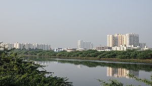
Okkiam Maduvu
Distance: Approx. 3518 meters
Latitude and longitude: 12.9229,80.2428
Okkiam Maduvu or Okkiyam Maduvu or Oggiyam Maduvu is a 2.8-kilometer-long water channel situated in Kanchipuram district located in southern suburbs of the city of Chennai, India. It gets water from the Pallikaranai Wetland and drains into the Buckingham canal.
Weather in this IP's area
mist
29 Celsius
34 Celsius
27 Celsius
29 Celsius
1006 hPa
81 %
1006 hPa
1006 hPa
4000 meters
2.57 m/s
130 degree
75 %
05:58:15
18:07:38