Country:
Region:
City:
Latitude and Longitude:
Time Zone:
Postal Code:
IP information under different IP Channel
ip-api
Country
Region
City
ASN
Time Zone
ISP
Blacklist
Proxy
Latitude
Longitude
Postal
Route
Luminati
Country
Region
tn
City
coonoor
ASN
Time Zone
Asia/Kolkata
ISP
National Internet Backbone
Latitude
Longitude
Postal
IPinfo
Country
Region
City
ASN
Time Zone
ISP
Blacklist
Proxy
Latitude
Longitude
Postal
Route
db-ip
Country
Region
City
ASN
Time Zone
ISP
Blacklist
Proxy
Latitude
Longitude
Postal
Route
ipdata
Country
Region
City
ASN
Time Zone
ISP
Blacklist
Proxy
Latitude
Longitude
Postal
Route
Popular places and events near this IP address

Ooty
Hill station city in Tamil Nadu, India
Distance: Approx. 1434 meters
Latitude and longitude: 11.41,76.7
Ooty (; officially Udagamandalam, anglicized: Ootacamund (), abbreviated as Udagai) is a town and municipality in the Nilgiris district of the Indian state of Tamil Nadu. It is located 86 km (53 mi) northwest of Coimbatore, and is the headquarters of Nilgiris district. Situated in the Nilgiri hills, it is known by the epithet "Queen of Hill Stations", and is a popular tourist destination.

Breeks Memorial School
School in Ooty, Tamil Nadu, India
Distance: Approx. 1881 meters
Latitude and longitude: 11.4127,76.7075
Breeks Memorial Anglo-Indian Higher Secondary School is a Christian co-educational school established in 1874. It was named after James Wilkinson Breeks, the first Commissioner (District Collector) of the Nilgiris. It was erected for the children of Europeans and Eurasians by public subscription shortly after his death, as a memorial to his services to the Nilgiris community.

Roman Catholic Diocese of Ootacamund
Roman Catholic diocese in Tamil Nadu, India
Distance: Approx. 1844 meters
Latitude and longitude: 11.4167,76.7086
The Roman Catholic Diocese of Ootacamund (Latin: Ootacamunden(sis)) is a diocese located in the city of Ootacamund (Ooty) in the ecclesiastical province of Madras and Mylapore in India.

Holy Trinity Church, Ooty
Distance: Approx. 1328 meters
Latitude and longitude: 11.413444,76.702056
Holy Trinity Church is located in Ooty (Ootacamund), in the state of Tamil Nadu. It is one of the oldest landmarks in Ooty. The building was initially used by Indian Christians as a place of worship on Sundays and used as a school during weekdays.

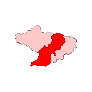
Udagamandalam Assembly constituency
One of the 234 State Legislative Assembly Constituencies in Tamil Nadu, in India
Distance: Approx. 1434 meters
Latitude and longitude: 11.41,76.7
Udagamandalam or 'Udhagamandalam' is a state assembly constituency in Tamil Nadu. Its State Assembly Constituency number is 108. It comes under the Nilgiris Lok Sabha constituency.
Udagamandalam taluk
Distance: Approx. 1434 meters
Latitude and longitude: 11.41,76.7
Udagamandalam taluk is a taluk of Nilgiris district of the Indian state of Tamil Nadu.
Woodside School, Ooty
Primary and secondary (co-educational) school in Ooty, Tamil Nadu, India
Distance: Approx. 802 meters
Latitude and longitude: 11.416118,76.698082
Woodside School is a co-educational boarding school and day school situated on the outskirts of Udhagamandalam Tamil Nadu, India.

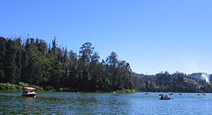
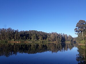
Ooty Lake
Artificial lake in Tamil Nadu, India
Distance: Approx. 1637 meters
Latitude and longitude: 11.4061,76.6882
Ooty lake is an artificial lake near Ooty in the Nilgiris district of Tamil Nadu, India. It covers an area of 26 hectares (64 acres). The boathouse on the lake is a major tourist attraction.

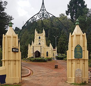
St. Stephen's Church, Udhagamandalam
Church in Tamil Nadu, India
Distance: Approx. 1253 meters
Latitude and longitude: 11.414687,76.702056
St. Stephen's Church is located on the road to Mysore in Ooty, in the state of Tamil Nadu, India. It is one of the oldest churches in the Nilgiris district.
Udagamandalam block
Distance: Approx. 1434 meters
Latitude and longitude: 11.41,76.7
The Udagamandalam block is a revenue block in the Nilgiris District of Tamil Nadu, India. It has a total of 13 panchayat villages.
St. Joseph's Higher Secondary School, Ooty
Higher secondary school in Ooty, Tamil Nadu, India
Distance: Approx. 1262 meters
Latitude and longitude: 11.409,76.693
St. Joseph's Higher Secondary School is a boys' school located in the scenic hill station town Ooty, which is part of The Nilgiris district in Tamil Nadu, India. The school was started by Christian missionaries in 1820.

Western Catchments
Distance: Approx. 1816 meters
Latitude and longitude: 11.4041782,76.6946178
Western Catchment is an area of The Nilgiris, Tamil Nadu, situated about 20 km from Ooty. The Western Catchment area is protected by the Forest Department, and tourists are not allowed in without permission. Earlier some regional movies were filmed here, but due to environmental protection permission is no longer given.
Weather in this IP's area
overcast clouds
11 Celsius
10 Celsius
11 Celsius
11 Celsius
1015 hPa
71 %
1015 hPa
773 hPa
10000 meters
0.16 m/s
1.54 m/s
352 degree
99 %
06:18:22
17:56:18