Country:
Region:
City:
Latitude and Longitude:
Time Zone:
Postal Code:
IP information under different IP Channel
ip-api
Country
Region
City
ASN
Time Zone
ISP
Blacklist
Proxy
Latitude
Longitude
Postal
Route
Luminati
Country
Region
tn
City
coonoor
ASN
Time Zone
Asia/Kolkata
ISP
National Internet Backbone
Latitude
Longitude
Postal
IPinfo
Country
Region
City
ASN
Time Zone
ISP
Blacklist
Proxy
Latitude
Longitude
Postal
Route
db-ip
Country
Region
City
ASN
Time Zone
ISP
Blacklist
Proxy
Latitude
Longitude
Postal
Route
ipdata
Country
Region
City
ASN
Time Zone
ISP
Blacklist
Proxy
Latitude
Longitude
Postal
Route
Popular places and events near this IP address

Coonoor
Hill Station in Tamil Nadu, India
Distance: Approx. 1344 meters
Latitude and longitude: 11.345,76.795
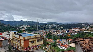
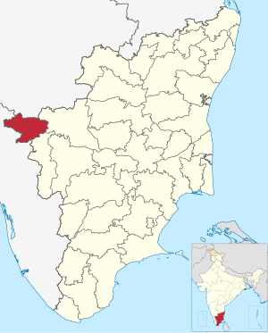
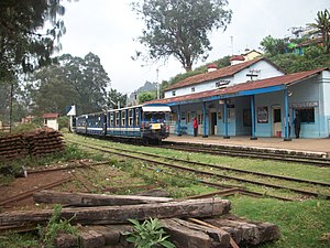
Coonoor (), is a taluk and a municipal town of the Nilgiris district in the Indian state of Tamil Nadu. As of 2011, the town had a population of 45,494. The town sits at the south-east corner of the Nilgiri plateau, and at the head of the Coonoor Ghat, the principal pass connecting the Nilgiris to the plains.
Aruvankadu
Village in Tamil Nadu, India
Distance: Approx. 1037 meters
Latitude and longitude: 11.35055556,76.77472222
Aruvankadu is a big village located in The Nilgiris District, Tamil Nadu, India. It is located between Coonoor and Ooty on the NH 67, 6 km from Coonoor town and 12 km from Ooty. It is connected by frequent bus services from various towns and cities.
Wellington, Tamil Nadu
Town in Tamil Nadu, India
Distance: Approx. 2112 meters
Latitude and longitude: 11.3636,76.7885
Wellington (Native name: Jakkatalla (Badaga)) is a town in the Nilgiris District of the Indian state of Tamil Nadu, located at three kilometres to the north of Coonoor on the NH-181. The town includes a Wellington Bazaar, and the Wellington Cantonment. The Wellington Cantonment is home to The Madras Regimental Centre (MRC) and The Defence Services Staff College (DSSC).
Hubbathala
Census town in Tamil Nadu, India
Distance: Approx. 2283 meters
Latitude and longitude: 11.35083333,76.7625
Hubbathala is a census town in the Nilgiris district in the Indian state of Tamil Nadu.
Huligal
Town in Tamil Nadu, India
Distance: Approx. 3076 meters
Latitude and longitude: 11.31888889,76.79027778
Huligal is a panchayat town in The Nilgiris district in the Indian state of Tamil Nadu.
Wellington Cantonment
Distance: Approx. 1117 meters
Latitude and longitude: 11.355529,76.7825328
Wellington is a cantonment town in the Coonoor sub-Division of Nilgiris District of Tamil Nadu. One of its most famous residents was Field Marshal Sam Manekshaw, who died in the town on June 27, 2008. This town is adjacent to the town of Coonoor.

Defence Services Staff College
Inter-service institution of the Indian Ministry of Defence
Distance: Approx. 2237 meters
Latitude and longitude: 11.363529,76.7917566
The Defence Services Staff College (DSSC) is a defence service training institution of the Ministry of Defence, Government of India. It trains officers of all three services of the Indian Armed Forces – (Indian Army, Indian Navy, Indian Air Force), selected officers from the Paramilitary forces and the Civil Services and officers from friendly foreign countries for command and staff appointments.
Hullickal
Village in Tamil Nadu, India
Distance: Approx. 3089 meters
Latitude and longitude: 11.319349,76.773244
Hullickal or Pulikkal is a Revenue Village in Coonoor Taluk of the Nilgiris District, Tamil Nadu, India.

Sim's Park, Coonoor
Botanical garden in Tamil Nadu, India
Distance: Approx. 2237 meters
Latitude and longitude: 11.35536111,76.80055556
Sim's Park is in Coonoor, The Nilgiris, Tamil Nadu. It is an important tourist place to visit in Coonoor, at a height of 1780 meters above mean sea level. Here the maximum temperature goes up to 28 degree Celsius and the minimum falls to 5 °C. The average rain fall of this garden is 150 cm.
Black Bridge (The Nilgiris)
Distance: Approx. 1824 meters
Latitude and longitude: 11.3613659,76.7785289
The Black Bridge (now the Manekshaw Bridge) is a historic bridge in Wellington, The Nilgiris District, India. At 43.5 metres long, the bridge spans across the Mynala stream, which joins the Coonoor River 2 kilometres downstream. The bridge connects Wellington Cantonment to the Ooty - Coonoor road (NH181).

Forest Dale, Nilgiris district
Distance: Approx. 2825 meters
Latitude and longitude: 11.3660435,76.7978937
Forest Dale is a small village near Coonoor in The Nilgiris District in Tamil Nadu. It is 1 km from Defence Services Staff College (DSSC), the officers training for the Indian Armed Forces and about 3.5 km from Coonoor.

2021 Indian Air Force Mil Mi-17 crash
Helicopter crash in India with 14 fatalities
Distance: Approx. 3096 meters
Latitude and longitude: 11.3325,76.80777778
On 8 December 2021, a Mil Mi-17V-5 transport helicopter operated by the Indian Air Force (IAF) crashed between Coimbatore and Wellington in the state of Tamil Nadu, after departing from Sulur Air Force Station. The helicopter was carrying Chief of Defence Staff General Bipin Rawat and 13 others, including his wife and staff. Everyone on board was killed in the immediate aftermath, except Group Captain Varun Singh, who died from his injuries at a hospital a week later.
Weather in this IP's area
light rain
21 Celsius
21 Celsius
21 Celsius
21 Celsius
1012 hPa
87 %
1012 hPa
825 hPa
10000 meters
1.41 m/s
2.15 m/s
102 degree
78 %
06:16:51
17:56:27

