Country:
 India
IndiaRegion:
City:
Latitude and Longitude:
Time Zone:
Postal Code:
IP information under different IP Channel
ip-api
Country
Region
City
ASN
Time Zone
ISP
Blacklist
Proxy
Latitude
Longitude
Postal
Route
IPinfo
Country
Region
City
ASN
Time Zone
ISP
Blacklist
Proxy
Latitude
Longitude
Postal
Route
MaxMind
Country
Region
City
ASN
Time Zone
ISP
Blacklist
Proxy
Latitude
Longitude
Postal
Route
Luminati
Country
INRegion
tn
City
karaikudi
ASN
Time Zone
Asia/Kolkata
ISP
National Internet Backbone
Latitude
Longitude
Postal
db-ip
Country
Region
City
ASN
Time Zone
ISP
Blacklist
Proxy
Latitude
Longitude
Postal
Route
ipdata
Country
Region
City
ASN
Time Zone
ISP
Blacklist
Proxy
Latitude
Longitude
Postal
Route
Popular places and events near this IP address

Karaikudi
City Corporation in Tamil Nadu, India
Distance: Approx. 831 meters
Latitude and longitude: 10.0735,78.7732
Karaikudi is the largest city in Sivaganga district in the Indian state of Tamil Nadu. Karaikudi Urban Agglomoration is the 21st largest urban area of Tamil Nadu based on 2011 census data. It is part of the area commonly referred to as "Chettinad" and has been declared a City Municipal Corporation by the Government of Tamil Nadu, on account of the palatial houses built with limestone called Kaarai veedu.
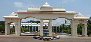
Alagappa University
State University located in Karaikudi
Distance: Approx. 2988 meters
Latitude and longitude: 10.078603,78.79468
Alagappa University is a public university located in Karaikudi, Tamil Nadu, India. Originated from Alagappa Arts College, founded by Alagappa Chettiar in 1947, it was established in 1985 by an Act of the Tamil Nadu government. It was converted from a unitary type to an affiliating type by the Tamil Nadu Universities Act, 2002, with jurisdiction over arts and science colleges in the districts of Ramanathapuram district and Sivaganga district.

Central Electro Chemical Research Institute
Distance: Approx. 3770 meters
Latitude and longitude: 10.08354444,78.80008333
Central Electro Chemical Research Institute is one of a chain of forty national laboratories under the aegis of the Council of Scientific and Industrial Research (CSIR) in New Delhi. Founded on 25 July 1948 at Karaikudi in Tamil Nadu, CECRI came into existence in January 1953.
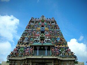
Kottaiyur
Sub Urban in Tamil Nadu, India
Distance: Approx. 5846 meters
Latitude and longitude: 10.115,78.791
Kottaiyur is a northern suburb of Karaikudi as well the part of Karaikudi City Municipal Corporation .The village is famous for Kottaiyur Sivan Temple, one of the master pieces of the Chettinad region. The temple and the area's old lime stone heritage buildings give Kottaiyur a unique identity. Kottaiyur is well developed and famous for its reputed educational institutions.
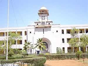
Alagappa Government Arts College
Distance: Approx. 3217 meters
Latitude and longitude: 10.078548,78.79703
Alagappa Government Arts College, is a co-educational arts and science college located in Karaikudi of Sivaganga District in Tamil Nadu, India.
Kattuthalaivasal
Area in Tamil Nadu, India
Distance: Approx. 1129 meters
Latitude and longitude: 10.07,78.78
Kattuthalaivasal is located in Karaikudi municipality in the Sivaganga District in the Indian state of Tamil Nadu. This area comprises Ward 15, Ward 16 and Ward 10. The majority of the people Kattuthalaivasal are Muslims .
Alagappa Polytechnic
Distance: Approx. 3894 meters
Latitude and longitude: 10.091968,78.794758
Alagappa Government Polytechnic College is a major Government polytechnic college in Karaikudi, Tamil Nadu, India. It is held directly under the control of the Government of Tamil Nadu. It is located next to the ACCET campus in Karaikudi.

Karaikudi Assembly constituency
One of the 234 State Legislative Assembly Constituencies in Tamil Nadu, in India
Distance: Approx. 1129 meters
Latitude and longitude: 10.07,78.78
Karaikudi is a state assembly constituency in Sivaganga district in Tamil Nadu. Most successful party: INC (5 times). It is one of the 234 State Legislative Assembly Constituencies in Tamil Nadu in India.
Karaikudi taluk
Distance: Approx. 1129 meters
Latitude and longitude: 10.07,78.78
Karaikudi taluk is a taluk of Sivagangai district of the Indian state of Tamil Nadu.

Karaikkudi Junction railway station
Railway junction in Tamil Nadu, India
Distance: Approx. 2426 meters
Latitude and longitude: 10.0678,78.7924
Karaikkudi Junction (station code: KKDI) is an NSG–4 category Indian railway station in Madurai railway division of Southern Railway zone. It serves Karaikudi Municipal Corporation and its Karaikudi Urban Agglomoration areas, located in Sivaganga district of the Indian state of Tamil Nadu.

Ariyakudi
Village in Tamil Nadu, India
Distance: Approx. 2799 meters
Latitude and longitude: 10.048135,78.787637
Ariyakudi is a village situated in the suburban region of Karaikudi in the Sivaganga District. Situated approximately 3 kilometers southeast of Karaikudi city, it has a population of 5,368 as of 2011. It has total of 9 wards.
Amaravathiputhur
Village in Tamil Nadu, India
Distance: Approx. 4987 meters
Latitude and longitude: 10.021881,78.767536
Amaravathipudur is a village situated in the suburban region of Karaikudi in the Sivaganga District as well as the part of Karaikudi City Municipal Corporation.This village panchayat has a total of 7 panchayat constituencies. 7 Panchayat Council members are elected from these. According to the 2011 India census, the total population in Amaravathipudur is 9,221.
Weather in this IP's area
few clouds
27 Celsius
29 Celsius
27 Celsius
27 Celsius
1007 hPa
69 %
1007 hPa
997 hPa
10000 meters
2.78 m/s
4.33 m/s
356 degree
24 %
06:04:23
18:13:07