120.200.225.162 - IP Lookup: Free IP Address Lookup, Postal Code Lookup, IP Location Lookup, IP ASN, Public IP
Country:
Region:
City:
Location:
Time Zone:
Postal Code:
IP information under different IP Channel
ip-api
Country
Region
City
ASN
Time Zone
ISP
Blacklist
Proxy
Latitude
Longitude
Postal
Route
Luminati
Country
ASN
Time Zone
Asia/Shanghai
ISP
China Mobile communications corporation
Latitude
Longitude
Postal
IPinfo
Country
Region
City
ASN
Time Zone
ISP
Blacklist
Proxy
Latitude
Longitude
Postal
Route
IP2Location
120.200.225.162Country
Region
liaoning
City
dandong
Time Zone
Asia/Shanghai
ISP
Language
User-Agent
Latitude
Longitude
Postal
db-ip
Country
Region
City
ASN
Time Zone
ISP
Blacklist
Proxy
Latitude
Longitude
Postal
Route
ipdata
Country
Region
City
ASN
Time Zone
ISP
Blacklist
Proxy
Latitude
Longitude
Postal
Route
Popular places and events near this IP address

North Pyongan Province
Province of North Korea
Distance: Approx. 3282 meters
Latitude and longitude: 40.1,124.4
North Pyongan Province (also spelled North P'yŏngan; Korean: 평안북도; MR: Phyŏnganbukto; IPA: [pʰjʌŋanbuk̚t͈o]) is a western province of North Korea. The province was formed in 1896 from the northern half of the former P'yŏng'an Province, remained a province of Korea until 1945, then became a province of North Korea. Its capital is Sinŭiju.

Sinuiju
Municipal city in North P'yŏngan, North Korea
Distance: Approx. 3282 meters
Latitude and longitude: 40.1,124.4
Sinŭiju (Korean: 신의주시; MR: Sinŭiju-si; IPA: [ɕinɰidzu ɕi]), is a city in North Korea which faces Dandong, Liaoning, China, across the international border of the Yalu River. It is the capital of North P'yŏngan province. Part of the city is included in the Sinŭiju Special Administrative Region, which was established in 2002 to experiment with introducing a market economy.

Sino-Korean Friendship Bridge
Bridge
Distance: Approx. 1592 meters
Latitude and longitude: 40.115,124.3925
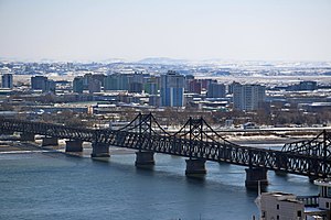
The Sino-Korean Friendship Bridge, or China–North Korea Friendship Bridge, is a bridge across the Yalu or Amnok River on the China–North Korea border. It connects the cities of Dandong in China and Sinuiju of North Korea, by railway and roadway but pedestrians are not allowed to cross between either side. The bridge serves as one of the few ways to enter or leave North Korea.

Sinuiju Special Administrative Region
Former planned SAR in North Korea
Distance: Approx. 3190 meters
Latitude and longitude: 40.10055556,124.39361111
Sinuiju Special Administrative Region (Korean: 신의주 특별 행정구) was a planned special administrative region (SAR) of North Korea based in the city of Sinuiju. Proclaimed in 2002, the SAR was envisioned to be directly governed as in the case of "Directly Governed Cities" but has yet to be put into de facto operation. Proposals for a special economic zone in Sinuiju to introduce market economics were first proposed to Chinese-Dutch businessman Yang Bin in 2001, who was proposed to be the zone's director.
Sinuiju Stadium
Sports venue in Sinuiju, North Korea
Distance: Approx. 2654 meters
Latitude and longitude: 40.110525,124.41408333
The Sinuiju Stadium (신의주경기장), also known as October Stadium (10월 경기장), is a multi-purpose stadium in Sinŭiju, North Korea, that is mainly used for events and football matches of the Amrokkang Sports Club. Built in 1965, it has a capacity of 17,500 spectators.

Sinuiju Chongnyon station
Railway station in North Korea
Distance: Approx. 2544 meters
Latitude and longitude: 40.107,124.4018
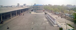
Sinuiju Chongnyon station, also known as Sinŭiju Ch'ŏngnyŏn station, is a railway station in Yŏkchŏn-dong, Sinŭiju-si, North P'yŏngan Province, North Korea. It is the northern terminus of the P'yŏngŭi Line of the Korean State Railway, and the starting point of the Kang'an Line, which is an industrial line serving the factories of Sinŭiju. The station is the main recipient for overland traffic between North Korea and the People's Republic of China, and is one of the country's most important rail stations, as it controls access to the Chinese city of Dandong over the Yalu River, via the Sino-Korean Friendship Bridge.

Yuanbao District
District in Liaoning, People's Republic of China
Distance: Approx. 2840 meters
Latitude and longitude: 40.1525,124.38111111
Yuanbao District (simplified Chinese: 元宝区; traditional Chinese: 元寶區; pinyin: Yuánbǎo Qū) is a district of the city of Dandong, Liaoning, People's Republic of China.
Sinuiju Formation
Early Cretaceous formation in North Korea
Distance: Approx. 3282 meters
Latitude and longitude: 40.1,124.4
The Sinuiju Formation(신의주층) is a geologic formation in North Korea. Formerly of uncertain age, it is now thought to be Early Cretaceous. A variety of fossils are known from the formation, including those of anurognathid pterosaurs (possibly Jeholopterus) and birds such as the specimen of a very large enantiornithine with a 5 cm (2.0 in) long tibia and a 3.5 cm (1.4 in) long pygostyle.

Memorial of the War to Resist US Aggression and Aid Korea
War museum in Liaoning, China
Distance: Approx. 2604 meters
Latitude and longitude: 40.1196,124.3668
The Memorial Hall of the War to Resist US Aggression and Aid Korea (Chinese: 抗美援朝纪念馆; pinyin: Kàngměi Yuáncháo Jìniànguǎn), also translated as the Korean War Museum, is a museum in Dandong, Liaoning. It is the only official museum in China that memorializes the Korean War (called the "War to Resist US Aggression and Aid Korea" in China). First established in 1953, it was rebuilt at its current location in October 1990.
Yalu River Broken Bridge
Historic defunct China–Korea bridge
Distance: Approx. 1615 meters
Latitude and longitude: 40.1149,124.3915
The Yalu River Broken Bridge (simplified Chinese: 鸭绿江断桥; traditional Chinese: 鴨綠江斷橋; pinyin: Yālù Jiāng Duàn Qiáo) is a truncated railway swing bridge converted to a viewing platform and historical site. Constructed in 1911 by the Empire of Japan, it was the first bridge built across the Yalu River and connected the Chinese city of Dandong with the Korean city of Sinuiju, linking Japanese-ruled Korea to the Eurasian rail network. The bridge originally consisted of twelve truss spans supported by stone foundations in the riverbed.
Dandong railway station
Railway station in Dandong, Liaoning, China
Distance: Approx. 1290 meters
Latitude and longitude: 40.123,124.3819
Dandong railway station (Chinese: 丹东站; pinyin: Dāndōng zhàn) is a railway station located in Zhenxing District, Dandong, Liaoning, China. It is the terminus of the Shenyang–Dandong railway, the Dandong–Dalian intercity railway, and the Shenyang–Dandong intercity railway. It is also connected to the Pyongui Line which heads south to North Korea via the Sino-Korean Friendship Bridge.
Zhenzhu Subdistrict
Subdistrict in Liaoning, People's Republic of China
Distance: Approx. 2780 meters
Latitude and longitude: 40.15027778,124.41222222
Zhenzhu Subdistrict (Chinese: 珍珠街道; pinyin: Zhēnzhū Jiēdào) is a subdistrict in Zhen'an District, Dandong, Liaoning, China.
Weather in this IP's area
clear sky
-0 Celsius
-6 Celsius
-0 Celsius
-0 Celsius
1026 hPa
28 %
1026 hPa
1020 hPa
10000 meters
5.78 m/s
7.44 m/s
346 degree

