12.189.192.94 - IP Lookup: Free IP Address Lookup, Postal Code Lookup, IP Location Lookup, IP ASN, Public IP
Country:
Region:
City:
Location:
Time Zone:
Postal Code:
ISP:
ASN:
language:
User-Agent:
Proxy IP:
Blacklist:
IP information under different IP Channel
ip-api
Country
Region
City
ASN
Time Zone
ISP
Blacklist
Proxy
Latitude
Longitude
Postal
Route
db-ip
Country
Region
City
ASN
Time Zone
ISP
Blacklist
Proxy
Latitude
Longitude
Postal
Route
IPinfo
Country
Region
City
ASN
Time Zone
ISP
Blacklist
Proxy
Latitude
Longitude
Postal
Route
IP2Location
12.189.192.94Country
Region
new jersey
City
ridgefield park
Time Zone
America/New_York
ISP
Language
User-Agent
Latitude
Longitude
Postal
ipdata
Country
Region
City
ASN
Time Zone
ISP
Blacklist
Proxy
Latitude
Longitude
Postal
Route
Popular places and events near this IP address

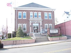
Ridgefield Park, New Jersey
Village in Bergen County, New Jersey, US
Distance: Approx. 370 meters
Latitude and longitude: 40.854705,-74.019926
Ridgefield Park is a village in Bergen County, in the U.S. state of New Jersey. As of the 2020 United States census, the village's population was 13,224, an increase of 495 (+3.9%) from the 2010 census count of 12,729, which in turn reflected a decline of 144 (−1.1%) from the 12,873 counted in the 2000 census. Of the 564 municipalities in the state, Ridgefield Park is one of only four with a village type of government, though it operates a Walsh Act (city commission) form of government.

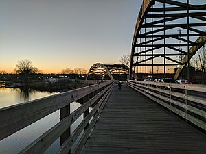
Overpeck Creek
River in New Jersey, United States
Distance: Approx. 1310 meters
Latitude and longitude: 40.854916,-74.007286
Overpeck Creek is a tributary of the Hackensack River, approximately 8 miles (13 km) long, in Bergen County in northeastern New Jersey in the United States. The lower broad mouth of the creek is part of the extended tidal estuary of the lower Hackensack and of the adjacent wetland region known as the New Jersey Meadowlands. The upper creek flows through suburban communities west of New York City.
WWRV
Spanish-language Christian radio station in New York City
Distance: Approx. 1391 meters
Latitude and longitude: 40.8451,-74.01958333
WWRV (1330 AM) is a Spanish-language Christian music and teaching station, licensed to New York, New York. It is owned by Radio Visión Cristiana Management. Studios are at 419 Broadway in Paterson, New Jersey.
WZRC
Cantonese radio station in New York City
Distance: Approx. 1396 meters
Latitude and longitude: 40.845,-74.02
WZRC, known on-air as "AM1480" (simplified Chinese: 中文广播电台; traditional Chinese: 中文廣播電臺; pinyin: Zhōngwén Guǎngbò Diàntái; Jyutping: Zung1 Man4 Gwong2 Bo3 Din6 Toi4), is a radio station licensed to New York, New York. The station is owned by Multicultural Broadcasting and airs Cantonese programming. It is one of two Cantonese radio stations serving the New York metropolitan area, the other is Chung Wah Chinese Broadcasting Company.
Maple Grove Park Cemetery (Hackensack, New Jersey)
Cemetery in New Jersey, US
Distance: Approx. 1380 meters
Latitude and longitude: 40.8601831,-74.0384736
Maple Grove Park Cemetery is located in Hackensack, New Jersey. It is operated by the Maple Grove Park Cemetery Association, at 535 Hudson Street in Hackensack. In 2004–2005 it received the remains of bodies removed from the Hudson County Burial Grounds in Secaucus, New Jersey.
Overpeck Township, New Jersey
Township that existed in Bergen County, New Jersey from 1897 to 1938
Distance: Approx. 352 meters
Latitude and longitude: 40.854722,-74.020278
Overpeck Township was a township that existed in Bergen County, New Jersey, United States, from 1897 to 1938. The township was incorporated by an Act of the New Jersey Legislature on March 23, 1897, and was formed coextensively with Ridgefield Park from portions of Ridgefield Township. On May 3, 1921, Overpeck Township acquired portions of both Bogota and Teaneck.
Ridgefield Park Public Schools
School district in Bergen County, New Jersey, US
Distance: Approx. 555 meters
Latitude and longitude: 40.86174,-74.025739
The Ridgefield Park Public Schools is a comprehensive community public school district that serves students in pre-kindergarten through twelfth grade from the Village of Ridgefield Park, in Bergen County, in the U.S. state of New Jersey. As of the 2020–21 school year, the district, comprised of four schools, had an enrollment of 2,178 students and 180.0 classroom teachers (on an FTE basis), for a student–teacher ratio of 12.1:1. The district is classified by the New Jersey Department of Education as being in District Factor Group "DE", the fifth-highest of eight groupings.
Ridgefield Park High School
High school in Bergen County, New Jersey, US
Distance: Approx. 731 meters
Latitude and longitude: 40.859861,-74.014456
Ridgefield Park Junior-Senior High School is a six-year comprehensive community public high school that serves students in seventh through twelfth grade from Ridgefield Park, in Bergen County, in the U.S. state of New Jersey, operating as the lone secondary school of the Ridgefield Park Public Schools. As of the 2023–24 school year, the school had an enrollment of 1,157 students and 89.6 classroom teachers (on an FTE basis), for a student–teacher ratio of 12.9:1. There were 377 students (32.6% of enrollment) eligible for free lunch and 163 (14.1% of students) eligible for reduced-cost lunch.

Paulison-Christie House
Historic house in New Jersey, United States
Distance: Approx. 665 meters
Latitude and longitude: 40.85277778,-74.0275
Paulison-Christie House is located in Ridgefield Park, Bergen County, New Jersey, United States. The house was added to the National Register of Historic Places on January 10, 1983. The house was built about 1775 by John Paulison who owned 150 acres in what was then known as "Old Hackensack." John Paulison was a Tory during the Revolutionary War and was known to have sold cattle from his farm to the British army.

Winant Avenue Bridge
Bridge in Little Ferry and Ridgefield Park
Distance: Approx. 905 meters
Latitude and longitude: 40.8511,-74.0293
The Winant Avenue Bridge is a vehicular movable bridge spanning the Hackensack River in Bergen County, New Jersey 14 miles (23 km) from its mouth at Newark Bay. Built in 1934, it is also known as the Route 46 Hackensack River Bridge and S46 Bridge, it carries U.S. Route 46 (US 46) in Little Ferry and Ridgefield Park. Owned and operated by the New Jersey Department of Transportation (NJDOT), the double leaf bascule bridge is located on a navigable reach.
West View, New Jersey
Populated place in Bergen County, New Jersey, US
Distance: Approx. 956 meters
Latitude and longitude: 40.865,-74.02777778
West View is an unincorporated community located within Ridgefield Park in Bergen County, in the U.S. state of New Jersey. It was a stop on the West Shore Railroad.

Ridgefield Park station
Railroad station in New Jersey, U.S.
Distance: Approx. 452 meters
Latitude and longitude: 40.85666667,-74.02777778
Ridgefield Park station, also known as West Shore Station, was a railroad station in Ridgefield Park, New Jersey, at the foot of Mount Vernon Street served by the New York, Susquehanna and Western Railroad (NYSW) and the West Shore Railroad, a division of New York Central (NYCRR). The New York, Ontario and Western Railway (NYO&W) had running rights along the West Shore and sometimes stopped at Ridgefield Park. First opened in 1872 it was one of three passenger stations in the village, the others being the Little Ferry station to the south and Westview station to the north.
Weather in this IP's area
clear sky
-2 Celsius
-8 Celsius
-4 Celsius
0 Celsius
1025 hPa
57 %
1025 hPa
1021 hPa
10000 meters
6.17 m/s
250 degree