Country:
 USA
USARegion:
City:
Latitude and Longitude:
Time Zone:
Postal Code:
IP information under different IP Channel
ip-api
Country
Region
City
ASN
Time Zone
ISP
Blacklist
Proxy
Latitude
Longitude
Postal
Route
IPinfo
Country
Region
City
ASN
Time Zone
ISP
Blacklist
Proxy
Latitude
Longitude
Postal
Route
MaxMind
Country
Region
City
ASN
Time Zone
ISP
Blacklist
Proxy
Latitude
Longitude
Postal
Route
Luminati
Country
USASN
Time Zone
America/Chicago
ISP
UNITAS
Latitude
Longitude
Postal
db-ip
Country
Region
City
ASN
Time Zone
ISP
Blacklist
Proxy
Latitude
Longitude
Postal
Route
ipdata
Country
Region
City
ASN
Time Zone
ISP
Blacklist
Proxy
Latitude
Longitude
Postal
Route
Popular places and events near this IP address

Piscataway, New Jersey
Township in Middlesex County, New Jersey, US
Distance: Approx. 1750 meters
Latitude and longitude: 40.545539,-74.46072
Piscataway ( piss-KAT-ə-way) is a township in Middlesex County, in the U.S. state of New Jersey. It is a suburb of the New York metropolitan area, in the Raritan Valley. As of the 2020 United States census, the township's population was 60,804, an increase of 4,760 (+8.5%) from the 2010 census count of 56,044, which in turn reflected an increase of 5,562 (+11.0%) from 50,482 at the 2000 census.

Society Hill, Middlesex County, New Jersey
Populated place in Middlesex County, New Jersey, US
Distance: Approx. 2484 meters
Latitude and longitude: 40.534508,-74.45608
Society Hill is an unincorporated community and former census-designated place (CDP) in Piscataway Township, Middlesex County, New Jersey, United States. As of the 2010 United States Census, the CDP's population was 3,829. The area was not listed as a CDP for the 2020 census.
Meadows Foundation (New Jersey)
Distance: Approx. 2612 meters
Latitude and longitude: 40.525201,-74.496188
The Meadows Foundation of Somerset County, New Jersey is a nonprofit corporation founded in 1978. It oversaw the restoration of seven historic houses in Somerset.
Piscataway Township Schools
School district in Middlesex County, New Jersey, US
Distance: Approx. 1112 meters
Latitude and longitude: 40.539249,-74.471474
The Piscataway Township Schools is a community public school district that serves students in pre-kindergarten through twelfth grade from Piscataway, in Middlesex County, in the U.S. state of New Jersey. In addition to its high school, there are four schools for K-3, two intermediate schools serving grades 4-5 and three middle schools for students in grades 6-8. As of the 2018–19 school year, the district, comprised of 10 schools, had an enrollment of 7,161 students and 530.1 classroom teachers (on an FTE basis), for a student–teacher ratio of 13.5:1.

Piscataway High School
High school in Middlesex County, New Jersey, United States
Distance: Approx. 637 meters
Latitude and longitude: 40.54831,-74.474628
Piscataway High School is a four-year comprehensive community public high school serving students in ninth through twelfth grades from Piscataway in Middlesex County, in the U.S. state of New Jersey, operating as the lone secondary school of the Piscataway Township Schools. The school is accredited by the New Jersey Department of Education and has been accredited by the Middle States Association of Colleges and Schools Commission on Elementary and Secondary Schools since 1963. Piscataway Township High School is known for its football program; three former players were drafted in the first round of the National Football League draft in two years, the first time in history that such an event has occurred.

Road Up Raritan Historic District
Historic district in New Jersey, United States
Distance: Approx. 2320 meters
Latitude and longitude: 40.52638889,-74.49138889
The Road Up Raritan Historic District is a 69-acre (28 ha) historic district located along River Road in the township of Piscataway in Middlesex County, New Jersey. It is north of Raritan Landing, once an important inland port on the Raritan River during the 18th and 19th centuries. The name is taken from an earlier colonial era name for what was once a Lenape path, Assunpink Trail that became a main road parallel to the river.
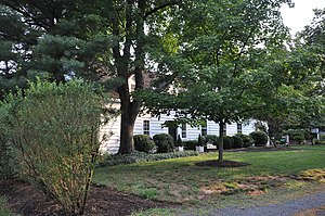
Matthias Smock House
Historic house in New Jersey, United States
Distance: Approx. 2532 meters
Latitude and longitude: 40.52388889,-74.48944444
The Matthias Smock House is a historic house located at 851 River Road in the township of Piscataway in Middlesex County, New Jersey, United States. It was documented by the Historic American Buildings Survey (HABS) in 1938. The house was added to the National Register of Historic Places on December 4, 1973, for its significance in architecture.
Isaac Onderdonk House
Historic house in New Jersey, United States
Distance: Approx. 1792 meters
Latitude and longitude: 40.5325,-74.49333333
The Isaac Onderdonk House, also known as the Walter C. and Julia Meuly House, is a historic house located at 685 River Road in the township of Piscataway in Middlesex County, New Jersey, United States. It was added to the National Register of Historic Places on October 30, 1973, for its significance in architecture. It was listed as a contributing property of the Road Up Raritan Historic District in 1997.

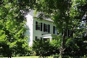
Ephraim Fitz-Randolph House
Historic house in New Jersey, United States
Distance: Approx. 1635 meters
Latitude and longitude: 40.54888889,-74.4625
The Ephraim Fitz-Randolph House is a historic house located at 430 S. Randolphville Road in the Randolphville section of Piscataway in Middlesex County, New Jersey. Built in 1825, it was documented by the Historic American Buildings Survey in 1936. The house was added to the National Register of Historic Places on March 14, 1973, for its significance in architecture.
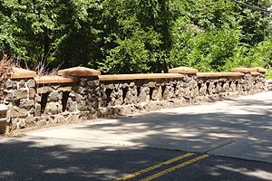
Randolphville Bridge
United States historic place
Distance: Approx. 2513 meters
Latitude and longitude: 40.53947222,-74.45288889
The Randolphville Bridge, also known as the South Randolphville Road Bridge over Ambrose Brook, is a historic road bridge located in the Randolphville section of the township of Piscataway in Middlesex County, New Jersey, United States. Completed in 1939, it was added to the National Register of Historic Places on September 17, 1999, for its significance in engineering and transportation.

Fieldville, New Jersey
Populated place in Middlesex County, New Jersey, US
Distance: Approx. 2143 meters
Latitude and longitude: 40.54722222,-74.50666667
Fieldville is a historical unincorporated community located within Piscataway Township in Middlesex County, in the U.S. state of New Jersey. The location is sometimes described as being on River Road south of Bound Brook. The community was named after John Field and his descendants who settled the area.
Randolphville, New Jersey
Populated place in Middlesex County, New Jersey, US
Distance: Approx. 2590 meters
Latitude and longitude: 40.53944444,-74.45194444
Randolphville is an unincorporated community located within the township of Piscataway in Middlesex County, in the U.S. state of New Jersey. It is the location of the historic Randolphville Bridge, built in 1939.
Weather in this IP's area
clear sky
10 Celsius
9 Celsius
8 Celsius
12 Celsius
1016 hPa
86 %
1016 hPa
1013 hPa
10000 meters
0.45 m/s
1.34 m/s
335 degree
06:32:28
19:18:45