Country:
Region:
City:
Latitude and Longitude:
Time Zone:
Postal Code:
IP information under different IP Channel
ip-api
Country
Region
City
ASN
Time Zone
ISP
Blacklist
Proxy
Latitude
Longitude
Postal
Route
Luminati
Country
ASN
Time Zone
Asia/Jakarta
ISP
PT. DATA Utama Dinamika
Latitude
Longitude
Postal
IPinfo
Country
Region
City
ASN
Time Zone
ISP
Blacklist
Proxy
Latitude
Longitude
Postal
Route
db-ip
Country
Region
City
ASN
Time Zone
ISP
Blacklist
Proxy
Latitude
Longitude
Postal
Route
ipdata
Country
Region
City
ASN
Time Zone
ISP
Blacklist
Proxy
Latitude
Longitude
Postal
Route
Popular places and events near this IP address

West Jakarta
Administrative city in Jakarta, Indonesia
Distance: Approx. 3138 meters
Latitude and longitude: -6.16833333,106.75888889
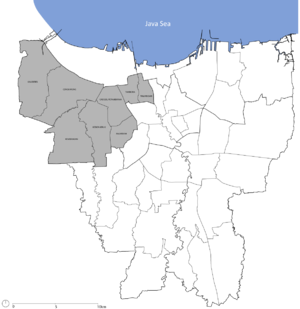
West Jakarta (Indonesian: Jakarta Barat; Betawi: Jakarte Bekulon), abbreviated as Jakbar, is one of the five administrative cities of the Special Capital Region of Jakarta, Indonesia. West Jakarta is not self-governed and does not have a city council, hence it is not classified as a proper municipality. It had a population of 2,281,945 at the 2010 Census and 2,434,511 at the 2020 Census; the official estimate as at mid 2023 was 2,611,515 (comprising 1,312,120 males and 1,299,395 females).
Duri Kosambi, Cengkareng
Village in Jakarta, Indonesia
Distance: Approx. 3437 meters
Latitude and longitude: -6.1721148,106.7205154
Duri Kosambi is an administrative village (kelurahan) in the Cengkareng district of Indonesia. It has postal code of 11750.
Indosiar Television Tower
TV-transmission, communication in West Jakarta, Indonesia
Distance: Approx. 2686 meters
Latitude and longitude: -6.193875,106.76821944
The Indosiar Television Tower is a 395 m (1,296 ft) guyed mast used for FM- and TV-broadcasting in West Jakarta, Indonesia, completed in 2006. It is currently the tallest structure in Indonesia. It consists of a 375 metre tall lattice structure with a side length of 6.3 m (20.7 ft), which carries on its top a 20 m (65.6 ft) high TV-broadcasting antenna.

Kedoya Selatan
Administrative village in DKI Jakarta, Indonesia
Distance: Approx. 2701 meters
Latitude and longitude: -6.18333333,106.76666667
Kedoya Selatan (Indonesian for South Kedoya) is an administrative village in the Kebon Jeruk district, city of West Jakarta, Indonesia. It has postal code of 11520. Taman Kedoya Baru residential estate and Kedoya Elok Apartment are located in this area.
2013 Ekayana Monastery bombing
Terrorist attack in Jakarta, Indonesia
Distance: Approx. 4132 meters
Latitude and longitude: -6.1779,106.7784
A terrorist attack occurred in Jakarta, Indonesia on August 4, 2013 at 6:53 p.m. It targeted a Buddhist monastery named Ekayana in Jakarta. This bombing caused injuries to three people.

Taman Kota railway station
Railway station in Indonesia
Distance: Approx. 3996 meters
Latitude and longitude: -6.158651,106.75651
Taman Kota Station (TKO, formerly Kembangan Station) is a class III railway station located in North Kembangan, Kembangan, West Jakarta. The station, which is located at an altitude of +12 meters, is included in the Jakarta Operational Area I and only serves the KRL Commuterline route.

Pesanggrahan River
River in Indonesia
Distance: Approx. 2171 meters
Latitude and longitude: -6.17374,106.74995
The Pesanggrahan River (Indonesian: Sungai Pesanggrahan or Kali Pesanggrahan) is a river with the upstream in the Bogor Regency, flowing through the cities of Depok, Jakarta and Tangerang, Banten. The river passes the districts of Tanah Sereal, Bojong Gede, Sawangan, Limo, Kebayoran Lama, Pesanggrahan, Kembangan, and Kebun Jeruk before flowing into the Cengkareng Drain. Based on 2005 data, 55 percent of the watershed area of the Pesanggrahan River is occupied by housing, only 7 percent is still forests, 20 percent rice fields, and 13 percent other agriculture fields.
St. Moritz, Jakarta
Shopping mall in Jakarta, Indonesia
Distance: Approx. 753 meters
Latitude and longitude: -6.188011,106.738755
St Moritz Penthouse and Residences is an integrated development, which consists of six apartment towers, office Tower, five star hotel (JW Marriot), 2 shopping centers, school, hospital, country club and convention center, located at Kembangan, West Jakarta, Indonesia. The complex has a land area of about 12 hectares (30 acres), which is developed by Lippo Group. The six apartment towers and Lippo Office Tower are integrated with Lippo Mall Puri.

Puri Indah
Neighborhood of Jakarta, Indonesia
Distance: Approx. 1212 meters
Latitude and longitude: -6.187951,106.733967
Puri Indah is a growing neighborhood at Kembangan, Jakarta, Indonesia. The area is in between South Kembangan and North Meruya administrative village of Kembangan district of West Jakarta. The area is located at the intersection of W1-W2 toll/expressway of the Jakarta Outer Ring Road.
West Vista
Residential in Jakarta, Indonesia
Distance: Approx. 4300 meters
Latitude and longitude: -6.157906,106.726351
West Vista is a twin towers skyscraper in Cengkareng, Jakarta, Indonesia. The 48 floors residential twin towers is part of an 8 hectares complex, of which 3 hectares are occupied by this building of 2855 apartment units. Singapore-based Keppel Land Limited is the developer of the complex.
The Museum of Modern and Contemporary Art in Nusantara
Art museum in Kota Jakarta Barat, Jakarta
Distance: Approx. 2647 meters
Latitude and longitude: -6.1909071,106.767875
The Museum of Modern and Contemporary Art in Nusantara or Museum MACAN is an art museum at Kebon Jeruk in Jakarta, Indonesia. The museum is the first in Indonesia to have a collection of modern and contemporary Indonesian and international art. It has a floor area of 7,107 m2 (76,500 sq ft) with display area of about 4,000 m2 (43,000 sq ft).
South Kembangan
Administrative village in Jakarta, Indonesia
Distance: Approx. 624 meters
Latitude and longitude: -6.187464,106.741189
South Kembangan is an administrative village in the Kembangan district, city of West Jakarta, Indonesia. It has postal code of 11610.
Weather in this IP's area
thunderstorm
31 Celsius
36 Celsius
30 Celsius
33 Celsius
1005 hPa
68 %
1005 hPa
1004 hPa
10000 meters
4.12 m/s
10 degree
40 %
05:26:07
17:50:35