Country:
Region:
City:
Latitude and Longitude:
Time Zone:
Postal Code:
IP information under different IP Channel
ip-api
Country
Region
City
ASN
Time Zone
ISP
Blacklist
Proxy
Latitude
Longitude
Postal
Route
Luminati
Country
ASN
Time Zone
Asia/Tokyo
ISP
Equinix (EMEA) Acquisition Enterprises B.V.
Latitude
Longitude
Postal
IPinfo
Country
Region
City
ASN
Time Zone
ISP
Blacklist
Proxy
Latitude
Longitude
Postal
Route
db-ip
Country
Region
City
ASN
Time Zone
ISP
Blacklist
Proxy
Latitude
Longitude
Postal
Route
ipdata
Country
Region
City
ASN
Time Zone
ISP
Blacklist
Proxy
Latitude
Longitude
Postal
Route
Popular places and events near this IP address

Fyshwick, Australian Capital Territory
Retail and light industry suburb of Canberra, Australia
Distance: Approx. 2242 meters
Latitude and longitude: -35.329,149.174
Fyshwick () is a retail and light industrial suburb of Canberra, Australia, east of the South Canberra district. At the 2016 census, Fyshwick had a population of 56. It has many motor vehicle dealers, stores selling home furnishings and hardware, and stores that sell goods wholesale.

Royal Military College, Duntroon
Australian Army training establishment
Distance: Approx. 2634 meters
Latitude and longitude: -35.29972222,149.165
The Royal Military College, Duntroon, also known simply as Duntroon, is the Australian Army's officer training establishment. It was founded at Duntroon, in Canberra, Australian Capital Territory, in 1911 and is at the foot of Mount Pleasant near Lake Burley Griffin, close to the Department of Defence headquarters at Russell Hill. Duntroon is adjacent to the Australian Defence Force Academy (ADFA), which is Australian Defence Force's tri-service military academy that provides military and tertiary academic education for junior officers of the Australian Army, Royal Australian Air Force and the Royal Australian Navy.

Duntroon, Australian Capital Territory
Suburb of Canberra, Australia
Distance: Approx. 2492 meters
Latitude and longitude: -35.3,149.16666667
Duntroon is a suburb of the city of Canberra in the Australian Capital Territory.

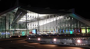
Canberra Airport
Airport in Canberra, Australia
Distance: Approx. 867 meters
Latitude and longitude: -35.30694444,149.195
Canberra Airport (IATA: CBR, ICAO: YSCB) is an international airport situated in the district of Majura, Australian Capital Territory. It serves Australia's capital city, Canberra, as well as the nearby city of Queanbeyan and regional areas of the Australian Capital Territory and southeastern New South Wales. Located approximately 8 km (5.0 mi) from the city centre, within the North Canberra district, it is the ninth-busiest airport in Australia.
Pialligo, Australian Capital Territory
Suburb of Canberra, Australian Capital Territory
Distance: Approx. 1100 meters
Latitude and longitude: -35.30638889,149.18
Pialligo (postcode: 2609) () is a rural suburb of Canberra, Australian Capital Territory, Australia. The name Pialligo has been used for the area since at least 1820, and is probably of Aboriginal origin. It was also the name for the parish in the area.
ACT Heritage Library
Library in Canberra, Australian Capital Territory
Distance: Approx. 2979 meters
Latitude and longitude: -35.33163,149.165449
The ACT Heritage Library is the state library of the Australian Capital Territory (ACT). It is the heritage section of the ACT Library and Information Services. Antoinette Buchanan has been the Manager of the ACT Heritage Library since 2004.

Fairbairn, Canberra
Former military air base in Canberra, Australian Capital Territory
Distance: Approx. 1701 meters
Latitude and longitude: -35.302,149.202
Fairbairn (), formerly RAAF Base Fairbairn, is a former Royal Australian Air Force (RAAF) military air base, located in Australia's national capital, Canberra, Australian Capital Territory. Over the years the name of the establishment, and the use of the land, has changed. The base was in use by the RAAF between 1940 and 2007, when the land occupied north and east of the Canberra Airport runways was sold to Capital Airport Pty Limited for the purposes of advancing civil aviation and the development of a business park.

Majura Park Shopping Centre
Shopping mall in Canberra, Australia
Distance: Approx. 1549 meters
Latitude and longitude: -35.29917,149.1909
The Majura Park Shopping Centre, formerly Brand Depot, is a big-box type shopping centre in the district of Majura in Canberra, Australia. It was developed by Canberra Airport as part of the Majura Park precinct. The shopping centre, which opened in 2006, is part of a larger office and retail precinct on the airport's western boundary, adjacent to Majura Road.

Canberra Outlet Centre
Shopping mall in Fyshwick, Australian Capital Territory
Distance: Approx. 2796 meters
Latitude and longitude: -35.3366,149.17846
Canberra Outlet Centre (formerly known as DFO Canberra and Homemaker Hub and Direct Factory Outlets Canberra) is an outlet type discount shopping centre located on the edge of Fyshwick, a light industrial suburb located in the southeast of Canberra. In addition to providing retail space for 100 specialty outlet stores, the Homewares/Furniture section of the centre is designed for 24 bulky goods retailers, such as furniture and electrical chains. Unlike many other outlet centres, the Canberra site is not adjacent to an airport.

The Canberra Times
Daily newspaper in Canberra, Australia
Distance: Approx. 2164 meters
Latitude and longitude: -35.32472222,149.17
The Canberra Times is a daily newspaper in Canberra, Australia, which is published by Australian Community Media. It was founded in 1926, and has changed ownership and format several times.

Kurrajong electorate
Electorate of the Australian Capital Territory
Distance: Approx. 2537 meters
Latitude and longitude: -35.3,149.21194444
The Kurrajong electorate is one of the five electorates for the unicameral 25-member Australian Capital Territory Legislative Assembly. It elected five members at the 2016 ACT election.

Jerrabomberra Wetlands
Protected area in Australian Capital Territory
Distance: Approx. 2673 meters
Latitude and longitude: -35.31204694,149.15959194
Jerrabomberra Wetlands Nature Reserve is a nationally important group of small wetlands in central Canberra. The Wetlands are on a part of the Molonglo River - Jerrabomberra Creek floodplain that became permanently inundated when the Molonglo River was dammed to form Lake Burley Griffin in 1964. ACT Parks and Conservation Service manages the Wetlands in partnership with the Woodlands and Wetlands Trust.
Weather in this IP's area
broken clouds
19 Celsius
19 Celsius
17 Celsius
20 Celsius
1020 hPa
65 %
1020 hPa
955 hPa
10000 meters
2.1 m/s
2.65 m/s
47 degree
83 %
05:48:43
19:47:10