Country:
Region:
City:
Latitude and Longitude:
Time Zone:
Postal Code:
IP information under different IP Channel
ip-api
Country
Region
City
ASN
Time Zone
ISP
Blacklist
Proxy
Latitude
Longitude
Postal
Route
IPinfo
Country
Region
City
ASN
Time Zone
ISP
Blacklist
Proxy
Latitude
Longitude
Postal
Route
MaxMind
Country
Region
City
ASN
Time Zone
ISP
Blacklist
Proxy
Latitude
Longitude
Postal
Route
Luminati
Country
ASN
Time Zone
Asia/Kolkata
ISP
Sify Limited
Latitude
Longitude
Postal
db-ip
Country
Region
City
ASN
Time Zone
ISP
Blacklist
Proxy
Latitude
Longitude
Postal
Route
ipdata
Country
Region
City
ASN
Time Zone
ISP
Blacklist
Proxy
Latitude
Longitude
Postal
Route
Popular places and events near this IP address
Buckingham Canal
Canal that runs in Andhra Pradesh and Tamilnadu in India
Distance: Approx. 694 meters
Latitude and longitude: 12.9849,80.2527
The Buckingham Canal is a 796 kilometres (494.6 mi)-long fresh water navigation canal, that parallels the Coromandel Coast of South India from Kakinada City in the Kakinada district of Andhra Pradesh to Parangipettai near Chidambaram, Cuddalore District of Tamil Nadu, India. The canal connects most of the natural backwaters along the coast to Chennai (Madras) port. The canal was constructed during British rule, and was an important waterway during the late nineteenth and early twentieth centuries.

Tharamani
Neighbourhood in Chennai, Tamil Nadu, India
Distance: Approx. 682 meters
Latitude and longitude: 12.9863,80.2432
Tharamani is an area in the south Indian city of Chennai. It is known for the presence of the city's first IT parks and numerous government educational and research institutions. It is located adjacent to the posh residential area of Adyar and Besant Nagar in South Chennai.

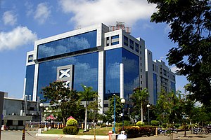
TIDEL Park
Tech Park in Chennai, India
Distance: Approx. 27 meters
Latitude and longitude: 12.9896946,80.2487258
TIDEL Park is an information technology (IT) park situated in the city of Chennai, India. The name TIDEL is a portmanteau of TIDCO and ELCOT. An ISO 9001/14001 company, In 2000, it was one of the largest IT parks in India.
Asian College of Journalism, Chennai
Journalism school in Chennai, Tamil Nadu, India
Distance: Approx. 750 meters
Latitude and longitude: 12.995967,80.246249
The Asian College of Journalism (ACJ) is a journalism school in Chennai, India, which offers postgraduate diploma courses in journalism.
Institute of Mathematical Sciences, Chennai
Research centre located in Chennai, India
Distance: Approx. 537 meters
Latitude and longitude: 12.994219,80.247075
The Institute of Mathematical Sciences (IMSc) (sometimes also referred to as Matscience) is a research centre located in Chennai, India. It is a constituent institute of the Homi Bhabha National Institute. IMSc is a national institute for fundamental research in frontier disciplines of the mathematical and physical sciences: theoretical computer science, mathematics, theoretical physics, and computational biology.

Indira Nagar, Chennai
Neighbourhood in Chennai District, Tamil Nadu, India
Distance: Approx. 624 meters
Latitude and longitude: 12.995107,80.24959
Indira Nagar (Tamil: இந்திரா நகர்) is a neighbourhood in Chennai, India. The region was developed by the Tamil Nadu Housing Board (TNHB) in the late 1970s and early 1980s. It contains residential plots, apartments, commercial complexes, large arterial roads, school zones, bus terminals, and slums.
CEWiT (India)
Distance: Approx. 693 meters
Latitude and longitude: 12.99091,80.24225
Centre of Excellence in Wireless Technology (CEWiT) is a nonprofit research society of IIT Madras set up to research potential innovations in wireless technology. The organization is set up with support from Ministry of Communication and IT and the Indian telecom industry.

International Tech Park, Chennai
Technology park in south India
Distance: Approx. 510 meters
Latitude and longitude: 12.985688,80.246061
The International Tech Park Chennai, Taramani or ITPC (as it is popularly known) is an hi-tech park in Taramani, Chennai. Located in Chennai's IT Corridor, it spans 15 acres, offering approximately 2 million sq ft of office space. Over 40 IT/ITES companies are operating out of the park.
MGR Film City
Distance: Approx. 492 meters
Latitude and longitude: 12.9924786,80.2450586
The MGR Film City is an integrated film studio complex in Taramani, Chennai. It was established in 1994 mainly to attract filmmakers and tourists and originally named after former chief minister of Tamil Nadu MG Ramachandran JJ Film City by the AIADMK government. When DMK returned to power in 1996 it was renamed MGR Film City after the popular actor and late Chief Minister M. G. Ramachandran.

Ramanujan IT City
Information Technology Park in Chennai, India
Distance: Approx. 218 meters
Latitude and longitude: 12.99083333,80.24694444
Ramanujan IT City is an information technology (IT) special economic zone (SEZ) situated in Chennai, India. Named after the Indian Mathematician Srinivasa Ramanujan, it is a joint venture of Tata Realty and Infrastructure Limited (TRIL), Indian Hotels Company Limited (IHCL) and Tamil Nadu Industrial Development Corporation (TIDCO). Situated next to the Tidel Park, it is being developed in a land measuring 25 acres with two zones with a total built-up area of 5.7 million sq ft.

World Bank office, Chennai
Extension of the World Bank headquartered in Washington, DC.
Distance: Approx. 756 meters
Latitude and longitude: 12.98388889,80.24472222
The World Bank Chennai is the extension of the World Bank headquartered in Washington, DC. The World Bank Chennai office offers corporate financial, accounting, administrative and IT services for the bank's offices in around 150 countries. The Chennai office handles several value-added operations of the bank that were earlier handled only in its Washington, D.C., office.

National Institute of Technical Teachers' Training and Research, Chennai
Institute in India
Distance: Approx. 292 meters
Latitude and longitude: 12.9873,80.2498
National Institute of Technical Teachers' Training and Research, Chennai (NITTTR) is a deemed to be university under distinct category under the Ministry of Education (or MoE), Government of India. NITTTR Chennai is located in Tharamani in Chennai.
Weather in this IP's area
haze
32 Celsius
39 Celsius
31 Celsius
32 Celsius
1005 hPa
72 %
1005 hPa
1004 hPa
5000 meters
3.6 m/s
270 degree
75 %
05:58:13
18:15:28
