Country:
Region:
City:
Latitude and Longitude:
Time Zone:
Postal Code:
IP information under different IP Channel
ip-api
Country
Region
City
ASN
Time Zone
ISP
Blacklist
Proxy
Latitude
Longitude
Postal
Route
Luminati
Country
Region
ji
City
surabaya
ASN
Time Zone
Asia/Jakarta
ISP
PT Media Sarana Data
Latitude
Longitude
Postal
IPinfo
Country
Region
City
ASN
Time Zone
ISP
Blacklist
Proxy
Latitude
Longitude
Postal
Route
db-ip
Country
Region
City
ASN
Time Zone
ISP
Blacklist
Proxy
Latitude
Longitude
Postal
Route
ipdata
Country
Region
City
ASN
Time Zone
ISP
Blacklist
Proxy
Latitude
Longitude
Postal
Route
Popular places and events near this IP address

2002 Bali bombings
Terrorist attacks in Indonesia
Distance: Approx. 1167 meters
Latitude and longitude: -8.71722222,115.17416667
The 2002 Bali bombings were a series of terrorist attacks that occurred on 12 October 2002, in the tourist district of Kuta on the Indonesian island of Bali. The attacks killed 202 people (including 88 Australians, 38 Indonesians, 23 Britons, and people of more than 20 other nationalities) and a further 209 people were injured. General Da'i Bachtiar, the Indonesian National Police at the time, said that the bombings was the "worst act of terror in Indonesia's history".

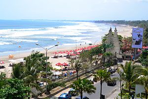
Kuta, Bali
Place in Bali, Indonesia
Distance: Approx. 1113 meters
Latitude and longitude: -8.73333333,115.16666667
Kuta is a tourist area, administratively an urban village (kelurahan), and the capital of Kuta District, Badung Regency, southern Bali, Indonesia. Kuta is a part of the Denpasar metropolitan area, 12 km (7.5 mi) south of downtown Denpasar. Originally known as a fishing village, it was one of the first towns on Bali to see substantial tourism, and as a beach resort remains one of Indonesia's major tourist destinations.

Jimbaran
Place in Bali, Indonesia
Distance: Approx. 4652 meters
Latitude and longitude: -8.76944444,115.17388889
Jimbaran is an Indonesian fishing village and tourist resort in southern Bali, administered under South Kuta District of Badung Regency. Located south of Ngurah Rai International Airport at the "neck" of the Bukit Peninsula, the village is renowned as a culinary destination, with stalls selling seafood saturating the area. Diners select the live seafood that they wish to eat, and it is immediately prepared, generally grilled over a fire of coconut husks rather than charcoal.

Legian
Suburban and beach area on Bali, Indonesia
Distance: Approx. 3213 meters
Latitude and longitude: -8.70055556,115.165
Legian is a suburban and beach area on the west coast of Bali in Indonesia, just north of Kuta and south of Seminyak, the area between Jl. Melasti and Jl. Dhyana Pura.
Ujung
Place in Bali, Indonesia
Distance: Approx. 3011 meters
Latitude and longitude: -8.71666667,115.2
Ujung is a village in Bali in the Lesser Sunda Islands of Indonesia. It is located 1.8 miles (2.9 km) outside Kuta on the south coast of the island . Nearby towns and villages include Tuban (1.5 nm), Pesanggaran (1.1 nm), Serangan (1.6 nm), Jimbaran (2.5 nm) and Benoa (2.1 nm).
Pesanggaran
Place in Bali, Indonesia
Distance: Approx. 3011 meters
Latitude and longitude: -8.71666667,115.2
Pesanggaran is a village in Bali in the Lesser Sunda Islands of Indonesia. It is located 3 miles (4.8 km) outside Kuta on the south coast of the island. Nearby towns and villages include Denpasar (4.0 nm), Pabeansanur (2.8 nm), Sanur (2.8 nm), Serangan (1.1 nm) and Ujung (1.1 nm).
Tuban, Kuta
Distance: Approx. 1699 meters
Latitude and longitude: -8.74277778,115.17722222
Tuban, Kuta is a village in Badung Regency, Bali, Indonesia. It is served by Ngurah Rai International Airport, with Kelan bordering south. Kelan is a part of Tuban subdistricts, Kuta District, Badung, Bali.

Lion Air Flight 904
2013 aircraft crash in Bali, Indonesia
Distance: Approx. 4405 meters
Latitude and longitude: -8.74916667,115.14138889
Lion Air Flight 904 was a scheduled domestic passenger flight from Husein Sastranegara International Airport in Bandung to Ngurah Rai International Airport in Bali, Indonesia. On April 13, 2013, the Boeing 737-800 operating the flight crashed into water short of the runway while on final approach to land. All 101 passengers and 7 crew on board survived the accident.

Bali Mandara Toll Road
Toll Road in Bali, Indonesia
Distance: Approx. 4965 meters
Latitude and longitude: -8.766487,115.197233
Bali Mandara Toll Road or Nusa Dua-Ngurah Rai-Benoa Toll Road is a toll road carried by a bridge stretching across the Gulf of Benoa. The 8.3-kilometre (5.2 mi) highway connects the city of Denpasar and South Kuta, Badung Regency, Nusa Dua and Ngurah Rai International Airport. It cost Rp 2.48 Trillion (USD 220 million) to construct and was intended to prevent traffic jams on the Ngurah Rai Bypass Road, previously the only road connecting areas of Bali on opposite sites of the airport.
Tanjung Benoa
Distance: Approx. 5957 meters
Latitude and longitude: -8.7583,115.2194
Tanjung Benoa is a peninsula that is a subdistrict (kelurahan) of Kuta South District of Badung Regency on Bali. It is famous for its beaches. Tanjung Benoa is also a location of various water sports like banana boat, scuba diving, parasailing, rolling donuts, seawalker, flying fish, snorkeling.

Ngurah Rai International Airport
Airport in Denpasar, Bali, Indonesia
Distance: Approx. 2415 meters
Latitude and longitude: -8.74805556,115.1675
I Gusti Ngurah Rai International Airport (IATA: DPS, ICAO: WADD), also known as Denpasar International Airport, is the main international airport of Bali, Indonesia. Located 13 kilometres (8.1 mi) from Downtown Denpasar, it serves the Denpasar metropolitan area and the whole island of Bali. Ngurah Rai is the second busiest airport in Indonesia after Soekarno-Hatta.
Bali International Convention Center
Distance: Approx. 1930 meters
Latitude and longitude: -8.71033333,115.17513889
Bali International Convention Center or BICC is a convention center located in Nusa Dua, Badung Regency, Bali, Indonesia. Since its inauguration, many important national and international conference, exhibition, fair, indoor sports and musical concerts were held at BICC including the 2007 United Nations Climate Change Conference, Miss World 2013, 2021 BWF World Tour Finals, and the 2022 G20 summit.
Weather in this IP's area
moderate rain
29 Celsius
36 Celsius
29 Celsius
29 Celsius
1011 hPa
84 %
1011 hPa
1010 hPa
10000 meters
1.03 m/s
130 degree
40 %
05:49:39
18:16:02

