119.160.169.197 - IP Lookup: Free IP Address Lookup, Postal Code Lookup, IP Location Lookup, IP ASN, Public IP
Country:
 Brunei
Region:
City:
Location:
Time Zone:
Postal Code:
ISP:
ASN:
language:
User-Agent:
Proxy IP:
Blacklist:
IP information under different IP Channel
ip-api
Country
Region
City
ASN
Time Zone
ISP
Blacklist
Proxy
Latitude
Longitude
Postal
Route
db-ip
Country
Region
City
ASN
Time Zone
ISP
Blacklist
Proxy
Latitude
Longitude
Postal
Route
IPinfo
Country
Region
City
ASN
Time Zone
ISP
Blacklist
Proxy
Latitude
Longitude
Postal
Route
IP2Location
119.160.169.197Country
bnRegion
tutong
City
tutong
Time Zone
Asia/Brunei
ISP
Language
User-Agent
Latitude
Longitude
Postal
ipdata
Country
Region
City
ASN
Time Zone
ISP
Blacklist
Proxy
Latitude
Longitude
Postal
Route
Popular places and events near this IP address

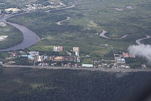
Tutong (town)
Municipality in Brunei
Distance: Approx. 1259 meters
Latitude and longitude: 4.80666667,114.65916667
Tutong Town (Malay: Pekan Tutong; Jawi: توتوڠ) or simply known as Tutong (tu-tong), is a municipality town in Mukim Pekan Tutong, Tutong District, Brunei. It is located about 40 kilometres (25 mi) from the country's capital Bandar Seri Begawan. It is the administrative centre of Tutong District.

Mukim Pekan Tutong
Mukim in Brunei
Distance: Approx. 0 meters
Latitude and longitude: 4.8,114.65
Mukim Pekan Tutong is a mukim in Tutong District, Brunei. The population was 9,883 in 2021. It encompasses Pekan Tutong, the district's sole town and administrative centre.

Seri Kenangan Beach
Beach in Tutong, Brunei
Distance: Approx. 1624 meters
Latitude and longitude: 4.807056,114.6371862
Seri Kenangan Beach (Malay: Pantai Seri Kenangan) is a recreational beach and spit located in Mukim Pekan Tutong, Tutong District. It lies approximately 2 kilometres (1.2 mi) west of Tutong town and is characterised by its unique position on a strip of land bordered by the Tutong River at the rear and the South China Sea at the front. The beach also sits in nearby villages such as Sengkarai, Penabai, and Kuala Tutong.

Sufri Bolkiah Secondary School
Public school in Tutong District, Brunei
Distance: Approx. 2060 meters
Latitude and longitude: 4.81252778,114.66366667
Sufri Bolkiah Secondary School (Malay: Sekolah Menengah Sufri Bolkiah; SMSB ) is a government secondary school for girls located in Bukit Bendera, Tutong, approximately three miles from Tutong town, Brunei. The school was originally established in 1969 on a 20 acres (8.1 ha) site and officially opened on 28 April 1971 under the name Tutong English School.

Tutong–Telisai Highway
Highway in Brunei
Distance: Approx. 1133 meters
Latitude and longitude: 4.7911778,114.6449143
Tutong–Telisai Highway (Malay: Lebuhraya Tutong–Telisai) is a major highway in Tutong District, Brunei.

Hassanal Bolkiah Mosque
Mosque in Tutong, Brunei
Distance: Approx. 1523 meters
Latitude and longitude: 4.80644444,114.66211111
Hassanal Bolkiah Mosque, Pekan Tutong (Malay: Masjid Hassanal Bolkiah, Pekan Tutong) or unofficially Hassanal Bolkiah Mosque, is a mosque located about 1 kilometre (0.62 mi) from Tutong, the town of Tutong District in Brunei. The mosque was opened in 1966; and it could hold up to 1,000 worshipers and has amenities like a library, a multipurpose hall, and a chamber for burial preparations.

Bukit Bendera, Brunei
Village in Tutong, Brunei
Distance: Approx. 1883 meters
Latitude and longitude: 4.813176,114.660645
Bukit Bendera is a populated area in Tutong, the town of Tutong District, Brunei. It is officially a village-level subdivision under the mukim or subdistrict of Pekan Tutong, as well as a designated postcode area with the postcode TA1341. The Tutong Municipal Department spans an area of about 0.024 square kilometres (0.0093 sq mi), encompassing parts of Petani and Bukit Bendera.

Petani
Village in Tutong District, Brunei
Distance: Approx. 785 meters
Latitude and longitude: 4.8032108,114.6562972
Kampong Petani (Malay: Kampung Petani), also simply known as Petani, is a populated area located in Tutong, the main town of Tutong District, Brunei. It is officially recognised as a village-level subdivision under the mukim (subdistrict) of Pekan Tutong, and it also serves as a designated postcode area with the postcode TA1741. Additionally, parts of the Petani area fall under the spatial jurisdiction of the Tutong municipality.

Kampong Sengkarai
Village in Brunei
Distance: Approx. 689 meters
Latitude and longitude: 4.8049,114.6462
Kampong Sengkarai (Malay: Kampung Sengkarai) is a village located in the Tutong District of Brunei, within the mukim of Pekan Tutong. With a postcode of TA2341, the village is situated approximately 2 kilometres (1.2 mi) from the town of Tutong. As of 2021, the population of the village was 1,694, comprising Tutong, Brunei Malay, and other ethnic groups.

Kampong Panchor Dulit
Village in Tutong District, Brunei
Distance: Approx. 1842 meters
Latitude and longitude: 4.805,114.66583333
Kampong Panchor Dulit (Malay: Kampung Panchor Dulit) is a village located in the Tutong District of Brunei, within the mukim of Pekan Tutong. The village's postcode is TA1941. The name Panchor is shared by several villages in Brunei, including Kampong Panchor Murai in the Brunei–Muara District, as well as Kampong Panchor Dulit and Kampong Panchor Papan in the Tutong District.
Kampong Serambangun
Village in Tutong, Brunei
Distance: Approx. 1556 meters
Latitude and longitude: 4.7860369,114.650557
Kampong Serambangun (Malay for Serambangun Village) is a village in Tutong District, Brunei, within the mukim of Pekan Tutong. The postcode for Kampong Serambangun is TA2541.

Istana Pantai
Palace in Brunei
Distance: Approx. 1499 meters
Latitude and longitude: 4.8072519,114.6386104
The Istana Pantai (English: Beach Palace) is one of the temporary official residence of the then Sultan of Brunei, Omar Ali Saifuddien III. The palace is located at Jalan Kuala Tutong, Tutong District, Brunei. Moreover, the building has become a tourist attraction and historical site in the present day.
Weather in this IP's area
overcast clouds
30 Celsius
34 Celsius
30 Celsius
30 Celsius
1010 hPa
69 %
1010 hPa
1008 hPa
10000 meters
4.16 m/s
6.46 m/s
221 degree
100 %