118.179.157.90 - IP Lookup: Free IP Address Lookup, Postal Code Lookup, IP Location Lookup, IP ASN, Public IP
Country:
Region:
City:
Location:
Time Zone:
Postal Code:
IP information under different IP Channel
ip-api
Country
Region
City
ASN
Time Zone
ISP
Blacklist
Proxy
Latitude
Longitude
Postal
Route
Luminati
Country
Region
c
City
dhaka
ASN
Time Zone
Asia/Dhaka
ISP
AmberIT Limited
Latitude
Longitude
Postal
IPinfo
Country
Region
City
ASN
Time Zone
ISP
Blacklist
Proxy
Latitude
Longitude
Postal
Route
IP2Location
118.179.157.90Country
Region
chattogram
City
teknaf
Time Zone
Asia/Dhaka
ISP
Language
User-Agent
Latitude
Longitude
Postal
db-ip
Country
Region
City
ASN
Time Zone
ISP
Blacklist
Proxy
Latitude
Longitude
Postal
Route
ipdata
Country
Region
City
ASN
Time Zone
ISP
Blacklist
Proxy
Latitude
Longitude
Postal
Route
Popular places and events near this IP address
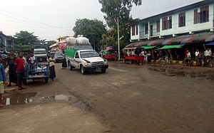
Teknaf
Distance: Approx. 1000 meters
Latitude and longitude: 20.86805556,92.29833333
Teknaf (Bengali: টেকনাফ) is a municipality of Teknaf Upazila of Cox's Bazar District in south-eastern Bangladesh. It forms the southernmost point in mainland Bangladesh (St. Martin's Island is the southernmost point).
Teknaf Upazila
Upazila in Chittagong, Bangladesh
Distance: Approx. 768 meters
Latitude and longitude: 20.86666667,92.3
Teknaf (Bengali: টেকনাফ Ṭeknaf) is an upazila of Cox's Bazar District in the Division of Chittagong, Bangladesh. It forms the southernmost point in mainland Bangladesh (St. Martin's Island is the southernmost point).

Maungdaw
Town in Rakhine State, Myanmar
Distance: Approx. 8125 meters
Latitude and longitude: 20.81666667,92.36666667
Maungdaw (Burmese: မောင်တောမြို့; MLCTS: maung:tau mrui., pronounced [máʊɰ̃dɔ́ mjo̰], Bengali: মংডু, romanized: Moṅḍu) is a town in Rakhine State, in the western part of Myanmar (Burma). It is the administrative seat of Maungdaw Township and Maungdaw District. Bordering Bangladesh, Maungdaw is home to one of 2 official border trade posts with Bangladesh.
Dhumdumia
Village in Chittagong Division, Bangladesh
Distance: Approx. 8950 meters
Latitude and longitude: 20.9322,92.2631
Dhumdumia, also spelled Damdamia, is a village in Cox's Bazar District, Bangladesh. It is part of Teknaf Upazila and is located next to the village of Jadipara.

Naf Tourism Park
Planned economic zone in Chittagong Division, Bangladesh
Distance: Approx. 6485 meters
Latitude and longitude: 20.915,92.279
Naf Tourism Park is a planned economic zone in Jaliardwip island, Cox's Bazar. Bangladesh Economic Zones Authority (BEZA) is developing this as part of its plan to build 100 special economic zones throughout the country. As of 2023, construction work on the project, approved in 2015, has been indefinitely halted due to objections raised by Myanmar regarding the dredging of sand from the nearby Naf River.

Cox's Bazar-4
Constituency of Bangladesh's Jatiya Sangsad
Distance: Approx. 1039 meters
Latitude and longitude: 20.87,92.3
Cox's Bazar-4 is a constituency represented in the Jatiya Sangsad (National Parliament) of Bangladesh. Since 6 August 2024 the constituency is Vacant.

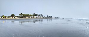
Teknaf Beach
Part of Cox's Bazar Beach
Distance: Approx. 3955 meters
Latitude and longitude: 20.846196,92.271963
Teknaf Beach (Bengali: টেকনাফ সৈকত) is a part of Cox's Bazar Beach, located at Teknaf Upazila of Cox's bazar district. Teknaf beach is surrounded by the Teknaf peninsula mangrove area. This beach is divided into sections; Shamlapur Beach (Baharchara Beach), Shilakhali Beach, Hajampara Beach, and Shapuree Island Beach.

Jaliardwip
Island in Bangladesh
Distance: Approx. 6518 meters
Latitude and longitude: 20.9155,92.2794
Jaliardwip (Bengali: জালিয়ার দ্বীপ) is an island in Teknaf upazila, Chittagong division in south-eastern Bangladesh covering an area of 271.93 acres (1.1 km2). It is an island on the Naf River which demarcates the border between Bangladesh and Myanmar. 21.12 acres of land on the island belongs to the Forest Department.
Sabrang Tourism Park
Special economic zone in Chittagong division, Bangladesh
Distance: Approx. 5952 meters
Latitude and longitude: 20.8102,92.2934
Sabrang Tourism Park is a tourism special economic zone located in Cox's Bazar district of Chittagong division, Bangladesh. It is being developed by Bangladesh Economic Zones Authority (BEZA) on a land of 940 acres (3.8 km2) in Sabrang union of Teknaf upazila. Situated approximately 96 kilometers away from Cox's Bazar Airport and accessible via the Cox's Bazar-Teknaf Marine Drive road, the park is planned to include special facilities for transportation to St.
Weather in this IP's area
clear sky
27 Celsius
27 Celsius
27 Celsius
27 Celsius
1018 hPa
37 %
1018 hPa
1018 hPa
10000 meters
1.14 m/s
2.34 m/s
11 degree
2 %
