118.179.149.232 - IP Lookup: Free IP Address Lookup, Postal Code Lookup, IP Location Lookup, IP ASN, Public IP
Country:
Region:
City:
Location:
Time Zone:
Postal Code:
IP information under different IP Channel
ip-api
Country
Region
City
ASN
Time Zone
ISP
Blacklist
Proxy
Latitude
Longitude
Postal
Route
Luminati
Country
Region
c
City
dhaka
ASN
Time Zone
Asia/Dhaka
ISP
AmberIT Limited
Latitude
Longitude
Postal
IPinfo
Country
Region
City
ASN
Time Zone
ISP
Blacklist
Proxy
Latitude
Longitude
Postal
Route
IP2Location
118.179.149.232Country
Region
chattogram
City
comilla
Time Zone
Asia/Dhaka
ISP
Language
User-Agent
Latitude
Longitude
Postal
db-ip
Country
Region
City
ASN
Time Zone
ISP
Blacklist
Proxy
Latitude
Longitude
Postal
Route
ipdata
Country
Region
City
ASN
Time Zone
ISP
Blacklist
Proxy
Latitude
Longitude
Postal
Route
Popular places and events near this IP address
Cumilla Medical College
Medical college in Bangladesh
Distance: Approx. 779 meters
Latitude and longitude: 23.4511,91.2022
Cumilla Medical College (Bengali: কুমিল্লা মেডিকেল কলেজ) is a Bangladesh Government Medical College and Hospital conducting MBBS and postgraduate courses in 6 disciplines under University of Chittagong(CU) and Chittagong Medical University(CMU).

Comilla Adarsha Sadar Upazila
Upazila in Chittagong, Bangladesh
Distance: Approx. 2367 meters
Latitude and longitude: 23.46666667,91.18333333
Comilla Adarsha Sadar is an upazila of Comilla District in the Division of Chittagong, Bangladesh.

Comilla
City in eastern Bangladesh
Distance: Approx. 978 meters
Latitude and longitude: 23.45,91.2
Comilla (Bengali: কুমিল্লা), officially spelled Cumilla, is a metropolis on the banks of the Gomti River in eastern Bangladesh. Comilla was one of the cities of ancient Bengal. It was once the capital of Tripura kingdom.
Comilla Victoria Government College
College in Bangladesh
Distance: Approx. 2268 meters
Latitude and longitude: 23.4598,91.1823
Comilla Victoria Government College (Bengali: কুমিল্লা ভিক্টোরিয়া সরকারি কলেজ, romanized: Cumilla Victoria Shorkari College), mostly known as Comilla Victoria College, is a government college in Comilla, Bangladesh. It is one of the oldest and most renowned colleges in Comilla as well as in the Chittagong division. The degree and honours branch of the college is located in Dharmapur area of Cumilla district.

Comilla Jagannath Temple
Hindu temple in Bangladesh
Distance: Approx. 836 meters
Latitude and longitude: 23.4623,91.21095
Comilla Jagannath Temple, also known as Sateroratna Mandir or seventeen-jewel temple, is located in Comilla, Bangladesh. It is one of the tallest temples in the country built in 1761 A.D. It is dedicated to the Hindu God Jagannath.

Meghna Division
Proposed division in Bangladesh
Distance: Approx. 978 meters
Latitude and longitude: 23.45,91.2
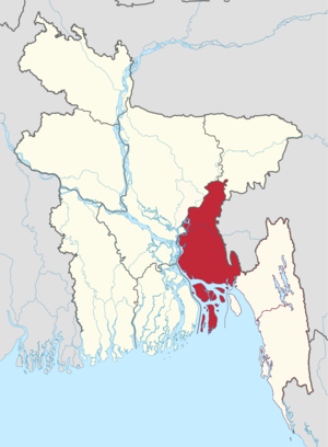
Meghna Division (Bengali: মেঘনা বিভাগ; in reference to the Meghna River), also known as Comilla Division (Bengali: কুমিল্লা বিভাগ), is a proposed administrative division within Bangladesh for the north-western parts of the existing Chittagong Division, comprising Brahmanbaria, Comilla, Chandpur, Noakhali, Feni, and Laxmipur Districts of Chittagong Division. The headquarter of the division would be in Comilla. It covers the south-easternmost areas of the country, with a total area of 12,848.53 km2 (4,960.85 sq mi) and a population at the 2011 census of 16,708,000.
Bakhrabad Gas Adarsha Bidhalaya
School in Comilla, Bangladesh
Distance: Approx. 961 meters
Latitude and longitude: 23.4513,91.2106
Bakhrabad Gas Adarsha Bidhalaya (Bengali: বাখরাবাদ গ্যাস আদর্শ বিদ্যালয়) is a Bangladeshi high school in Comilla about a half kilometre north from Comilla Medical College..
Mainamoti Medical College
Distance: Approx. 279 meters
Latitude and longitude: 23.4556,91.2057
Mainamoti Medical College is a private medical college in Baropara, Comilla, Bangladesh. It is under the Chittagong Medical University.It is one of the largest and renowned private medical colleges in Cumilla.

Kandirpar
Distance: Approx. 2352 meters
Latitude and longitude: 23.4608,91.1816
Kandirpar is situated on Comilla, Bangladesh. It is considered the heart of the Cumilla district.

Comilla Government Women's College
Bangladeshi College
Distance: Approx. 2182 meters
Latitude and longitude: 23.4563,91.1831
Comilla Government Women's College (Bengali: কুমিল্লা সরকারি মহিলা কলেজ, romanized: Cumilla Shorkari Mahila College), is a public college in Comilla, Bangladesh established in 1960. The college is located in Comilla including its Intermediate, Honors and Masters section.

Matri Bhandar
Sweet shop in Bangladesh
Distance: Approx. 2238 meters
Latitude and longitude: 23.4619157,91.182947
Matri Bhandar (Bengali: মাতৃ ভাণ্ডার) is a Bangladeshi traditional confectionery store well known for Rasmalai. The taste of Rasmalai of Matri Bhandar has been appreciated in various national and international important places and events. Rasmalai of Matribhandar is on the list of favorite food of various famous and important personalities.

Tipperah Palace
Historical palace in Comilla, Bangladesh
Distance: Approx. 1642 meters
Latitude and longitude: 23.456092,91.188428
The Tipperah Palace (Bengali: ত্রিপুরা রাজবাড়ি), also known as Comilla Rajbari (Bengali: কুমিল্লা রাজবাড়ি), is the former residential palace of Manikya dynasty, rulers of the princely state of Tripura, built by Nabadwipchandra Dev Burman in the 19th century. It housed the military warehouse, government offices and poultry farm under the Department of Livestock Services from 1947 to 2010s. At present, it is under the process of conversion to a museum, which is located in Comilla District, Bangladesh.
Weather in this IP's area
clear sky
21 Celsius
20 Celsius
21 Celsius
21 Celsius
1020 hPa
47 %
1020 hPa
1018 hPa
10000 meters
2.47 m/s
3.16 m/s
339 degree