Country:
 New Zealand
Region:
City:
Latitude and Longitude:
Time Zone:
Postal Code:
IP information under different IP Channel
ip-api
Country
Region
City
ASN
Time Zone
ISP
Blacklist
Proxy
Latitude
Longitude
Postal
Route
IPinfo
Country
Region
City
ASN
Time Zone
ISP
Blacklist
Proxy
Latitude
Longitude
Postal
Route
MaxMind
Country
Region
City
ASN
Time Zone
ISP
Blacklist
Proxy
Latitude
Longitude
Postal
Route
Luminati
Country
NZASN
Time Zone
Pacific/Auckland
ISP
Two Degrees Networks Limited
Latitude
Longitude
Postal
db-ip
Country
Region
City
ASN
Time Zone
ISP
Blacklist
Proxy
Latitude
Longitude
Postal
Route
ipdata
Country
Region
City
ASN
Time Zone
ISP
Blacklist
Proxy
Latitude
Longitude
Postal
Route
Popular places and events near this IP address
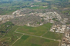
Hornby, New Zealand
Suburb of Christchurch, New Zealand
Distance: Approx. 1345 meters
Latitude and longitude: -43.55,172.53333333
Hornby is a major residential and retail suburb at the western edge of Christchurch, New Zealand. The suburb is directly connected to other parts of Christchurch and the South Island by a number of main arterial routes, including State Highway 1 and the Christchurch Southern Motorway.
Wigram
Suburb of Christchurch, New Zealand
Distance: Approx. 771 meters
Latitude and longitude: -43.5533,172.5584
Wigram is a suburb in the southwest of Christchurch, New Zealand. The suburb lies close to the industrial estates of Sockburn and the satellite retail and residential zone of Hornby, and has undergone significant growth in recent years due to housing developments. It is seven kilometres to the west of the city centre.

Air Force Museum of New Zealand
Military and Aviation Museum in Christchurch, New Zealand
Distance: Approx. 422 meters
Latitude and longitude: -43.5466,172.5477
The Air Force Museum of New Zealand, formerly called The Royal New Zealand Air Force Museum, is located at Wigram, the RNZAF's first operational base, in Christchurch, in the South Island of New Zealand. It opened on 1 April 1987 as part of the celebrations for the RNZAF's 50th anniversary, and is primarily a museum of the Royal New Zealand Air Force, its predecessor, the New Zealand Permanent Air Force and New Zealand squadrons of the Royal Air Force. The Air Force Museum of New Zealand's mission is to preserve and present the history of New Zealand military aviation for commemoration, learning, inspiration and enjoyment.
Wigram Aerodrome
Closed Airport in Christchurch, NZ
Distance: Approx. 256 meters
Latitude and longitude: -43.55111111,172.55277778
Wigram Aerodrome (ICAO: NZWG) is located in the Christchurch suburb of Sockburn, later to be split-suburb of Wigram and now split again as Wigram Skies. It was gifted by Sir Henry Wigram for the Canterbury (NZ) Aviation Company on 20 September 1916 and originally named Sockburn Airport. In 1923 that was then gifted to the Crown as a Royal New Zealand Air Force base.
Riccarton High School
School
Distance: Approx. 1950 meters
Latitude and longitude: -43.53611111,172.56472222
Riccarton High School (Māori: Te Kura Tuarua o Pūtaringamotu) is a state co-educational secondary school located in Upper Riccarton, a suburb of Christchurch, New Zealand. With a roll of 1,026 students, it is one of the five largest secondary schools in Christchurch.
St Thomas of Canterbury College
School
Distance: Approx. 1816 meters
Latitude and longitude: -43.5344,172.5566
St Thomas of Canterbury College is a college for year 7 to 13 boys and offers a Catholic education to its students. It is located in Christchurch, New Zealand. The college is integrated into the state education system under an integration agreement which was first entered into by the Christian Brothers (as the proprietors of the college) and the Government of New Zealand on 11 November 1981 under Section 7 of the Private Schools Conditional Integration Act 1975.

Wigram Airfield Circuit
Temporary motor racing circuit
Distance: Approx. 205 meters
Latitude and longitude: -43.55138889,172.55166667
Wigram Airfield Circuit was a temporary motor racing circuit at Wigram Aerodrome, Christchurch, New Zealand. The airfield is a former base of the Royal New Zealand Air Force. It is named after Sir Henry Wigram.
Marylands School
Residential school in Christchurch, New Zealand
Distance: Approx. 2010 meters
Latitude and longitude: -43.56170278,172.56898056
Marylands School was a residential school for children with learning difficulties in Christchurch, New Zealand. It was opened in 1955 and run by the Roman Catholic order Brothers Hospitallers of St. John of God.

Aidanfield
Suburb of Christchurch, New Zealand
Distance: Approx. 2267 meters
Latitude and longitude: -43.565,172.569
Aidanfield is a suburb in the south-west of Christchurch, New Zealand, about 8 kilometres (5.0 mi) from the city centre. The land, which had been owned by the Good Shepherd Sisters since 1886, now incorporates the Mount Magdala Institute and the St John of God Chapel, which has a Category I heritage listing by the New Zealand Historic Places Trust (now Heritage New Zealand). The first residents moved into the suburb in 2002.
Hornby Clocktower
Building in Hornby, New Zealand
Distance: Approx. 1942 meters
Latitude and longitude: -43.54346,172.52769
The Hornby Clocktower (also known as the Hornby Clock Tower or simply as the clock tower to local residents) was an iconic Christchurch building, situated in the suburb of Hornby on New Zealand State Highway 1. It marked the southern entrance to Christchurch for over 50 years. The building was one of the tallest non-industrial structures in Hornby, a primarily low-rise area of Christchurch.

Sockburn, New Zealand
Suburb of Christchurch, New Zealand
Distance: Approx. 1670 meters
Latitude and longitude: -43.535,172.55
Sockburn is an industrial suburb of Christchurch, New Zealand, located between Hornby and Riccarton, some 7 kilometres (4.3 mi) west of the Christchurch city centre. The suburb is roughly bounded by the triangle formed by State Highway 1 in the west, Main South Road (SH73a) in the south and SH73 in the north. The suburb of Wigram, containing the city's former RNZAF base (now an aviation museum), is located nearby.
Ngā Puna Wai Sports Hub
Sports complex in Christchurch, New Zealand
Distance: Approx. 2242 meters
Latitude and longitude: -43.558,172.5755
Ngā Puna Wai Sports Hub is a multi-sports complex located in the suburb of Aidanfield in the city of Christchurch, in New Zealand's South Island. The complex contains international standard sports facilities and was developed using a partnership between Christchurch City Council and regional sports organisations. Ngā Puna Wai Sports Hub was officially opened on 8 March 2019.
Weather in this IP's area
light rain
4 Celsius
-2 Celsius
2 Celsius
4 Celsius
996 hPa
89 %
996 hPa
993 hPa
10000 meters
8.49 m/s
28.61 m/s
201 degree
75 %
06:28:32
18:20:24