Country:
Region:
City:
Latitude and Longitude:
Time Zone:
Postal Code:
IP information under different IP Channel
ip-api
Country
Region
City
ASN
Time Zone
ISP
Blacklist
Proxy
Latitude
Longitude
Postal
Route
IPinfo
Country
Region
City
ASN
Time Zone
ISP
Blacklist
Proxy
Latitude
Longitude
Postal
Route
MaxMind
Country
Region
City
ASN
Time Zone
ISP
Blacklist
Proxy
Latitude
Longitude
Postal
Route
Luminati
Country
ASN
Time Zone
Pacific/Auckland
ISP
Two Degrees Networks Limited
Latitude
Longitude
Postal
db-ip
Country
Region
City
ASN
Time Zone
ISP
Blacklist
Proxy
Latitude
Longitude
Postal
Route
ipdata
Country
Region
City
ASN
Time Zone
ISP
Blacklist
Proxy
Latitude
Longitude
Postal
Route
Popular places and events near this IP address
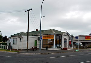
Seddon, New Zealand
Town in Marlborough, New Zealand
Distance: Approx. 862 meters
Latitude and longitude: -41.67,174.07361111
Seddon is a small town in Marlborough, New Zealand. It is located 25 kilometres (16 mi) south of Blenheim, close to the mouths of the Awatere and Blind Rivers and the Lake Grassmere salt works. Salt and lime are major local industries, and the Awatere Valley is an important part of the Marlborough wine region.

Awatere River
River in Marlborough, New Zealand
Distance: Approx. 9568 meters
Latitude and longitude: -41.608,174.167
The Awatere River is a large river flowing through Marlborough, New Zealand. Flowing along the trace of the active Awatere Fault, it runs northeast through a straight valley to the west of the Inland Kaikōura mountains. This valley is parallel with that of the Waiau Toa / Clarence River, 20 kilometres (12 mi) to the south.
Blind (Otūwhero) River
River in New Zealand
Distance: Approx. 6097 meters
Latitude and longitude: -41.65888889,174.15555556
The Blind (Otūwhero) River is a small river in the Marlborough district of New Zealand. It flows into Clifford Bay 4 kilometres (2.5 mi) north of Lake Grassmere. A small settlement named Blind River is located on its south bank.
2013 Lake Grassmere earthquake
Severe earthquake in New Zealand
Distance: Approx. 8982 meters
Latitude and longitude: -41.73,174.15
The 2013 Lake Grassmere earthquake was a magnitude 6.6 earthquake that occurred at 2:31:05 pm (NZST) on Friday 16 August 2013. The epicentre was located about 10 km south-east of Seddon, under Lake Grassmere, with a focal depth of 8 km. The earthquake caused significant land damage in the local area, with landslips blocking roads, including the main highway between Blenheim and Christchurch.
Weather in this IP's area
light rain
5 Celsius
0 Celsius
5 Celsius
5 Celsius
992 hPa
89 %
992 hPa
981 hPa
10000 meters
6.9 m/s
10.62 m/s
183 degree
90 %
06:22:00
18:14:40
