Country:
 New Zealand
Region:
City:
Latitude and Longitude:
Time Zone:
Postal Code:
IP information under different IP Channel
ip-api
Country
Region
City
ASN
Time Zone
ISP
Blacklist
Proxy
Latitude
Longitude
Postal
Route
IPinfo
Country
Region
City
ASN
Time Zone
ISP
Blacklist
Proxy
Latitude
Longitude
Postal
Route
MaxMind
Country
Region
City
ASN
Time Zone
ISP
Blacklist
Proxy
Latitude
Longitude
Postal
Route
Luminati
Country
NZRegion
auk
City
auckland
ASN
Time Zone
Pacific/Auckland
ISP
Two Degrees Networks Limited
Latitude
Longitude
Postal
db-ip
Country
Region
City
ASN
Time Zone
ISP
Blacklist
Proxy
Latitude
Longitude
Postal
Route
ipdata
Country
Region
City
ASN
Time Zone
ISP
Blacklist
Proxy
Latitude
Longitude
Postal
Route
Popular places and events near this IP address
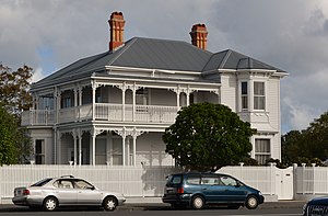
Herne Bay, New Zealand
Suburb in Auckland, New Zealand
Distance: Approx. 984 meters
Latitude and longitude: -36.85,174.73333333
Herne Bay is an affluent suburb of Auckland, New Zealand. It is located on the southwestern shore of the Waitematā Harbour to the west of the Auckland Harbour Bridge. It is known for its extensive harbour views, marine villas and Edwardian age homes.

Ponsonby, New Zealand
Suburb in Auckland, New Zealand
Distance: Approx. 1478 meters
Latitude and longitude: -36.852,174.739
Ponsonby (Māori: Te Rimu Tahi) is an inner-city suburb of Auckland located 2 km west of the Auckland CBD. The suburb is oriented along a ridge running north–south, which is followed by the main street of the suburb, Ponsonby Road. Ponsonby was originally a working class neigbourhood, now it is a predominantly upper-middle class residential suburb, Ponsonby today is also known in Auckland for its dining and shopping establishments. From the Great Depression until the 1980s it contained many rundown buildings, and had a somewhat 'colourful' reputation.

Westmere, New Zealand
Suburb in Auckland, New Zealand
Distance: Approx. 1525 meters
Latitude and longitude: -36.855,174.72
Westmere is a residential suburb of Auckland, in northern New Zealand. The Auckland Council provides local governance. On the southern shore of the Waitematā Harbour, this former peninsula is by road about 6 kilometres (4 mi) west of the city centre.

Watchman Island
Island in New Zealand
Distance: Approx. 954 meters
Latitude and longitude: -36.8349,174.732
Watchman Island (Te Kākāwhakaara in Māori, officially Watchman Island / Te Kākāwhakaara) is a tiny sandstone island in the Waitematā Harbour of Auckland, New Zealand. It lies approximately 600 metres north of the Herne Bay suburb.

Tāmaki Makaurau
Māori electorate in Auckland, New Zealand
Distance: Approx. 1150 meters
Latitude and longitude: -36.8404,174.7399
Tāmaki Makaurau (te reo Māori name for Auckland) is a New Zealand parliamentary Māori electorate returning one Member of Parliament to the New Zealand House of Representatives. It was first formed for the 2002 election. The electorate covers central and southern Auckland, and southern parts of western Auckland.
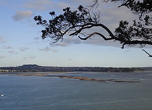
Meola Reef
Lava flow in Auckland, New Zealand
Distance: Approx. 1308 meters
Latitude and longitude: -36.84293,174.712616
Meola Reef, or Te Tokaroa in Māori ('toka'='rock', 'roa'='long'), is a lava flow forming a reef peninsula across part of Auckland's Waitemata Harbour, New Zealand. The reef extends for over 2 kilometres across the harbour, to within 500 metres of Kauri Point on the northern shore.

St Paul's College, Auckland
School
Distance: Approx. 1569 meters
Latitude and longitude: -36.8542,174.7373
St Paul's College is a Catholic secondary school for boys owned by the Marist Brothers and located in the central Auckland suburb of Ponsonby on a spacious 7.3 hectare campus. The Marist Brothers first opened a school on the site (Sacred Heart College) in 1903. St Paul's College (named after the apostle Paul) commenced operations in 1955..

Hawke Scout Hall
Boatshed and Scout hall in Auckland, New Zealand
Distance: Approx. 839 meters
Latitude and longitude: -36.84991667,174.72504167
The Hawke Scout hall is a building located on the edge of Coxs Bay, which is between the suburbs of Herne Bay and Westmere in Auckland, New Zealand. It is primarily used by Sea Scouts.

Coxs Bay
Bay in the Auckland region of New Zealand
Distance: Approx. 839 meters
Latitude and longitude: -36.849917,174.725041
Coxs Bay or Opoututeka is a bay located in the Waitematā Harbour, within the Auckland region of New Zealand. It is situated between the settlements of Westmere to the southwest and Herne Bay to the northeast, with Grey Lynn to the southeast. The bay is protected from the west by Te Tokoroa/Meola Reef, the end of one of the longest lava flows in the Auckland volcanic field.

Gluepot Tavern
Distance: Approx. 1578 meters
Latitude and longitude: -36.847387,174.743963
The Gluepot Tavern was a live music venue in Auckland, New Zealand. It closed in 1994. The building was opened in 1937.

Stebbing Studios
Recording studio in Auckland, New Zealand
Distance: Approx. 1157 meters
Latitude and longitude: -36.84517778,174.739875
Stebbing Studios is a recording studio in Auckland, New Zealand. Artists who have recorded at the studio over the years include Ray Columbus & The Invaders, Split Enz, Gary Havoc & The Hurricanes, Th' Dudes, The Human Instinct, and Waves. The studio was founded by Eldred Stebbing, who also founded pioneer New Zealand music label Zodiac Records.
Auckland regional faults
Known faults close to Auckland, New Zealand
Distance: Approx. 1155 meters
Latitude and longitude: -36.84055556,174.74
The Auckland regional geologic faults have low seismic activity, compared to much of New Zealand, but do result in an earthquake risk to the Auckland metropolitan area, New Zealand's largest city. There is also evidence of past tectonic, volcanic associations in a city located within what is, at best, a very recently dormant Auckland volcanic field. The only definite active fault in the Auckland Region, as defined geopolitically, is the Wairoa North Fault.
Weather in this IP's area
overcast clouds
15 Celsius
15 Celsius
14 Celsius
16 Celsius
1026 hPa
70 %
1026 hPa
1026 hPa
10000 meters
3.6 m/s
50 degree
100 %
06:32:45
19:39:27