117.54.104.135 - IP Lookup: Free IP Address Lookup, Postal Code Lookup, IP Location Lookup, IP ASN, Public IP
Country:
Region:
City:
Location:
Time Zone:
Postal Code:
IP information under different IP Channel
ip-api
Country
Region
City
ASN
Time Zone
ISP
Blacklist
Proxy
Latitude
Longitude
Postal
Route
Luminati
Country
Region
bt
City
southtangerang
ASN
Time Zone
Asia/Jakarta
ISP
INDO Internet, PT
Latitude
Longitude
Postal
IPinfo
Country
Region
City
ASN
Time Zone
ISP
Blacklist
Proxy
Latitude
Longitude
Postal
Route
IP2Location
117.54.104.135Country
Region
jakarta raya
City
jakarta
Time Zone
Asia/Jakarta
ISP
Language
User-Agent
Latitude
Longitude
Postal
db-ip
Country
Region
City
ASN
Time Zone
ISP
Blacklist
Proxy
Latitude
Longitude
Postal
Route
ipdata
Country
Region
City
ASN
Time Zone
ISP
Blacklist
Proxy
Latitude
Longitude
Postal
Route
Popular places and events near this IP address
International Design School
Higher education institution based in Jakarta, Indonesia
Distance: Approx. 1319 meters
Latitude and longitude: -6.213898,106.834788
IDS | BTEC is a higher education institution based in Jakarta, Indonesia, with its campus at Kemang, Jakarta. IDS was founded by Andi S. Boediman in 2000, as Digital Studio College. In 2010, the school was renamed IDS | International Design School, and in February 2024 the school was renamed IDS | BTEC. IDS | BTEC, established in 2000 in Jakarta, is an educational institution specializing in visual communication encompassing design, animation, and film & media production.

Sasmita Loka Ahmad Yani Museum
Indonesian National Hero Museum in Central Jakarta, Indonesia
Distance: Approx. 1090 meters
Latitude and longitude: -6.20458611,106.83656667
The Sasmita Loka Ahmad Yani Museum houses a collection from Ahmad Yani and some dioramas about the G-30-S/PKI, 30 September 1965. The museum is located in jalan Lembang 58 or jalan Laturharhari 65, Central Jakarta, Indonesia.

Pegangsaan, Menteng
Administrative village in DKI Jakarta, Indonesia
Distance: Approx. 1089 meters
Latitude and longitude: -6.2,106.85
Pegangsaan is an administrative village in the Menteng district of Indonesia. It has a postal code of 10320. This administrative village is also known as the location of the house where the Proclamation of Indonesian Independence was read.
Gondangdia, Menteng
Administrative village in DKI Jakarta, Indonesia
Distance: Approx. 1659 meters
Latitude and longitude: -6.2,106.83333333
Gondangdia is an administrative village in the Menteng district of Jakarta, Indonesia. It has a postal code of 10350.
Kenari, Senen
Administrative village in Indonesia
Distance: Approx. 1592 meters
Latitude and longitude: -6.19444444,106.84666667
Kenari is an administrative village in the Senen district of Indonesia. It has postal code of 10430. The administrative village is also known as the southernmost area of Senen Subdistrict and the location of the University of Indonesia and Cipto Mangunkusumo Hospital.

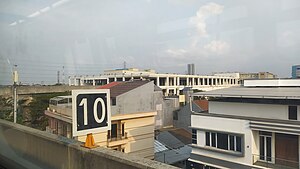
Manggarai railway station
Railway station in Indonesia
Distance: Approx. 537 meters
Latitude and longitude: -6.2099,106.8502
Manggarai Station (MRI) is a railway station at Manggarai, Tebet, South Jakarta, Jakarta, Indonesia. At present, it serves primarily as a transit station for KRL Commuterline's Bogor Line, Cikarang Loop Line, and Soekarno–Hatta Airport Rail Link; The Bukit Duri depot is located at the south side of the station, it also serves as a storage for intercity trains before they go to Gambir or Jakarta Kota stations for their departure. Currently, the station is undergoing development and will feature three levels.

Cikini railway station
Railway station in Indonesia
Distance: Approx. 1227 meters
Latitude and longitude: -6.1985,106.8413
Cikini Station is a railway station located on Jl. Cikini Raya, Cikini, Menteng, Jakarta. This station is only served by KRL Commuterline commuter trains from Jakarta Kota to Depok and Bogor.

Kota Kasablanka
Shopping mall in Jakarta, Indonesia
Distance: Approx. 1685 meters
Latitude and longitude: -6.223576,106.842685
Kota Kasablanka is a mixed-development covering an area of 11.5 hectares (28 acres) at Tebet in Jakarta, Indonesia, which consists of office tower, serviced office suites, shopping center, convention hall and condominium towers. This super-block is developed by PT Pakuwon Jati Tbk (PWON). CasaGrande Residence is the apartment block which has four towers, each has 36 floors namely Mirage, Avalon, Montreal and Montana.

Menteng Pulo War Cemetery
Dutch war cemetery in Jakarta, Indonesia
Distance: Approx. 1657 meters
Latitude and longitude: -6.2223345,106.8394822
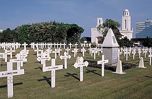
Menteng Pulo War Cemetery, also Dutch Field of Honor Menteng Pulo (Dutch: Nederlands Ereveld Menteng Pulo, Indonesian: Makam Kehormatan Belanda di Menteng Pulo), is a war cemetery at Jl. Menteng Pulo RT. 3 RW. 12, Menteng Dalam, Tebet, Jakarta in Indonesia. It is one of two Dutch war cemeteries in Jakarta, the other one is Ancol War Cemetery at Ancol.

Situ Lembang Park
Park in Menteng, Jakarta, Indonesia
Distance: Approx. 1625 meters
Latitude and longitude: -6.19834,106.835153
Situ Lembang Park (Indonesian: Taman Situ Lembang) is a park located at Menteng, Jakarta, Indonesia. Situ means lake, while Lembang is the name of the road adjacent the park. The park is nestled within houses of Menteng residential area and located close to another park Taman Suropati.

Matraman railway station
Railway station in Indonesia
Distance: Approx. 1689 meters
Latitude and longitude: -6.2124,106.8603
The Matraman Station (MTR) is the KRL Commuterline train station located on the border between Kebon Manggis, Matraman and Kampung Melayu, Jatinegara, East Jakarta, Indonesia. This station is adjacent to the Gunung Antang localization area and was built as the part of the Manggarai–Cikarang doubled-double track project.

Setiabudi LRT Station
Distance: Approx. 1693 meters
Latitude and longitude: -6.209277,106.830211
Setiabudi LRT Station is a light rail station located on Jalan H.R. Rasuna Said, Guntur, Setiabudi, South Jakarta. The station, which is located at an altitude of +22.55 meters, serves the Cibubur and Bekasi lines of the Jabodebek LRT system. Despite sharing the same name, it is not an interchange and is not to be confused with the MRT Jakarta station at Setiabudi Astra station, and is in fact located 600 meters apart from each other.
Weather in this IP's area
thunderstorm
29 Celsius
33 Celsius
29 Celsius
30 Celsius
1007 hPa
68 %
1007 hPa
1003 hPa
6000 meters
3.09 m/s
330 degree
40 %