Country:
 Pakistan
Region:
City:
Latitude and Longitude:
Time Zone:
Postal Code:
IP information under different IP Channel
ip-api
Country
Region
City
ASN
Time Zone
ISP
Blacklist
Proxy
Latitude
Longitude
Postal
Route
IPinfo
Country
Region
City
ASN
Time Zone
ISP
Blacklist
Proxy
Latitude
Longitude
Postal
Route
MaxMind
Country
Region
City
ASN
Time Zone
ISP
Blacklist
Proxy
Latitude
Longitude
Postal
Route
Luminati
Country
PKASN
Time Zone
Asia/Karachi
ISP
Pakistan Telecommunication Company Limited
Latitude
Longitude
Postal
db-ip
Country
Region
City
ASN
Time Zone
ISP
Blacklist
Proxy
Latitude
Longitude
Postal
Route
ipdata
Country
Region
City
ASN
Time Zone
ISP
Blacklist
Proxy
Latitude
Longitude
Postal
Route
Popular places and events near this IP address
Allama Iqbal Open University
Public university in Islamabad, Pakistan
Distance: Approx. 2462 meters
Latitude and longitude: 33.68285319,73.05725157
Allama Iqbal Open University is a public university in Islamabad, Pakistan. It is named after Allama Muhammad Iqbal, the country's national poet. It is the world's fifth largest institution of higher learning in terms of enrolment, with an annual enrollment of 1,121,038 students (as of 2010), the majority are women and course enrollment of 3,305,948 (2011).
Higher Education Commission (Pakistan)
Statutory body formed by the Government of Pakistan
Distance: Approx. 948 meters
Latitude and longitude: 33.67,73.05
The Higher Education Commission (colloquially known as HEC) is a statutory body formed by the Government of Pakistan which was established in 2002 under the Chairmanship of Atta-ur-Rahman. Its main functions are funding, overseeing, regulating and accrediting the higher education institutions in the country. It was first established in 1974 as University Grants Commission (UGC), and came into its modern form on 11 September 2002 after Atta-ur-Rahman's reforms, which received international praise.
International Islamic University
Islamic public university in Islamabad, Pakistan
Distance: Approx. 1824 meters
Latitude and longitude: 33.65673056,73.02476111
The International Islamic University (IIU) is an Islamic public university located in Islamabad, Pakistan. It was established in 1980 and restructured in 1985, and remains a valuable source for Higher Education in Pakistan. The university is regularly listed among the most recognized universities and prestigious degree awarding institutions of Pakistan by the Higher Education Commission of Pakistan.
National University of Modern Languages
University in Islamabad, Pakistan
Distance: Approx. 779 meters
Latitude and longitude: 33.66666667,73.05
The National University of Modern Languages (NUMLs) (Urdu: قومی جامعہ جدید زبانیں) is a multi-campus public university with its main campus located in Islamabad, Pakistan and other campuses in different cities of Pakistan.
Pakistan Red Crescent Society
Humanitarian organization in Pakistan
Distance: Approx. 2236 meters
Latitude and longitude: 33.68326336,73.05140992
Pakistan Red Crescent Society (Urdu: ہلالِ احمر پاکستان), is a humanitarian organization that provides emergency medical and relief services in Pakistan. The organization was founded on 20 December 1947 after Pakistan's independence by an order called The Pakistan Red Cross Order, issued by Muhammad Ali Jinnah, as Governor General of Pakistan. He became the founding president of the Society.
2009 International Islamic University bombing
Terrorist attack in Pakistan
Distance: Approx. 1254 meters
Latitude and longitude: 33.65825,73.03088889
On 20 October 2009, at least six people, including three women, were killed, and as many as 29 people injured, 25 of them women, in twin suicide attacks at International Islamic University in the Pakistani capital Islamabad. Police said that the blasts at the university were caused by suicide bombers. This was the first-ever attack on students in the country since the start of 21st century terrorism in Pakistan in 2001.

I-10, Islamabad
Sector in Islamabad Capital Territory, Pakistan
Distance: Approx. 2065 meters
Latitude and longitude: 33.64687325,73.03616471
I-10 is a sector of Islamabad, Pakistan. It is a lightly built area, located on the southwestern edge of the city. I-10 borders Rawalpindi to the south and neighbors I-9 and I-11, while sectors H-9, H-10, and H-11 are located adjacent.

Margalla railway station
Railway station in Islamabad, Pakistan
Distance: Approx. 596 meters
Latitude and longitude: 33.663653,73.048182
Margalla Railway Station (Urdu: مارگلہ ریلوے اسٹیشن) (formerly Islamabad Railway Station) is located between Khayaban-i-Jauhar (Sector H-9) and Service Road North (Sector I-9) in Islamabad, Capital Territory, Pakistan. The entrance to the station is from Khayaban-i-Jauhar side.

The Millennium Universal College
Distance: Approx. 2573 meters
Latitude and longitude: 33.65276,73.0182
The Millennium Universal College (TMUC) is a college in Pakistan.
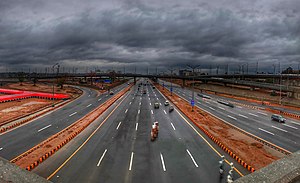
Peshawar Morr Interchange
Road junction
Distance: Approx. 2258 meters
Latitude and longitude: 33.68453,73.04756
Peshawar Morr Interchange (also known as G-9 interchange) is Pakistan's biggest interchange in Islamabad, Pakistan. It is located at the intersection of Srinagar Highway and the Ninth Avenue, connecting the G and H sectors of Islamabad. Peshawar Morr interchange eased traffic congestion on two main highways of the capital city i.e.
Shifa Tameer-e-Millat University
Pakistani university
Distance: Approx. 2662 meters
Latitude and longitude: 33.67772542,73.06607987
Shifa Tameer-e-Millat University (STMU) is a private university, established in 2012 in Islamabad, Pakistan. It is set up as a nonprofit institution in the private sector.
Krishna Temple, Islamabad
Religious building in Islamabad, Pakistan
Distance: Approx. 505 meters
Latitude and longitude: 33.66422222,73.04730556
Shri Krishna Mandir, still under construction, is the first Hindu temple to be granted permission to be built in Islamabad, capital of Pakistan, on 0.5 acre land in the H-9 area of Islamabad Capital Territory. It will be a place of worship for the 3,000 Hindu families living in Islamabad. The temple will be managed by the Pakistan Hindu Panchayat.
Weather in this IP's area
clear sky
26 Celsius
26 Celsius
26 Celsius
26 Celsius
1006 hPa
76 %
1006 hPa
948 hPa
10000 meters
0.89 m/s
2.24 m/s
32 degree
05:52:37
18:12:10